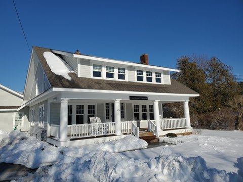
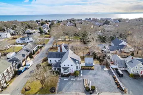
466 Rte 28b2 Harwich Port, MA 02646-1604
Property profile & analytics
466 Rte 28b2, Harwich Port, MA 02646-1604
- Office Spaces
- 512 SF
Property ID
US38-0625646
The Realmo ID is a unique identifier assigned to every property, incorporating country codes and precise geo-coordinates for 300x300-foot land blocks. It enables standardized data collection and seamless integration of disparate sources such as ownership, tax, title data and physical specifications. By aggregating current and historical records, the Realmo ID powers advanced analytics and delivers deep, verifiable insights for real estate professionals.
Location Intelligence
Current Use by Public Records
- Office Spaces
Property Details for 466 Rte 28b2
- Year built
- 1987
- Construction
- FRAME
- Zone code
- R
- Property type
- Office Spaces
- APN
- HARW M:13 P:F8 E:B2
- APU
- HARWM13PF8EB2
Sales History
| Date | Price | Buyer | Seller | Deed Type | Mortgage |
|---|---|---|---|---|---|
| Oct 23, 2020 | $120,000 | William D Crowell | Guavaberry Nt | Quit Claim Deed | $88k · Cape Cod Five Cents Svgs Bk |
| Mar 26, 2015 | — | Guavaberry Trust | Oday Kathleen P | Quit Claim Deed · related | — |
Value Estimations
based on Realmo’s proprietary methodology
-
AI approach
-
CAP approach
-
Comparable approach
-
Alternative Use
Get a detailed, property-specific estimation — fast and free
Location Insight
- Map
- Local Demand
- City
- Harwich Port
- County
- Barnstable
- State
- Massachusetts
- Longitude
- -70.0818
- Latitude
- 41.6691
- CBSA code
- 12700
- CBSA name
- BARNSTABLE TOWN, MA METROPOLITAN STATISTICAL AREA
Property Tax & Assessments
Tax date
Tax Amount
Assessed Land Value
Assessed Improvement Value
Total Assessed Value
Applied Tax Rate
Land Market Value
Improvement Market Value
Total Market Value
2024
$800
$0.00
$132,600
$132,600
-
$0.00
$0.00
$0.00