ETJ-Positioned Residential Development
23+/- Acres Oasis Drive Denison, TX 75020
For Sale
$1,690,000
LAND - Denison, TX
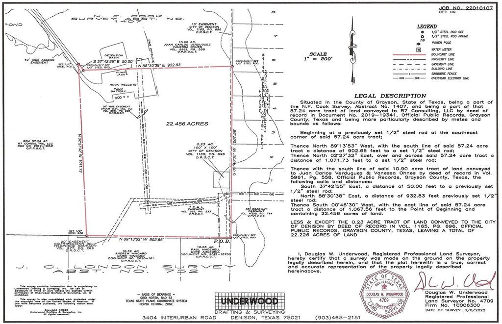
Lot Size22.46 Acres
Days on Market91
Property Features for 23+/- Acres Oasis Drive
General Information
- Property type
- Land
- Property subtype
- Other
- Vegetation
- Grassed, Wooded
- Standard status
- Active
- APN
- 443936
- Lot size
- 22.46 Acres
Taxes and HOA fees
- Tax Description
- G-1407 COOK N F A-G1407, ACRES 22.226
- Tax Annual Amount
- 18
Listing Agency:
eXp Realty LLC
(888) 519-7431
Listed By:
Bill Lee · License #0633076
(888) 519-7431
Added: Apr 24
Changed: Jun 3
Last Checked: Jul 23 at 10:06PM
MLS# 21193400
Copyright © 2026 North Texas Real Estate Information Systems, Inc. All rights reserved. All information provided by the listing agent/broker is deemed reliable but is not guaranteed and should be independently verified.
Investment Insights
Based on property information with market context.
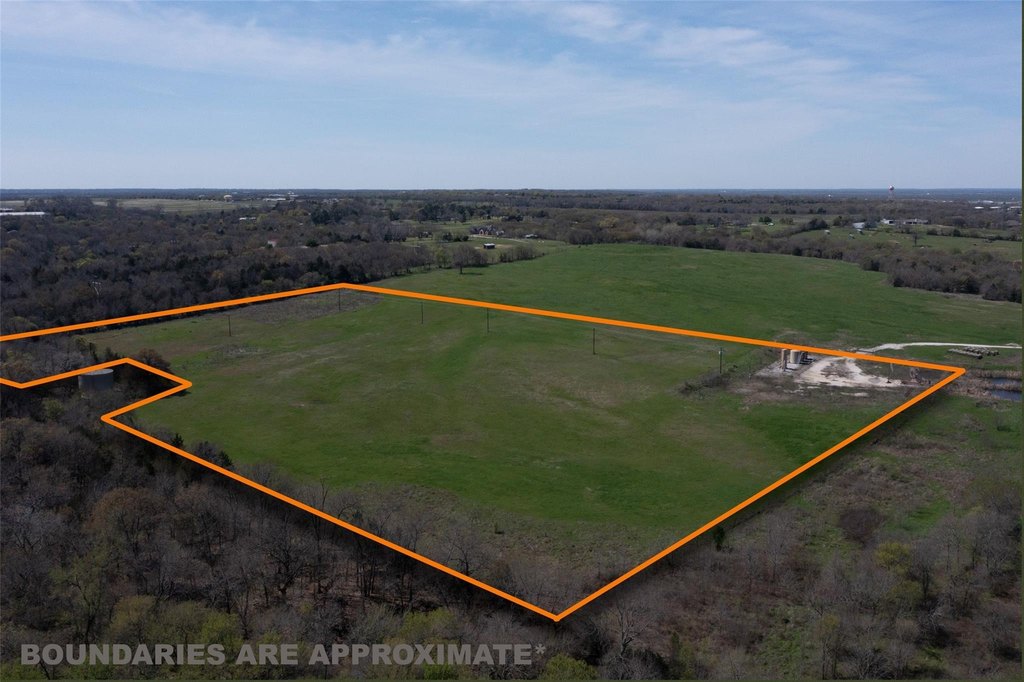
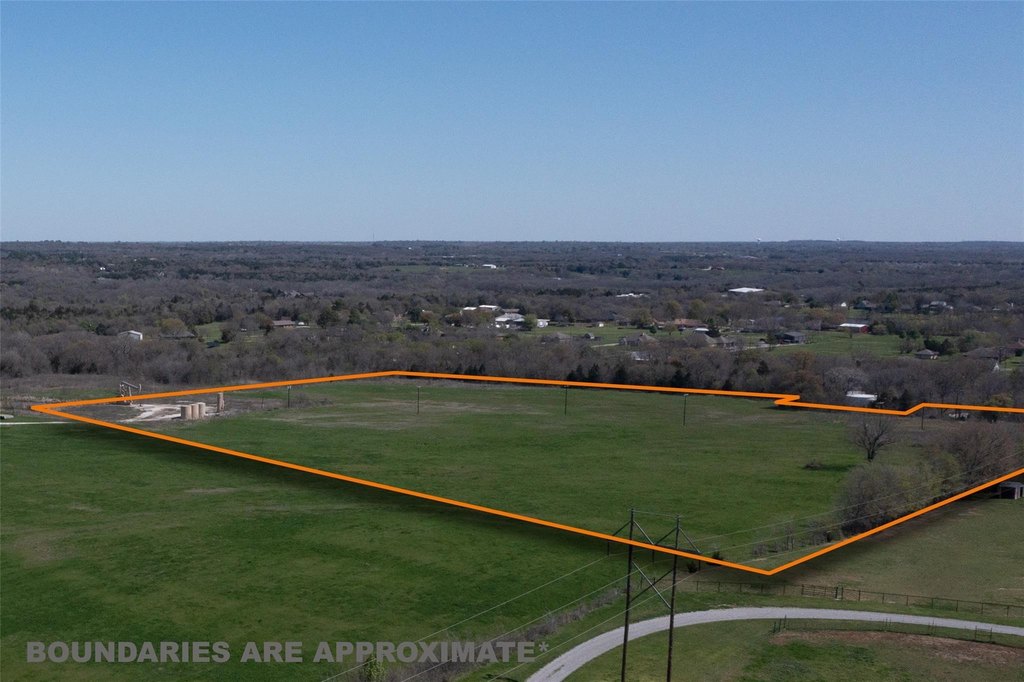
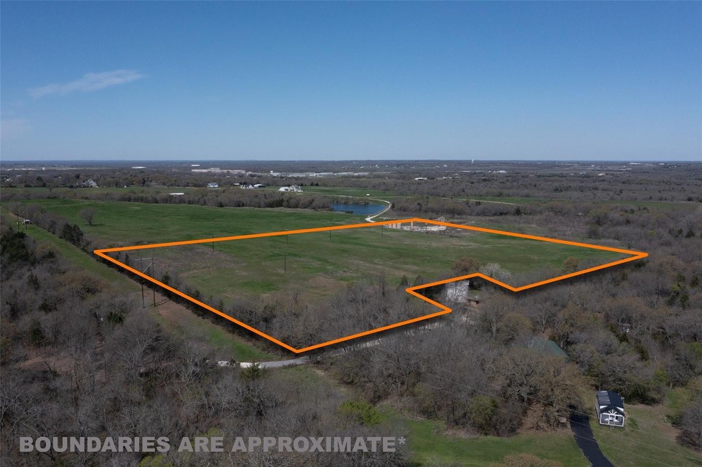
An approximately 22.456-acre development site positioned in the Denison ETJ, offering a configuration suited for residential expansion. The tract is described as nestled between the established Lakeview Addition and Highview Estates, with access from both neighborhoods. The owner has secured a will-serve letter from the City of Denison for water service for up to 30 single-family homes, and a 10" water main runs along the property boundary.
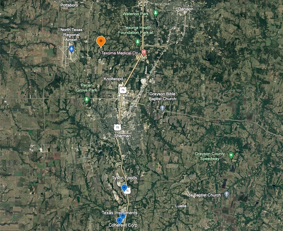
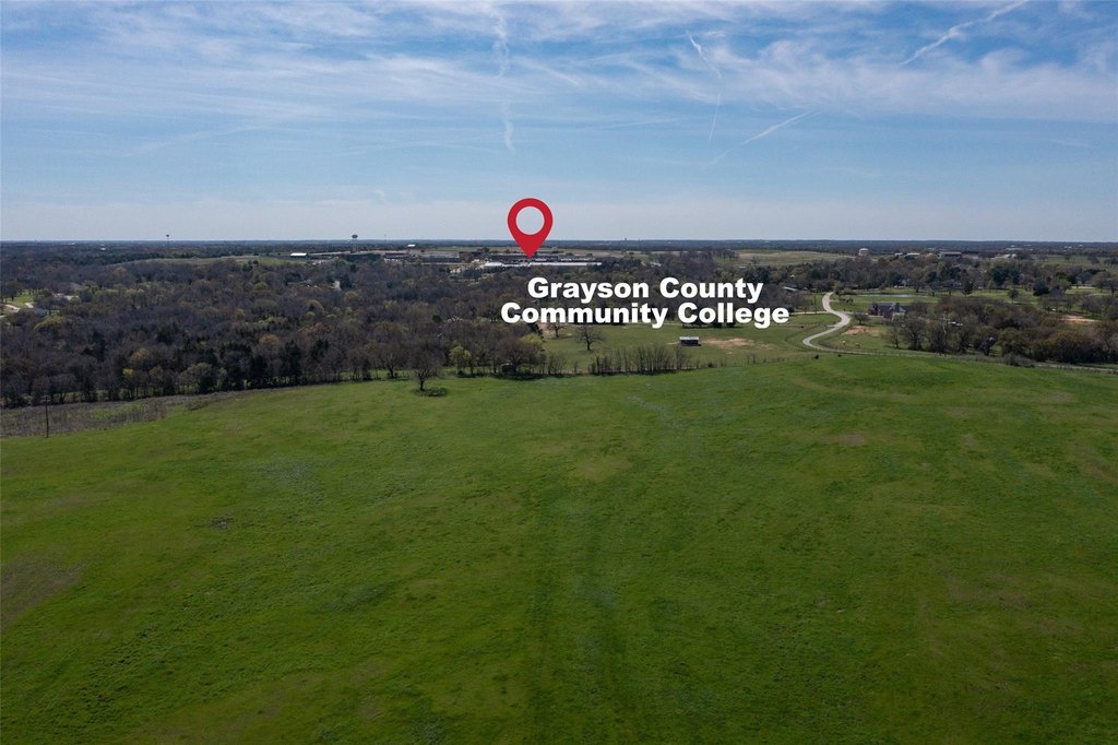
The offering is located just 6 miles from the Preston Harbor master-planned community on Lake Texoma, which is presented as a major driver of new residential and tourism demand. Public remarks also note nearby growth including the Heritage Ranch master-planned community about 3 miles away, plus easy access to US-75 and US-82. The surrounding area is further supported by large semiconductor expansions in nearby Sherman, alongside proximity to Grayson College and Texoma Medical Center, as well as shopping and dining.
With city-supported water capacity for up to 30 single-family homes and convenient neighborhood connectivity, this land is positioned for developers seeking a practical path to workforce housing or estate-style residential development in a growth-oriented Denison trade area. For buyers and brokers looking for a site with documented municipal water planning, it offers a clear starting point to move toward entitlements and buildout.
Key Highlights
- Nearly 23‑acre development tract in Denison ETJ
- Will‑serve letter from City of Denison for water service for up to 30 single‑family homes
- 10" water main runs along the property boundary
Property Analytics
Location Intelligence
Current Use by Public Records
Residential land & home ...


FAQs
What type of property is this?
Residential land & home lot - Prime ETJ tract with dual-neighborhood access and will-serve water support for up to 30 single-family homes.
Where is this residential land & home lot located?
The property is located at 23+/- Acres Oasis Drive Denison, TX.
What is the asking price?
The asking price for this property is $1,690,000.
What are key features of this property?
This property features: Nearly 23‑acre development tract in Denison ETJ; Will‑serve letter from City of Denison for water service for up to 30 single‑family homes; 10" water main runs along the property boundary


