88 Rte 6a Sandwich, MA 02563-1866
Property profile & analytics
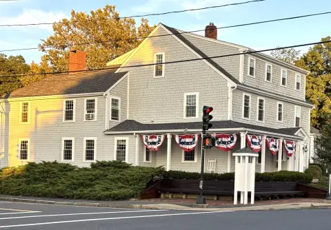
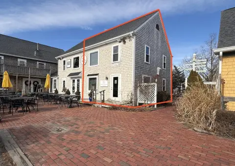
88 Rte 6a, Sandwich, MA 02563-1866
- Office buildings
- 7,296 SF
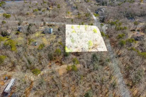
- 0.58 lot acres
Property ID
US38-1888861
The Realmo ID is a unique identifier assigned to every property, incorporating country codes and precise geo-coordinates for 300x300-foot land blocks. It enables standardized data collection and seamless integration of disparate sources such as ownership, tax, title data and physical specifications. By aggregating current and historical records, the Realmo ID powers advanced analytics and delivers deep, verifiable insights for real estate professionals.
Location Intelligence
Current Use by Public Records
- Office buildings
Property Details for 88 Rte 6a
- Year built
- 2013
- Construction
- FRAME
- Lot size
- 0.58 lot acres
- Zone code
- BL-1
- Property type
- Office buildings
- APN
- SAND M:0088 B:0003
- APU
- SANDM0088B0003
Sales History
| Date | Price | Buyer | Seller | Deed Type | Mortgage |
|---|---|---|---|---|---|
| Aug 19, 2014 | — | 88 6a LLC | — | Grant Deed · related | $1.1M · Rockland Tr |
| May 31, 2012 | $300,000 | 88-6a LLC | Tudor Hill RT | Grant Deed | — |
| Mar 13, 2003 | — | Carmat RT | — | Deed Of Trust · related | $650k · Community Bank NA |
| Apr 21, 2000 | $400,000 | Carmat RT | Sextant Corp | Grant Deed | $380k · Compass Bank For Savings |
| May 13, 1998 | $94,000 | Sandwich Coop Bk | Bahrawy,jens A | Grant Deed · related | — |
| Dec 4, 1989 | $125,000 | Jens A Bahrawy | The Sextant Corp | Grant Deed | $119k · Sandwich Cp Bank |
| Mar 7, 1988 | $482,400 | Cpe Office Collaborat | The Sextant Corp | Grant Deed | $450k · Mechanics Bank |
Value Estimations
based on Realmo’s proprietary methodology
-
CAP approach
- CAP Return
- Estimation
- 6%
- $2,725,000
- 6.5%
- $2,515,000
- 7%
- $2,335,000
-
Comparable approach
- Method
- Estimation
- Statistic Estimate
- $1,799,000
- AI Estimate
- $2,066,000
Market price range: $940k - $2.52MMarket price range: $825k - $2.69M -
Alternative Use
- Use
- Estimation
- OFFICE BUILDING
- $1,645,000 Current use
- RESTAURANT
- $1,810,000 Change: +10% Conversion: Moderate
- RETAIL STORES
- $1,650,000 Change: +0% Conversion: Moderate
- COMMERCIAL (GENERAL)
- $1,640,000 Change: -0% Conversion: Easy
Get a detailed, property-specific estimation — fast and free
Location Insight
- Map
- Local Demand
- City
- Sandwich
- County
- Barnstable
- State
- Massachusetts
- Longitude
- -70.502
- Latitude
- 41.7647
- CBSA code
- 12700
- CBSA name
- BARNSTABLE TOWN, MA METROPOLITAN STATISTICAL AREA
Property Tax & Assessments
Tax date
Tax Amount
Assessed Land Value
Assessed Improvement Value
Total Assessed Value
Applied Tax Rate
Land Market Value
Improvement Market Value
Total Market Value
2024
$12,924
$333,900
$862,800
$1,196,700
-
$0.00
$0.00
$0.00