Realmo Analytics
Unlock property reports, ownership, financials, or compile property list owners likely to sell.
We will call you to discuss how Realmo analytics may help you.
 For Sale
1 / 19
Property summary
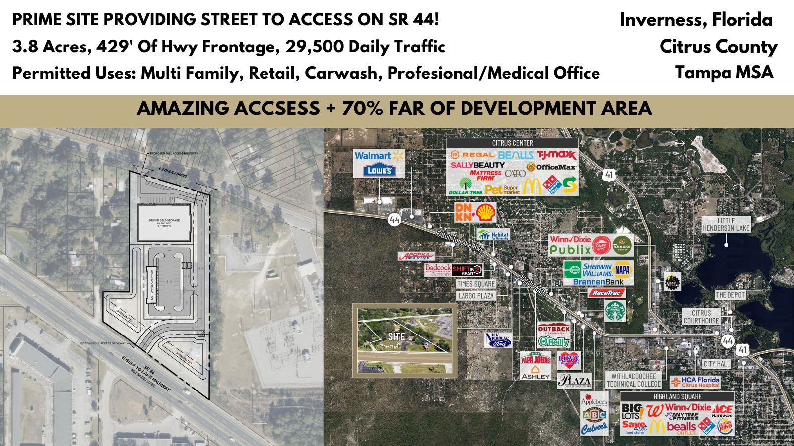
3.8 ACRES GNC ON HWY 44 IN INVERNESS, FL 3865 & 3899 E Gulf To Lake Hwy, Inverness, Florida 34453 This large and rare 3.8 acres of land zoned GNC Commercial features 429’ of Highway frontage on SR 44 (29,500 AADT) just West of the signalized intersection at Independence Hwy. This location offers high visibility and ingress and egress from both East and Westbound traffic via the open median on SR 44 and street-to-street access from SR 44 to Forest Drive. Convenience is at your doorstep with this… property, as it enjoys proximity to Downtown Inverness (3.6 Miles), Lecanto (7.3 Miles), Hernando (4.2 Miles), and Crystal River (15.1 Miles). In addition, you're just a stone's throw away from TJ Maxx (1.3 Miles), Walmart (1.6 Miles), and more national retail. General Commercial Zoning allows for a variety of uses including Retail, Medical/Professional Office, Automotive, ALF, multi-family, C-Store, Banks, Car Wash Facilities, and more. Located in Citrus County, Florida, a bustling community of 155,582 residences growing at 1.29% exceeding the national average and part of the Tampa-St. Petersburg MSA offers a promising environment for businesses seeking growth opportunities. ___________________________________________________________________________ Logistic Details: County Road 486 runs entirely along West Norvell Bryant Highway. It runs West to East from SR 44 east of Crystal River into US-41 in Hernando, just south of the southern terminus of SR 200. The route was once the former SR 486. County Road 486 spans 4 lanes, is almost entirely a divided highway, and is flanked by a parallel bicycle path on the south side. County Road 491 is Lecanto Highway, a bi-county South to North road that begins at the Hernando-Citrus County Line in Oak Grove near the Withlacoochee State Forest and ends at SR 200 in Stoke's Ferry, just south of the intersection with the northern segment of CR 39. It was formerly designated as SR 491. County Road 44 (often marked as County Road 44W) exists as the western tip of old Florida State Road 44, south of "Downtown" Crystal River. The suffix "W" was most likely added to not confuse this section with State Road 44, to the north, and to show its location by being west of US 19 and US 98(SR 55). As with the majority of these types of 'coastal spur' routes, in West Central Florida, it is county-maintained. U.S. Route 19 (US-19) runs 264 miles (425 km) along Florida's West Coast from an interchange with U.S. Route 41 in Memphis, Florida, south of Tampa, and continues to the Georgia border north of Monticello, Florida. Newly 6 lane Highway was constructed from the Hernando County line to Fort Island Trail and US 19 in Crystal River, Florida. ___________________________________________________________________________ Suncoast Parkway: The Suncoast Parkway recently opened was a $135 Million Dollar expansion that extends 13 miles north from US-98 to SR 44 which features 15 new bridges, electronic tolling gantries, and the extension of The Suncoast Trail part of the Florida's Statewide Greenways and Trail System. The Suncoast Parkway is just 68 Miles 1 hour and 15 mins from Tampa making it a great commuting Highway for the workforce seeking to be outside of the Tampa traffic. The Veterans Expressway and Suncoast Parkway is a north–south toll road near the Florida Gulf Coast. Maintained and operated by Florida's Turnpike Enterprise, this 68-mile transportation corridor extends from State Road 60 in Tampa, north to State Road 44 near Lecanto. Citrus County Growth: Citrus County, Florida's estimated population is 155,582 with a growth rate of 1.29% in the past year according to the most recent United States census data. Citrus County, Florida is the 34th largest county in Florida. The 2010 Population was 141,173 and has seen a growth of 10.21% since this time. Citrus County's current LDC allows for approximately a population of 350k residencies. Given the expansion of the Suncoast Parkway and the 6-lane expansion of US 19, we are in the path of tremendous growth. Currently, Citrus County has 60,000 vacant parcels of land prime for development. The County and incorporated Cities have plans for extensive utility expansion throughout the county including the expansion of the Crystal River Airport Runway 5000 feet to allow for larger aircraft to land and take off including a newly funded 75 acres industrial complex granted by the state to expand utilities, road reconstruction to support eighteen wheelers and to include environmentally friendly and energy conservation features. All Due Diligence can be found on the Crexi page: Link All LOIs should be submitted through the Crexi page: Link All questions regarding this property can be directed to emails: Info@ eliasgeorge.com All calls can be reached out to number: (352) 200-2635 (Disclaimer - All in person showings require proof of ability to purchase.)
Ownership intelligence
Owner of record from public deeds, plus portfolio, hold profile and investor signals where the data supports them. Included with a plan.
Owner contacts
Skip-traced phones and e-mails of the owner. Included with a plan.
Debts
Recorded lenders, amounts and estimated maturities of the owner's loan book — included with a plan.
Property tax
No data for this sectionNo tax or assessment record is on file for this parcel in the county feed.
Value estimate
· Oct 2026No data for this sectionNo value estimate could be modeled: the record carries too little market input for this parcel.
Recently sold
No data for this sectionNo cleaned sale $/SF benchmark exists for this use type in this ZIP, submarket or county yet.
Cap rate analysis
No income signal is modeled for this parcel yet — the Cap Rates tab runs the workflow.
Zoning insight
No data for this sectionNo zoning code is on file for this parcel. Coverage grows with every catalog release.
Location intelligence
Demand index: how under-served this business type is around this point — modeled from the LocInt grid (area demand vs. what already operates, adjusted by real visit traffic). Higher means stronger unmet demand.
Location
Every figure names its source: public record, benchmark, or modeled. Coverage varies by property — thin data is stated as missing, never invented.
Comparables
6 recorded sales · 17 properties nearbyComparable nearby


Similar Nearby for Sale
Similar Nearby for Lease
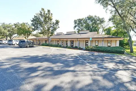
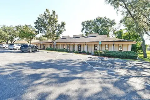
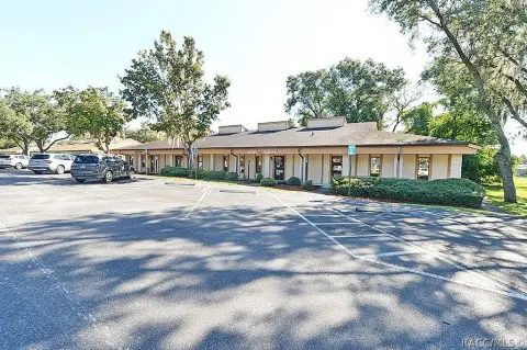
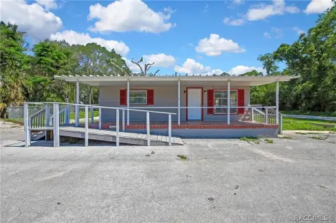

Instant AI valuation built from comps, income signals, and proprietary benchmarks.A defensible range, not a single guess.
from $199/month
Cap rate calculated from real income and expense signals, benchmarked against sales of similar assets nearby.
from $199/month
The recorded zoning designation, what the district officially allows, and the municipal source it comes from.
No zoning code is on file for this parcel. Zoning coverage grows with every catalog release — check back, or open Location Intelligence for use analysis of this corner.
Unlock the evidence behind ownership: portfolio, transactions, debt and any signals we can model, to help you decide who to contact next.
Registration is required before any owner information is shown.
Phones and e-mails of the people behind this property's owner, traced from licensed contact data.
Owner phones and e-mails come with a plan - traced from licensed contact data, with verification and Do-Not-Call flags on every number.
The mortgage data comes with a plan: recorded loans of the owner - lender, amount, rate and the estimated maturity - as part of the Ownership Intelligence workspace.
Registration is required before any owner information is shown.
Rey answers here. ChatGPT, Grok and Claude get the same data packet.
Includes: Price & PSF · Cap rate · Location · Zoning
Our comps and market reports get this label in your Google results.
 One click on Google
- 10 Targeted Leads
- 1 Full Property Report
- Lead Lists by Intent
- Signals & Scores
- Building Details
- Value Estimation
- Cap Rate Evaluation
- Liens & Mortgages
- Ownership & Contacts
- Local Market trends
-
Zoning Insight— not in this plan -
Location Analytics— not in this plan
- 300 Targeted Leads a month
- 30 Full Property Reports
- Lead Lists by Intent
- Signals & Scores
- Building Details
- Value Estimation
- Cap Rate Evaluation
- Liens & Mortgages
- Ownership & Contacts
- Local Market trends
- Zoning Insight
-
Location Analytics— not in this plan
- 1,500 Targeted Leads a month
- 150 Full Property Reports
- Lead Lists by Intent
- Signals & Scores
- Building Details
- Value Estimation
- Cap Rate Evaluation
- Liens & Mortgages
- Ownership & Contacts
- Local Market trends
- Zoning Insight
- Location Analytics
The PDF can’t be displayed here
Use Download PDF or Open in new tab above to view the sample report.
Sample leads
-
 Off Market
1201, CAPTAINS BAY RD, AK
Absentee
1201, CAPTAINS BAY RD, AK
-
 Off Market
AK
Absentee
AK
-
 Off Market
W, BROADWAY, AK
Absentee
W, BROADWAY, AK
-
 Off Market
551 W, BROADWAY, AK
Absentee
551 W, BROADWAY, AK
Sample leads
-
 Off Market
1404, ATS, AK
Loan from 20067.7% rateColumbia State Bank
1404, ATS, AK
-
 Off Market
1503, BALLYHOO RD, AK
Loan from 2009Columbia State Bank
1503, BALLYHOO RD, AK
-
 Off Market
721 E, DEPOT DR, AK
Loan from 2019Northrim Bank
721 E, DEPOT DR, AK
-
 Off Market
AK
Loan from 2019Northrim Bk
AK
Still being built. It lands here next, beside the two above.
The PDF can’t be displayed here
Your browser has no PDF viewer of its own.