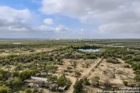
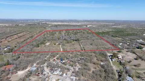
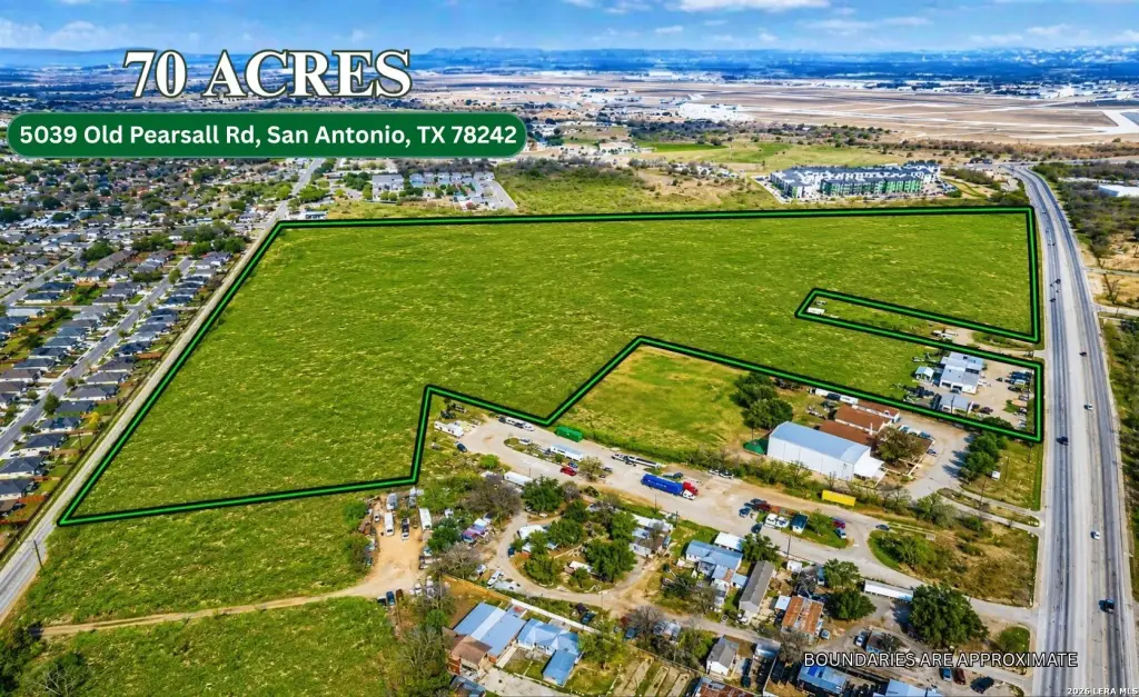
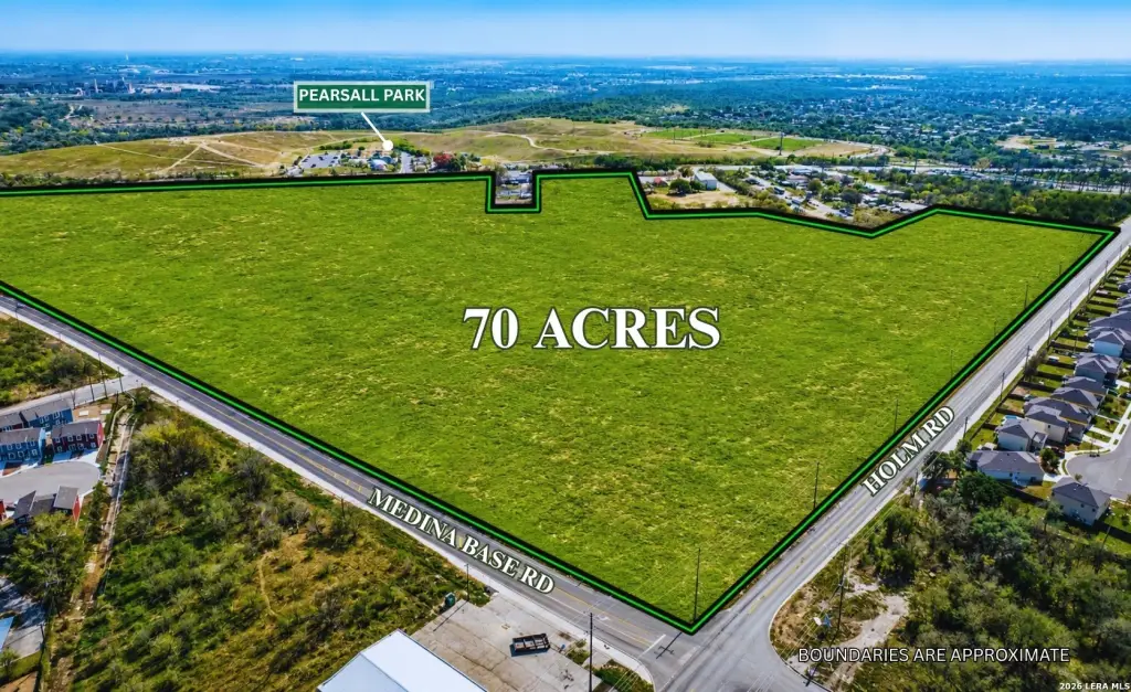
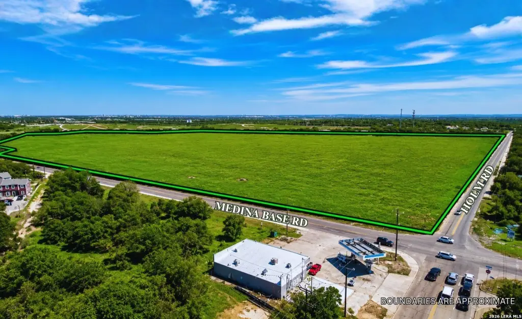
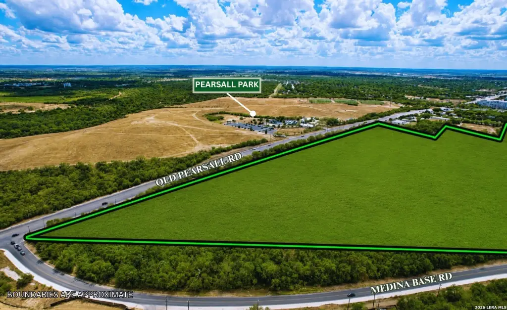
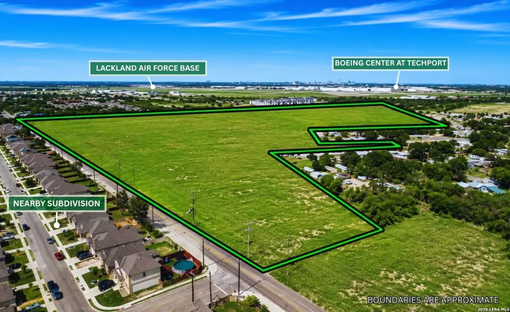
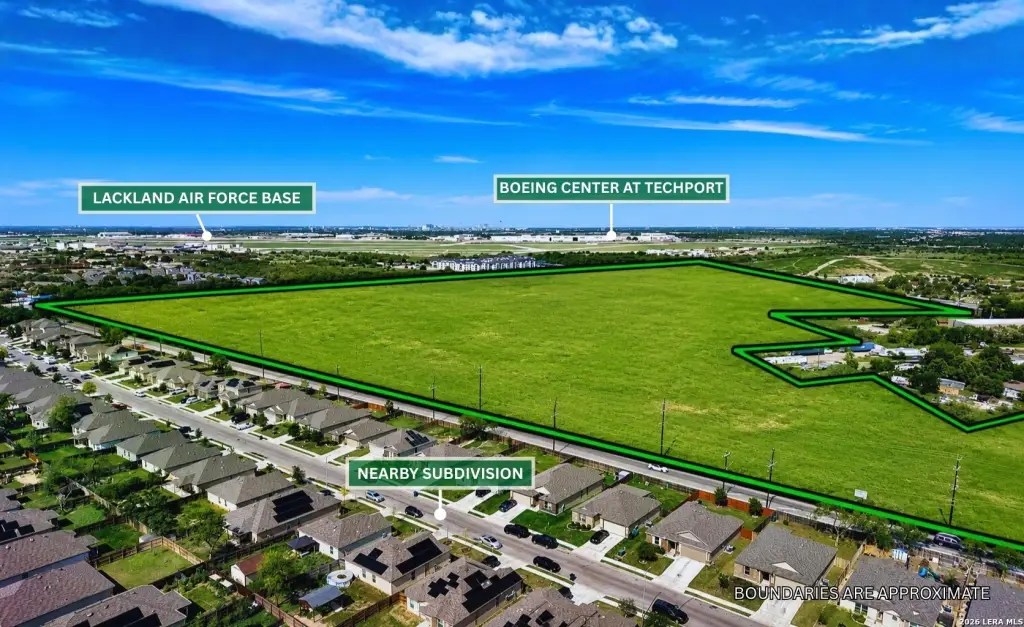
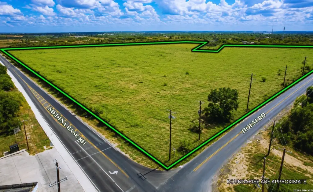
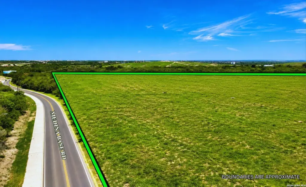
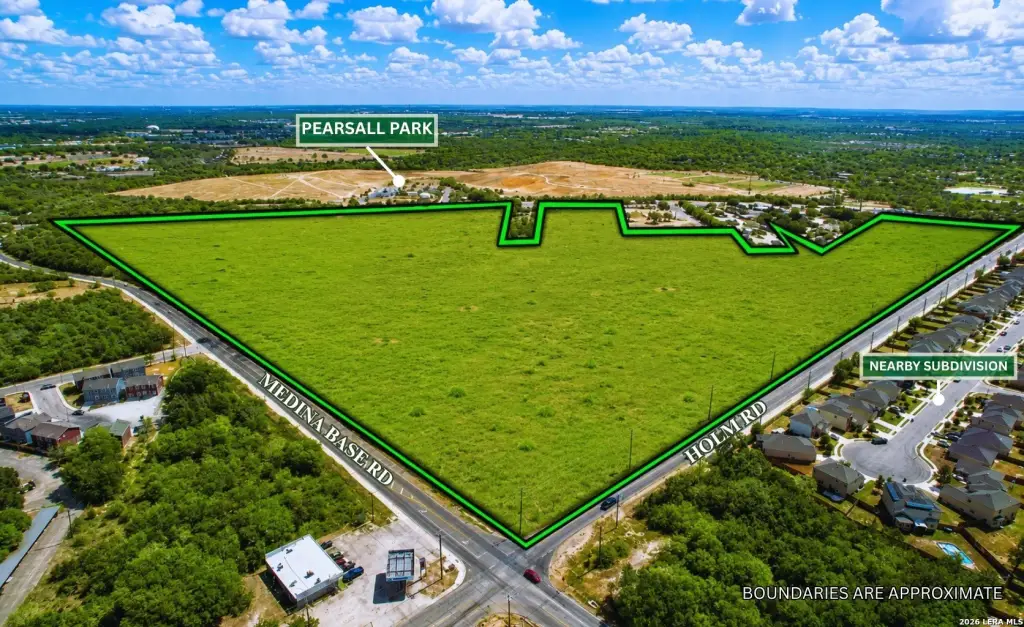
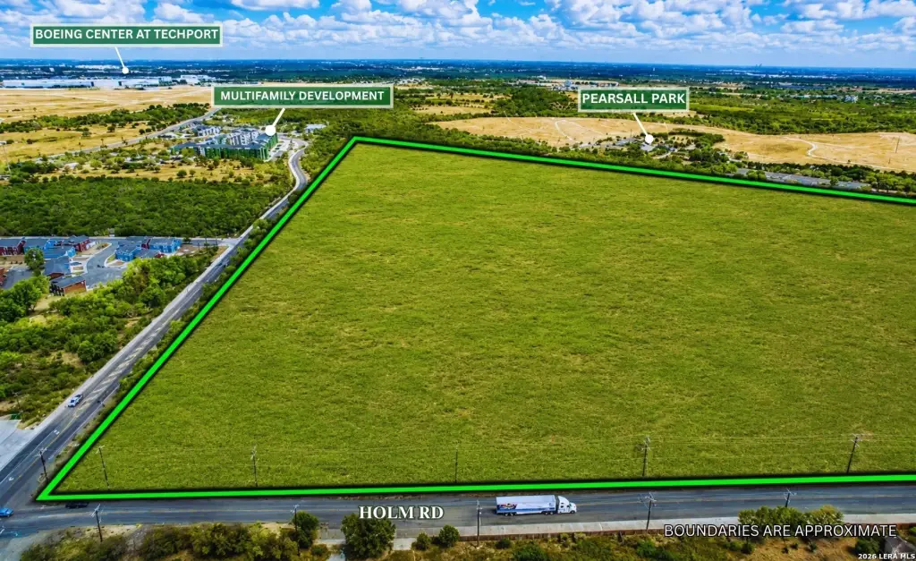
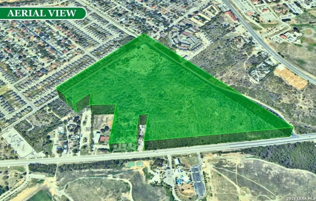
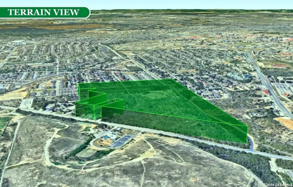
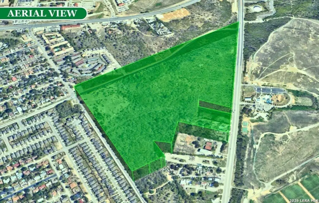
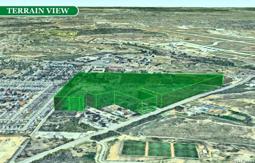
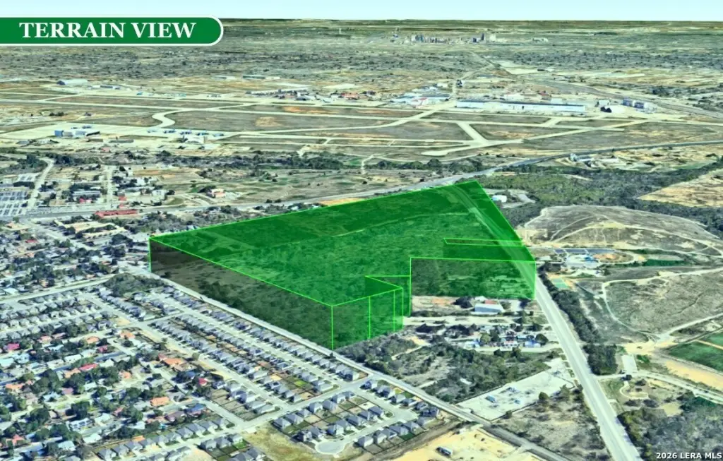
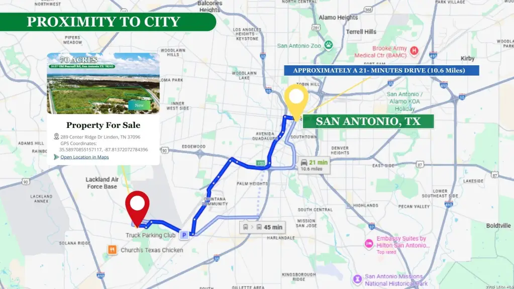
70 AC Old Pearsall Rd, San Antonio, TX 78242


- Added:
- Jun 22, 2026
- Days on Market:
- 3
- Last Refresh:
- Jun 24 at 7:06 am
Property Features for 70 AC Old Pearsall Rd
General Information
- Property type
- Land
- Property subtype
- Other
- Zoning
- TOD
- Standard status
- Active
- Lot size
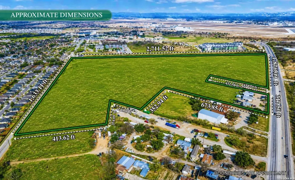
- 70.00 Acres
Taxes and HOA fees
- Tax Annual Amount
- 196586

Listing agent Uri Uriah License #9002555 (210) 315-8885
Listing office Uriah Real Estate Organization 3000 W IH 10, San Antonio, TX (830) 600-5263
Listing date Jun 22, 2026
Copyright © 2026 LERA MLS. All rights reserved. All information provided by the listing agent/broker is deemed reliable but is not guaranteed and should be independently verified.
HighLights
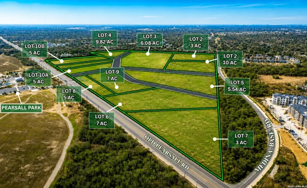
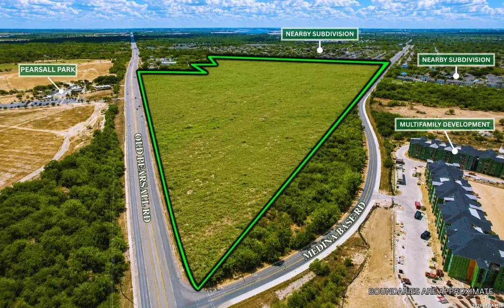
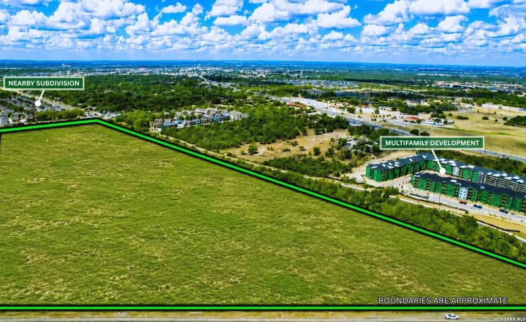
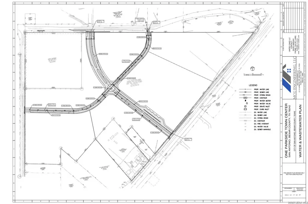
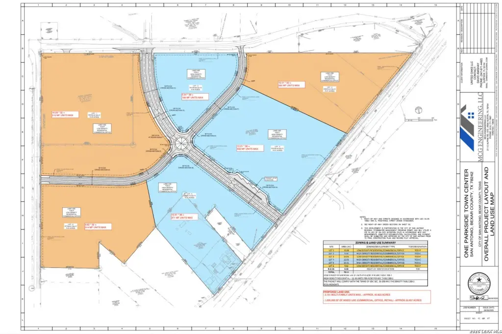
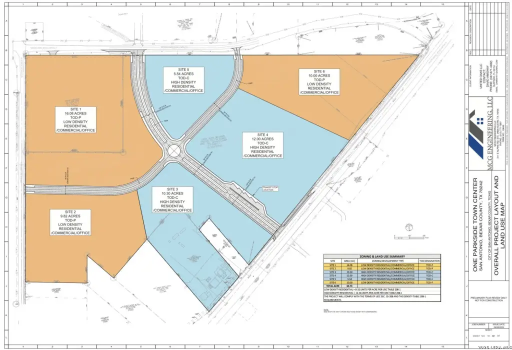
- 70‑acre contiguous infill site at 5039 Old Pearsall Rd with fully entitled transit‑oriented development (TOD) designation in San Antonio.
- Approved TOD density/use allocations support up to 33 multifamily or residential detached units per acre.
- Entitlement includes in excess of 1,000,000 SF of commercial development planned across the 70‑acre footprint.
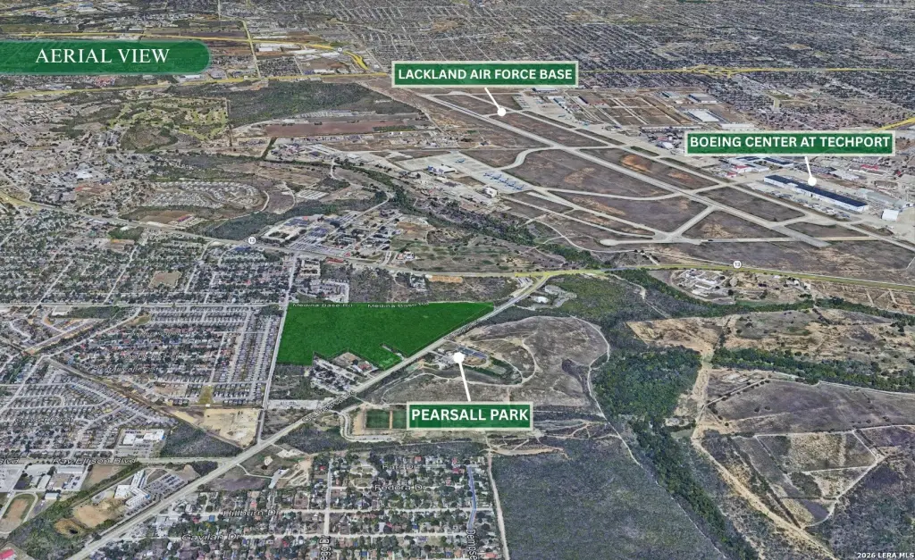
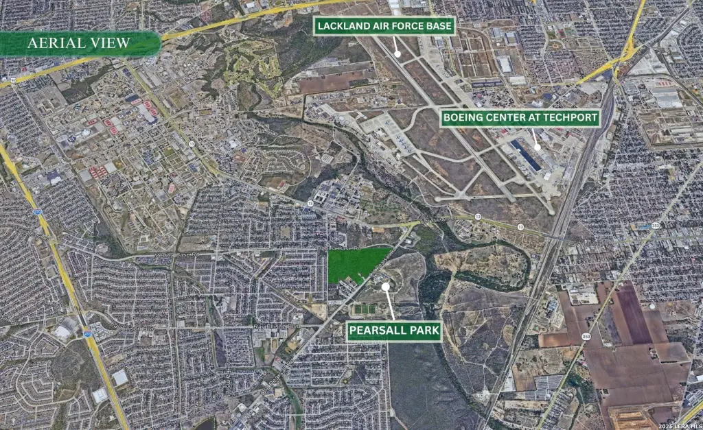
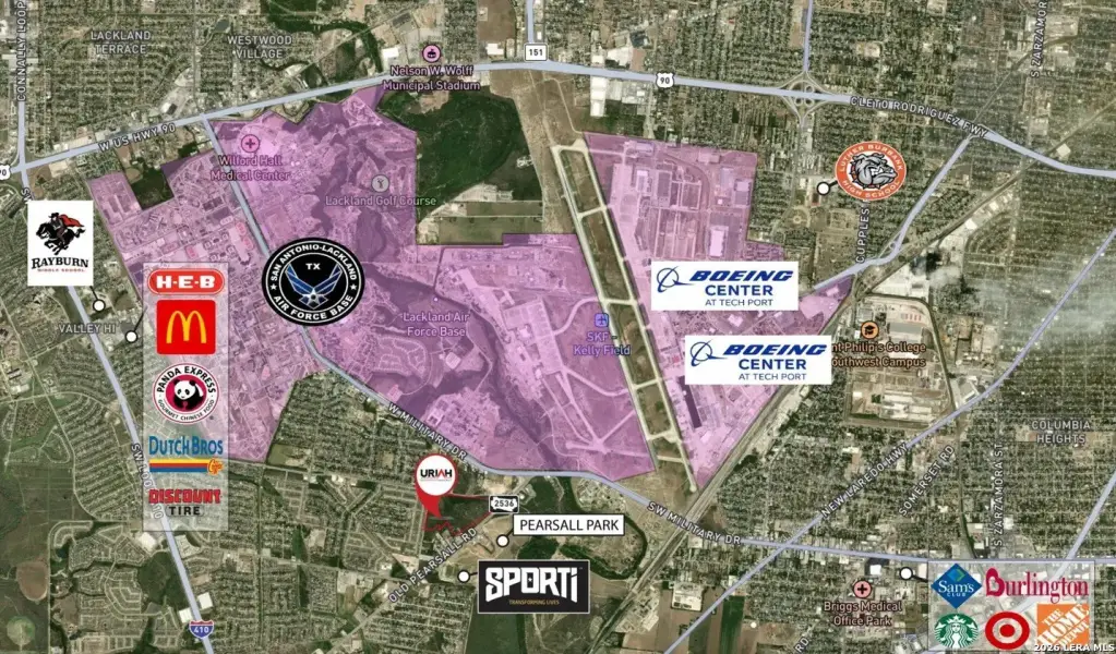
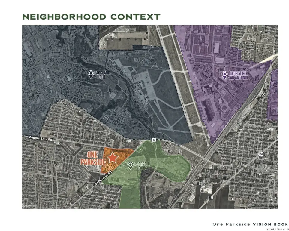
- Site adjacency: directly next to Pearsall Park and the Greenway Trails.
- Ownership is willing to subdivide for a coordinated bundle of pad sites and density tracts under one master vision.
- Planned TOD product includes high‑density residential plus neighborhood/destination retail, office, medical office, hospitality, and flex/industrial.
Overview
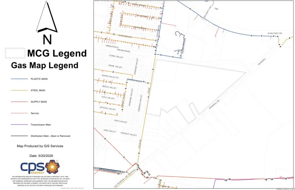
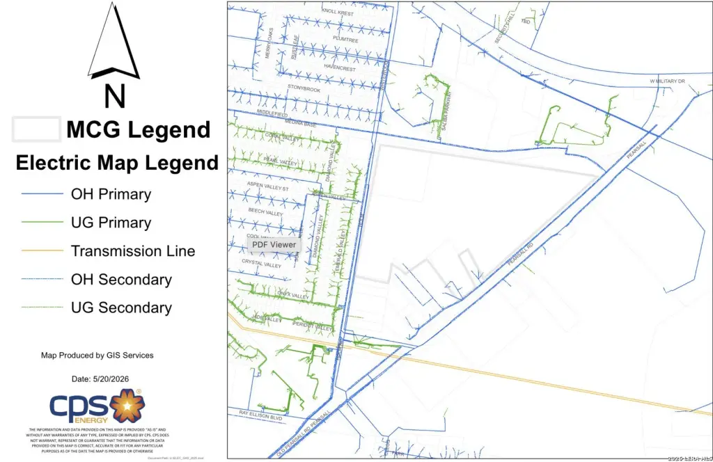
The site is located on the southwest side of San Antonio and is said to be directly adjacent to Pearsall Park and the Greenway Trails, described as heavily used recreational amenities. The property also notes immediate access to major transportation corridors and regional infrastructure.
For developers, this land package is designed to reduce entitlement uncertainty while allowing phased execution. The reported density allocations vary across the property, which is intended to give flexibility to phase by area and optimize product type by parcel. Ownership is also willing to subdivide, which supports structuring the project as a coordinated set of pad sites and density tracts under a single master vision.
Current Use by Public Records
Map
- City
- San Antonio
- County
- Comal
- State
- Texas
- Longitude
- -98.59792
- Latitude
- 29.361387