Residential Development
65ac Tbd High Corral Road Boise, ID 83716


For Sale
$1,475,000
LAND - Boise, ID
Lot Size65.19 Acres
Days on Market115
Property Features for 65ac Tbd High Corral Road
General Information
- Property type
- Land
- Property subtype
- Other
- Standard status
- Active
- APN
- RP05N04E355468
- Lot size
- 65.19 Acres
Taxes and HOA fees
- Tax Year
- 2025
- Tax Description
- T5n R4e Sec 35 Parcel In Pt Of Sw1/4 Of Se1/4 & Se1/4 Of Sw1/2
- Tax Annual Amount
- 67
Listing Agency:
Victory Realty
(208) 412-5598
Listed By:
Amanda Callahan · License #SP46722
(208) 339-3010
Added: Apr 2
Changed: Jul 17
Last Checked: Jul 25 at 6:06PM
MLS# 98980436
Copyright © 2026 Intermountain Multiple Listing Service. All rights reserved. All information provided by the listing agent/broker is deemed reliable but is not guaranteed and should be independently verified.
Investment Insights
Based on property information with market context.
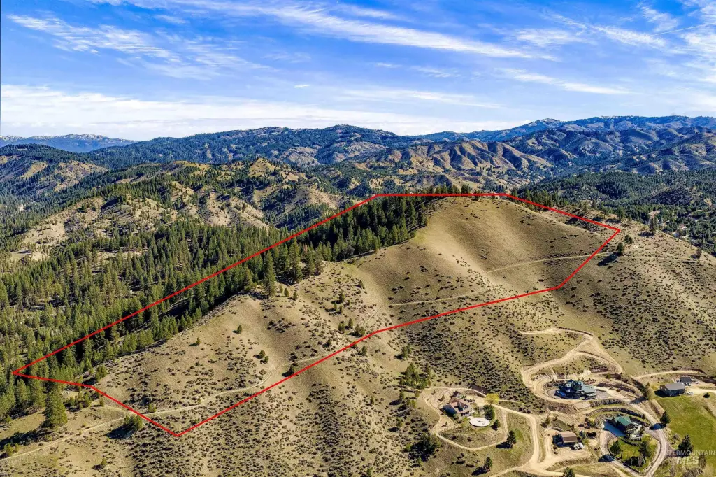
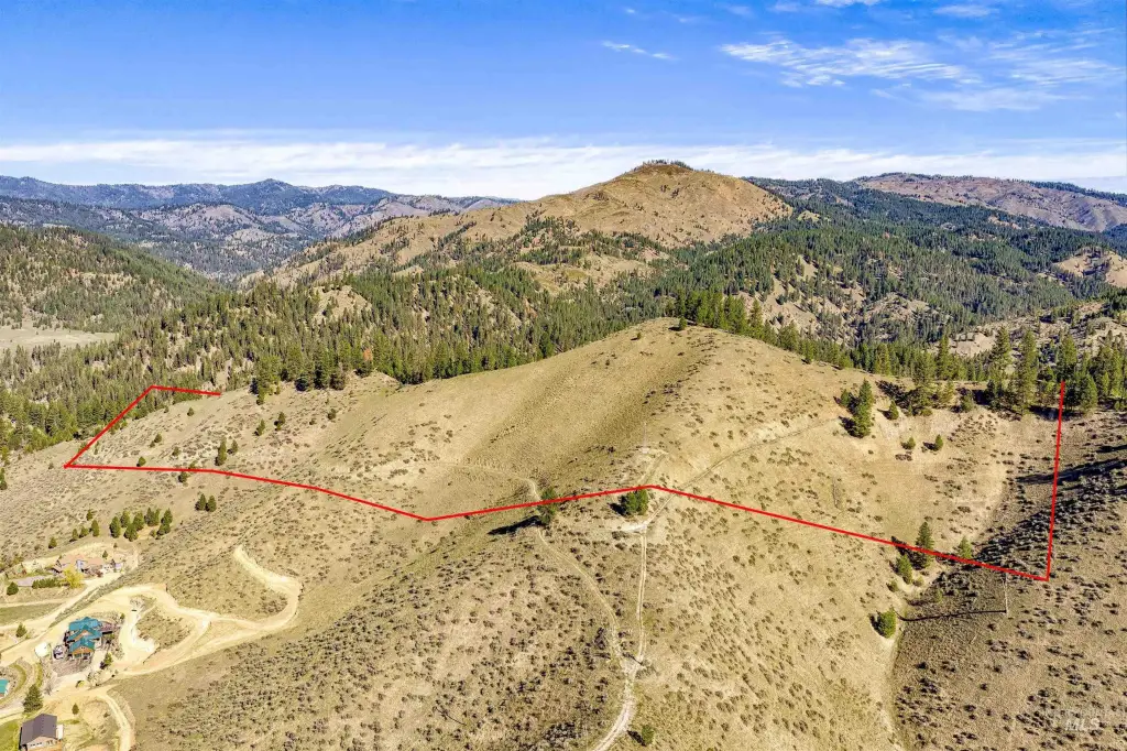
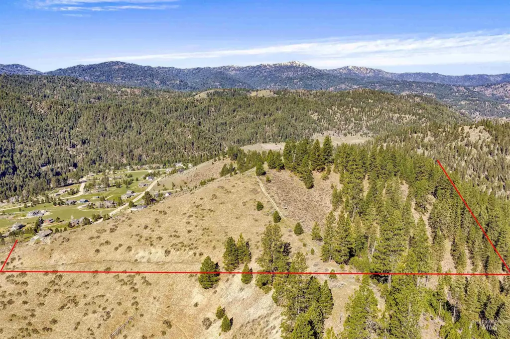
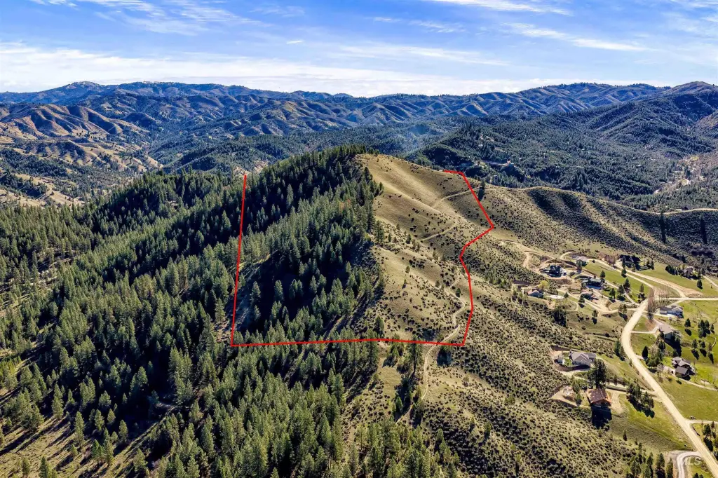
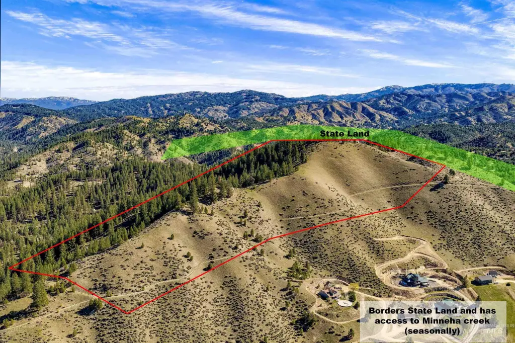
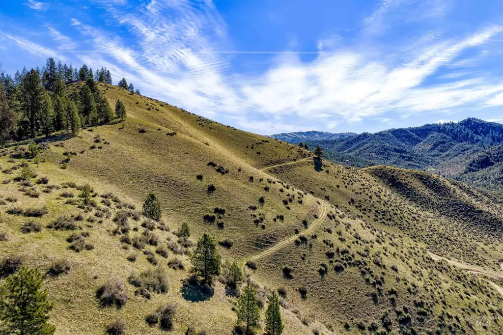
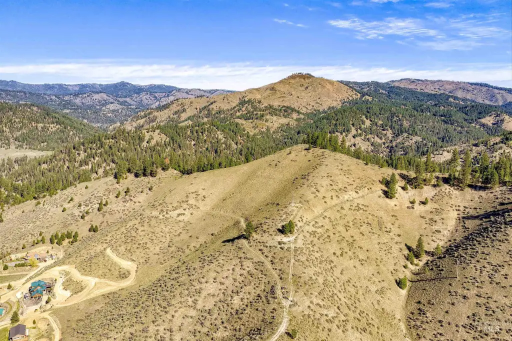
This 65.19-acre vacant land parcel in Boise County is set up for either a primary home build or a small subdivision plan. The property is described as having wide, open views in multiple directions, with mountain, timber, wildlife, and “big sky” scenery. The offering includes a stated 1x split that may allow it to be subdivided up to 4 lots, providing flexibility for different layout concepts. The remarks also note there are no CC&Rs, giving buyers discretion in how they use and develop the land. Lot lines shown in photos are for reference only and are not exact.
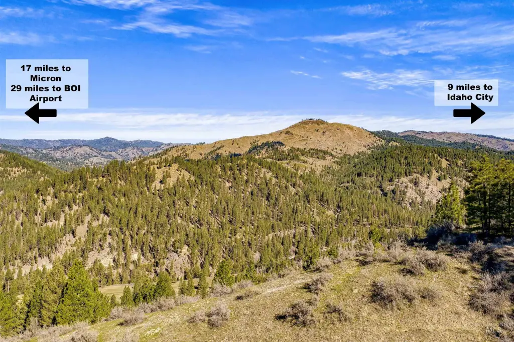
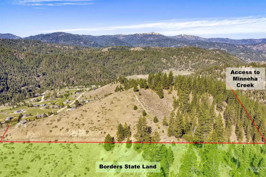
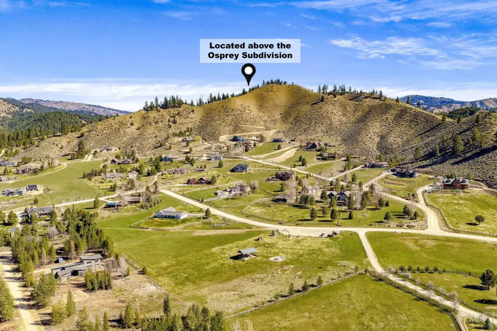
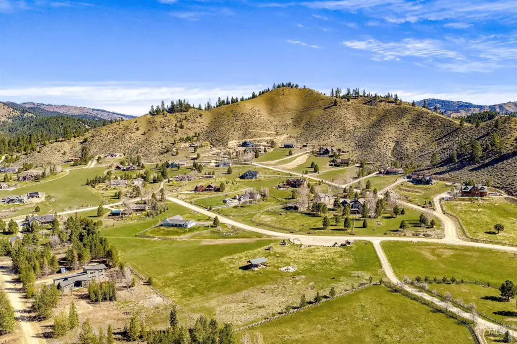
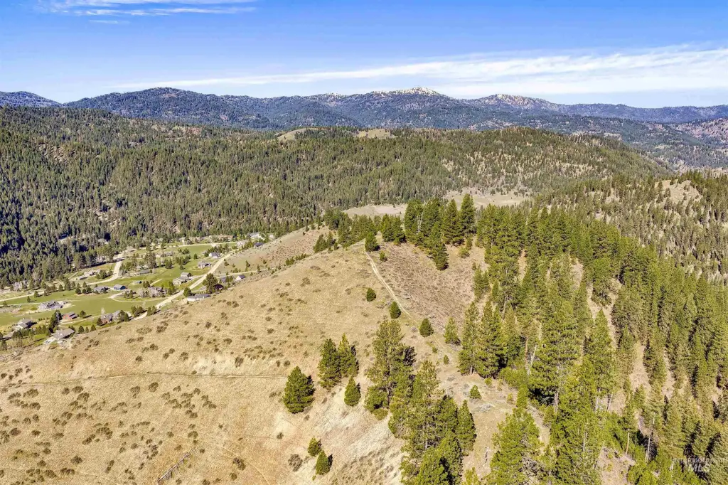
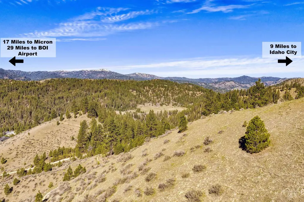
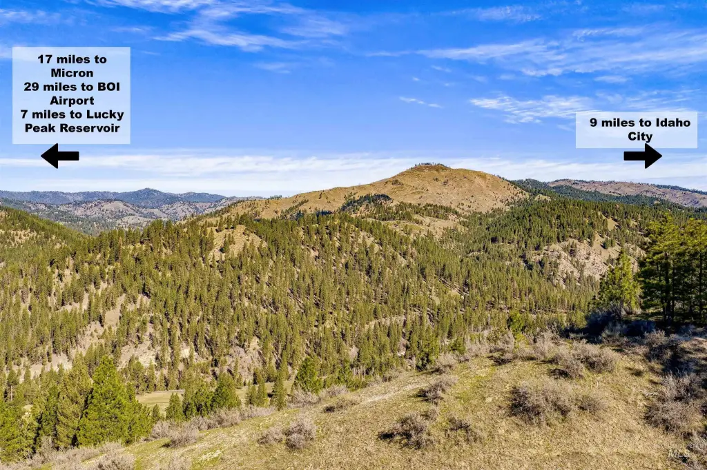
The parcel is described as sitting above the Osprey Subdivision and bordering State Land “Minneha,” with direct access to recreation and wildlife activity. Lucky Peak is noted as nearby for boating and fishing, and Mores Creek is described as minutes from the property. The location is stated as approximately 9 miles to Idaho City for local amenities, 17 miles to Micron, and 29 miles to the BOI airport.
For tenants, buyers, or operators seeking land that can support a custom residence with space and privacy, this site offers a straightforward path to a single build. For buyers looking for a small development approach, the included split option and CC&R-free status are practical considerations when planning lot layouts and ownership structure.
Key Highlights
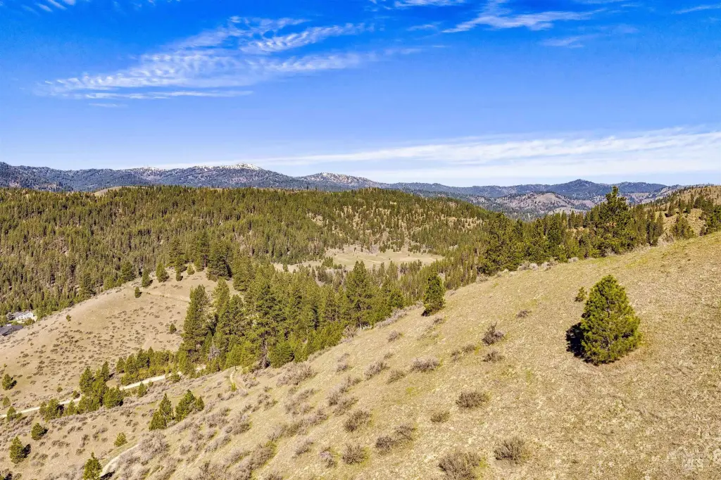
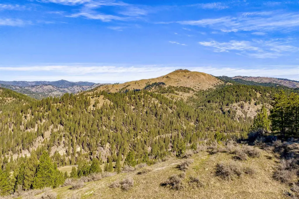
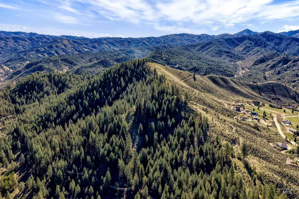
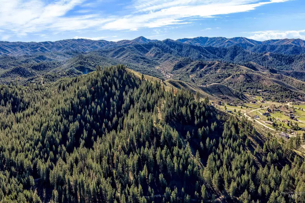
- 65.19 acre property with INCREDIBLE 360‑degree views of mountains, timber, wildlife, and big skies.
- Development potential: Sub‑dividable into up to 4 lots with 1 split available.
- Borders State Land "Minneha" providing direct access to endless recreation and wildlife viewing.
Property Analytics
Property Profile
Location Intelligence
Current Use by Public Records
Residential land & home ...


FAQs
What type of property is this?
Residential land & home lot - 65-acre Boise County parcel offers subdivision flexibility and borders state land for direct recreation access.
Where is this residential land & home lot located?
The property is located at 65ac Tbd High Corral Road Boise, ID.
What is the asking price?
The asking price for this property is $1,475,000.
What are key features of this property?
This property features: 65.19 acre property with INCREDIBLE 360‑degree views of mountains, timber, wildlife, and big skies.; Development potential: Sub‑dividable into up to 4 lots with 1 split available.; Borders State Land "Minneha" providing direct access to endless recreation and wildlife viewing.


