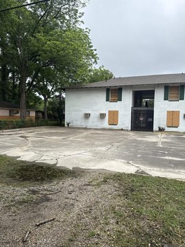
2914 Oneal Ln, Baton Rouge, LA 70816
- Added:
- Jan 16, 2026
- Days on Market:
- 170
- Last Refresh:
- Jul 5 at 5:06 am
Property Features for 2914 Oneal Ln
General Information
- Property type
- Commercial Sale
- Property subtype
- Other
- Standard status
- Active
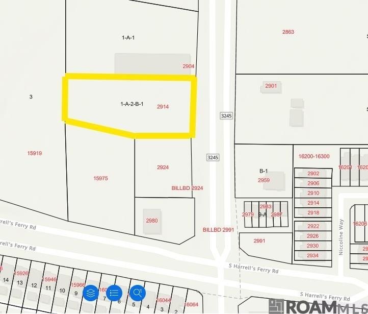
- Lot size
- 1.26 Acres
Taxes and HOA fees
- Tax Description
- Ward: 1-4, Subdivision: Lirocchi, Lot: 1-A-2-B-1. Lot 1-A-2-B-1, Cont. 1.32 Acres,Resub. Of Lot 1-A-2-B, Lirocchi,Cont. 2.02 Acres. Resub. 1984-96.Less Parcel 02-03 To City/Parish.2009. (975-12131).
Utilities
- Utilities
- Water Available
Listing agent Jonathan Tittlebaum (504) 300-0700
Listing office Reve REALTORS 4827 Prytania St, Baton Rouge, LA (504) 300-0700
Listing date Jan 16, 2026
Copyright © 2026 Greater Baton Rouge Association of REALTORS. All rights reserved. All information provided by the listing agent/broker is deemed reliable but is not guaranteed and should be independently verified.
HighLights
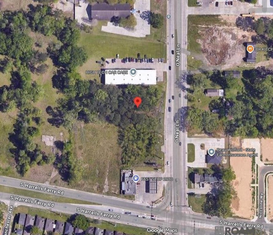
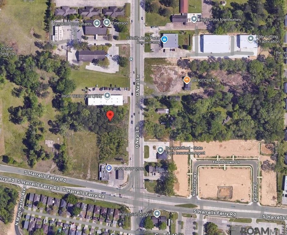
- 1.32 acres (subject to survey) on O'Neal Ln (LA 3245) with approximately 165 ft of frontage on the west side.
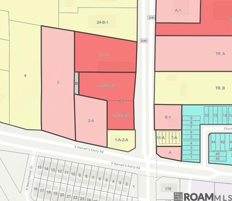
- Zoned primarily C2 (heavy commercial), with a small rear strip zoned B for off‑street parking.
- City of Baton Rouge sanitary sewer and Baton Rouge Water Company water mains located within the O'Neal Ln right of way; water available.
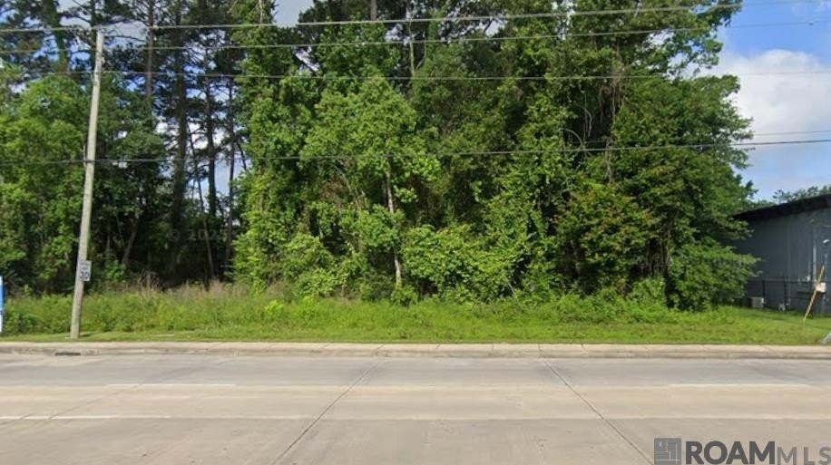
- Mostly level and mostly wooded site on a heavily traveled 5‑lane commercial corridor with direct exposure to heavy daily traffic.
- Flood zone: mostly X with a small portion at the rear in AE (subject to confirmation).
- Within the City of Baton Rouge and East Baton Rouge Parish; about 1 mile south of the I‑12 and O'Neal Ln interchange and about 400+/- ft north of South Harrells Ferry Rd.
Overview
The property is located in the City of Baton Rouge and East Baton Rouge Parish, approximately 1 mile south of the I-12 and O’Neal Lane interchange and about 400+/- feet north of South Harrells Ferry Road. It sits along a heavily traveled commercial corridor with direct exposure to heavy daily traffic.
This parcel can be a practical fit for investors or developers seeking a highly visible location on a major five-lane corridor, with a zoning framework that is primarily designed for heavy commercial activity. The mix of C-2 zoning and a limited B-zoned rear area for off-street parking supports a range of site planning considerations, subject to final permitting and confirmation of flood requirements.
Current Use by Public Records
Location Insight
- Map
- Local Demand
- City
- Baton Rouge
- County
- East Baton Rouge
- State
- Louisiana
- Longitude
- -91.008305
- Latitude
- 30.426567