Commercial Corner Land with Dual
2200 N Gettysburg Avenue Dayton, OH 45406
For Sale
$55,000
LAND - Dayton, OH
Lot Size0.87 Acres
Days on Market186
Property Features for 2200 N Gettysburg Avenue
General Information
- Property type
- Land
- Property subtype
- Other
- Zoning
- Commercial
- Standard status
- Active
- APN
- R72-15808-0008
- Lot size
- 0.87 Acres
Taxes and HOA fees
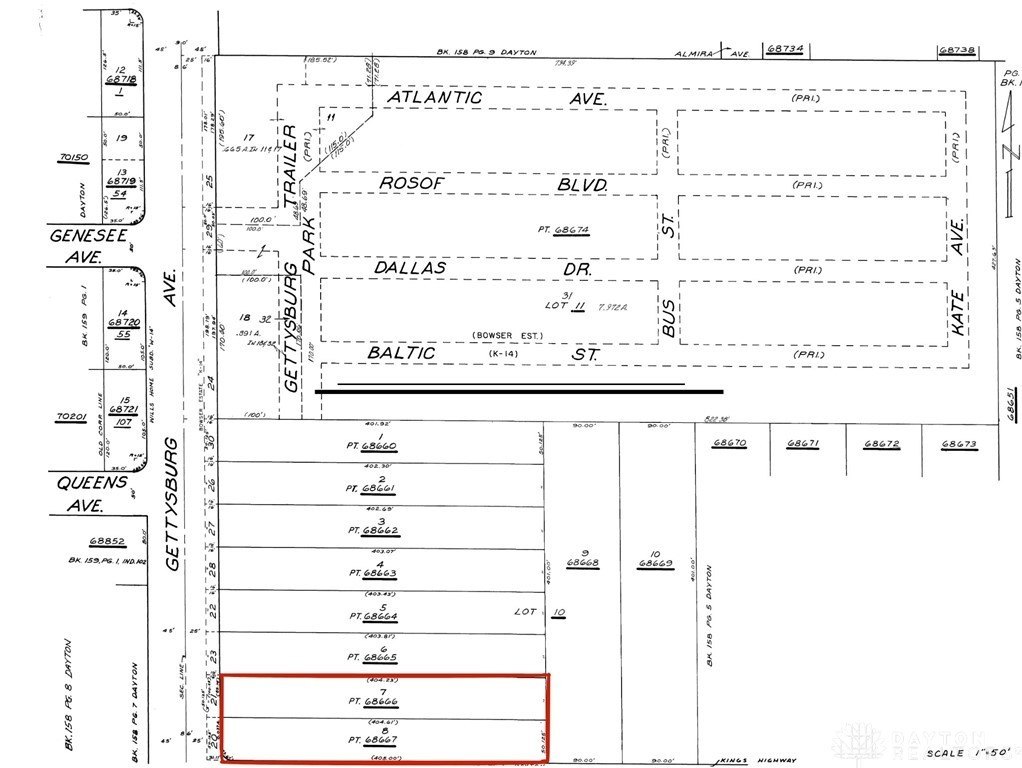
- Tax Description
- Parcels R72 15808 0008 and R72 15808 0007
Utilities
- Water source
- Public
Listing Agency:
eXp Realty
(866) 212-4991
Listed By:
Veronica Pando · License #2021003223
(513) 304-3991
Added: Jan 21
Changed: Jun 10
Last Checked: Jul 26 at 3:06PM
MLS# 950450
Copyright © 2026 Dayton Realtors. All rights reserved. All information provided by the listing agent/broker is deemed reliable but is not guaranteed and should be independently verified.
Investment Insights
Based on property information with market context.
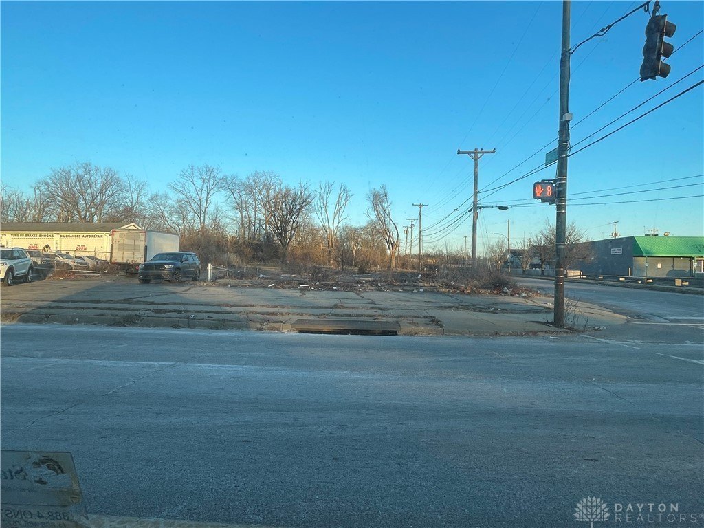
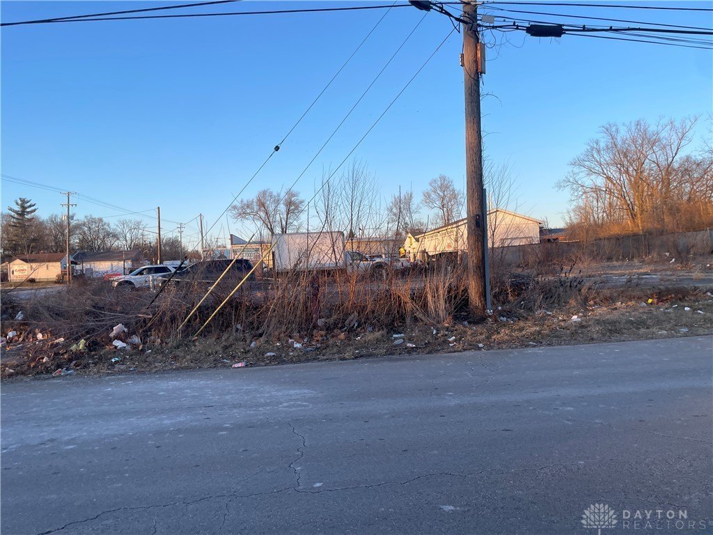
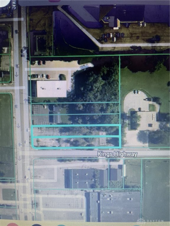
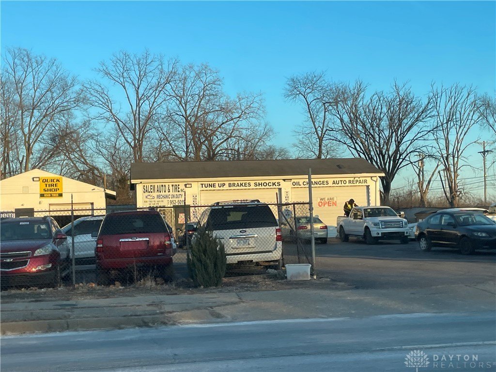
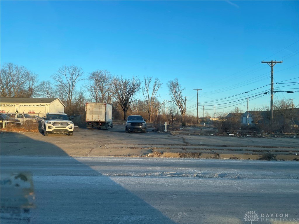
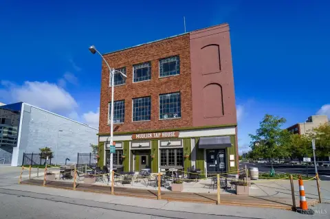
This commercial land offering includes two lots totaling approximately 0.9 acres, with each lot measuring approximately 400 feet by 100 feet. The combined configuration supports flexible site planning for a range of commercial concepts, including layouts that accommodate vehicle access and parking. With frontage and accessibility emphasized by the parcel design, the property is well suited for buyers looking to position a new use on a prominent corner.
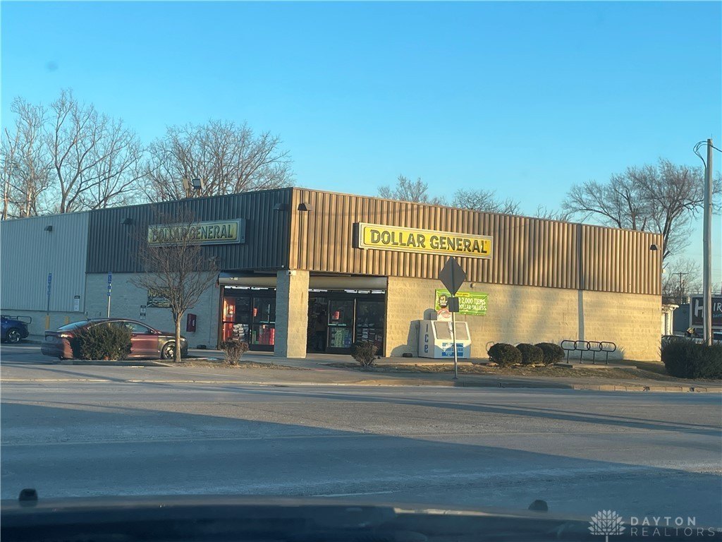
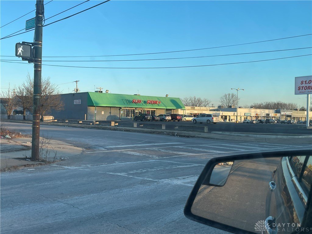
The site is located at the corner of Gettysburg Road and Kings Highway and provides dual street frontage for increased exposure and multiple access points. Public remarks note a high-traffic corner location and proximity to a wide variety of restaurants, shopping, and service businesses, including major grocery shopping with Kroger nearby. A Dollar General is described as being just a few feet down the street.
From a tenant or operator perspective, the commercial zoning and corner placement provide a practical foundation for development that needs dependable roadway presence and straightforward circulation. The site’s regional connectivity is highlighted by proximity to major transportation routes, including I-75, I-70, Route 48, Route 49, and US Route 35, supporting access for both local and regional customer traffic.
Key Highlights
- Commercial property on a high‑traffic corner at Gettysburg Road and Kings Highway with dual street frontage
- Two lots totaling approx. 0.9 acres (about 400 ft x 100 ft each) for flexible building and site planning
- Public water available
Property Analytics
Property Profile
Location Intelligence
Current Use by Public Records
Commercial land


FAQs
What type of property is this?
Commercial land - Two-lot commercial site with dual street frontage, designed for flexible development, parking, and strong visibility.
Where is this commercial land located?
The property is located at 2200 N Gettysburg Avenue Dayton, OH.
What is the asking price?
The asking price for this property is $55,000.
What are key features of this property?
This property features: Commercial property on a high‑traffic corner at Gettysburg Road and Kings Highway with dual street frontage; Two lots totaling approx. 0.9 acres (about 400 ft x 100 ft each) for flexible building and site planning; Public water available


