Waterfront Lake-View Land
1613 Hillside Drive Sanger, TX 76266
1613 Hillside Drive, Sanger, TX, 76266
$850,000
For Sale
$850,000
LAND - Sanger, TX
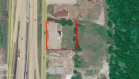
Lot Size2.00 Acres
Days on Market15
Property Features for 1613 Hillside Drive
General Information
- Property type
- Land
- Property subtype
- Other
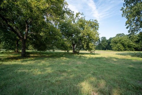
- Vegetation
- Brush, Grassed
- Standard status
- Active
- APN
- R1054479
- Lot size
- 2.00 Acres
Taxes and HOA fees
- Tax Description
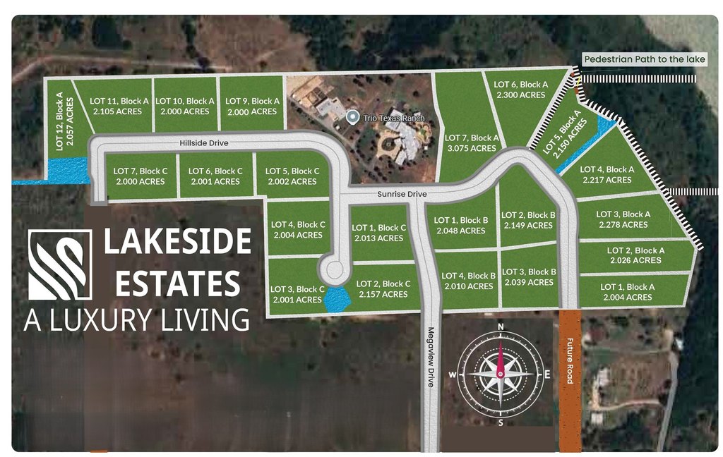
- LAKESIDE ESTATES (SANGER ISD) BLK A LOT 3
- Tax Annual Amount
- 3801
Utilities
- Utilities
- Propane
- Sewer type
- Aerobic Septic, Septic Tank
- Heating system
- Propane (Heating)
- Water source
- Private, Well
- Water front features
- Beach Access, Lake Front
- Water front
- 1
Listing agency
Teifke Real Estate
(512) 870-8184
Listed by
Stephen Barber · License #0679940
(512) 914-4806
Added: Jul 8 Updated: Jul 12 at 3:35AM Checked: Jul 22 at 5:06AM
MLS# 21258373
Copyright © 2026 North Texas Real Estate Information Systems, Inc. All rights reserved. All information provided by the listing agent/broker is deemed reliable but is not guaranteed and should be independently verified.
Investment Insights
Based on property information with market context.
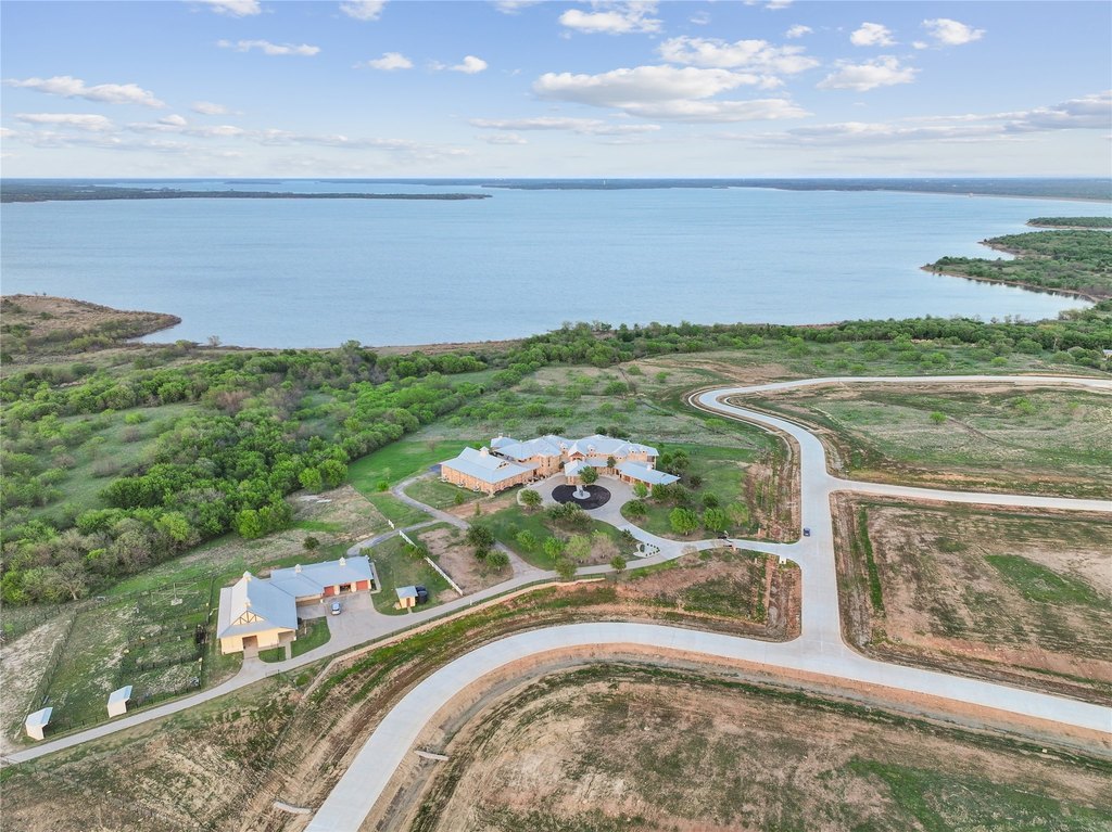
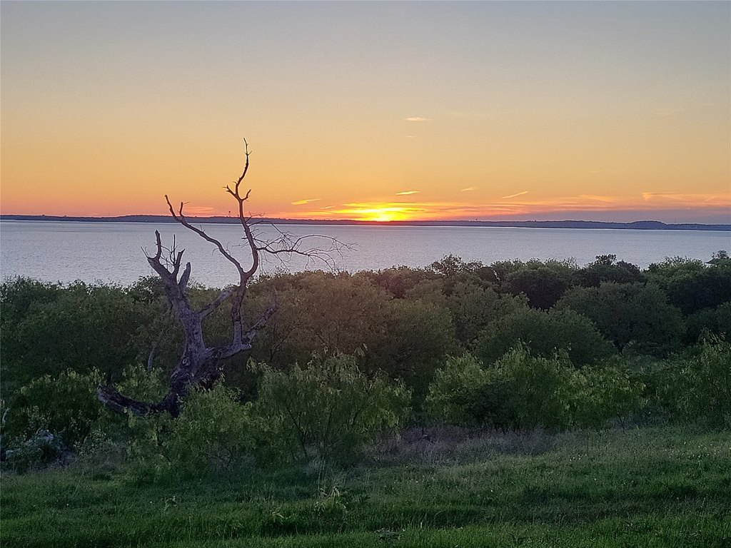
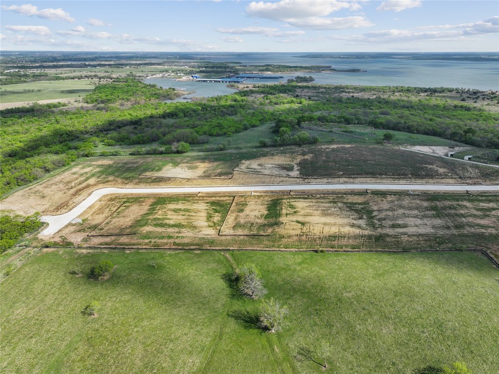
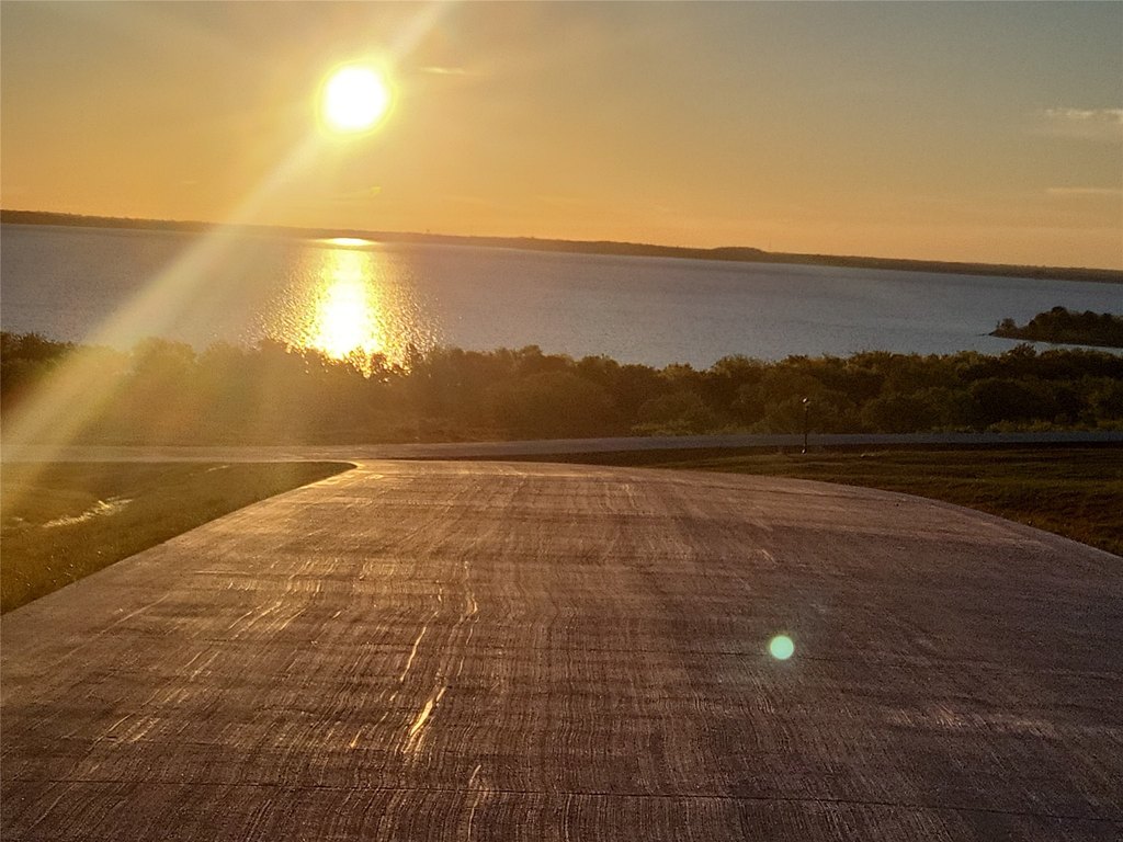
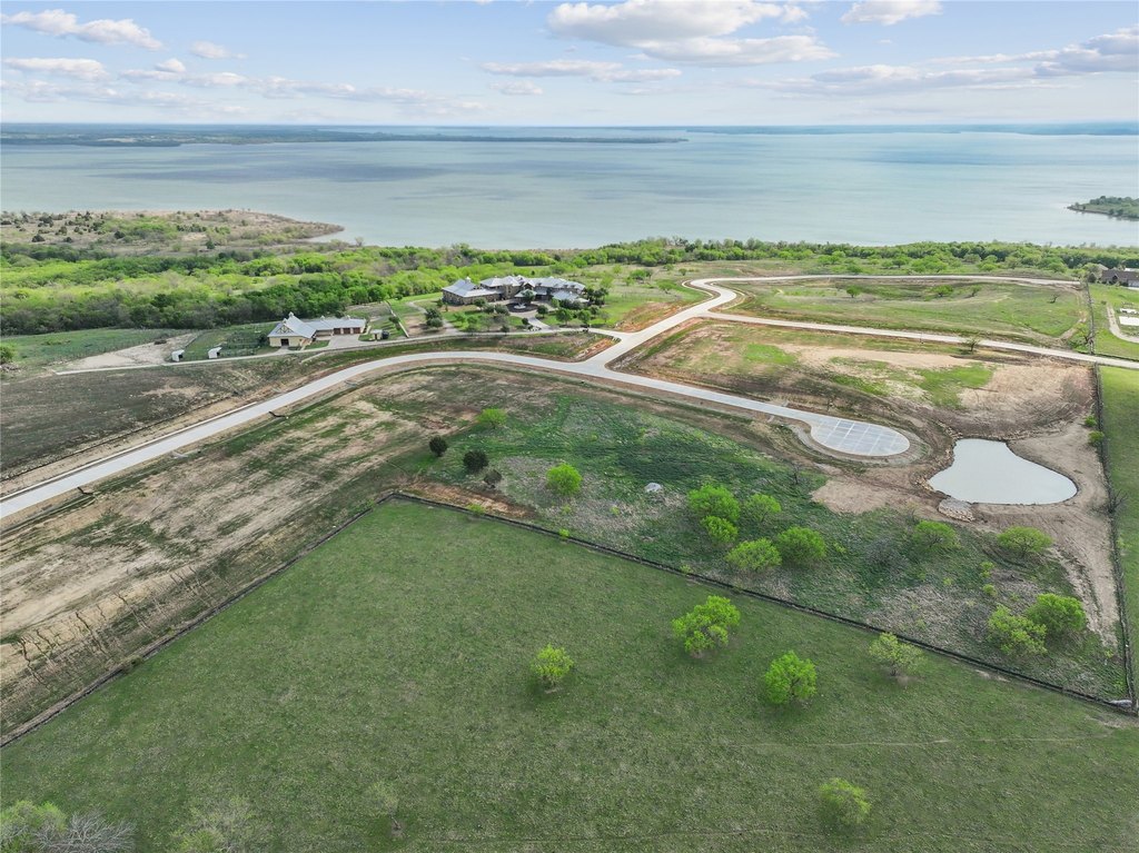
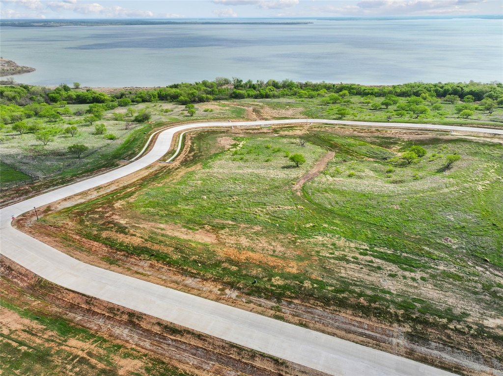
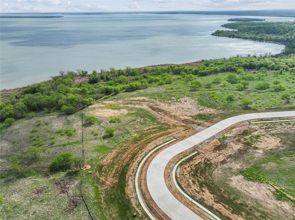
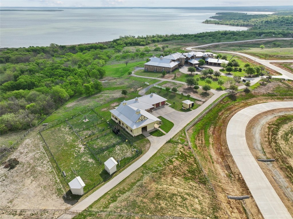
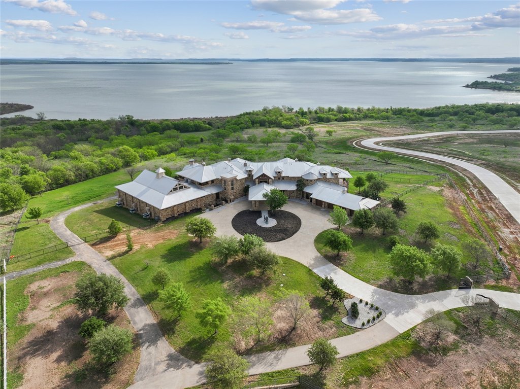
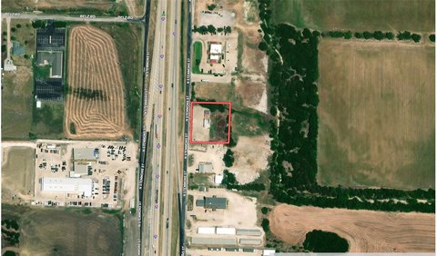
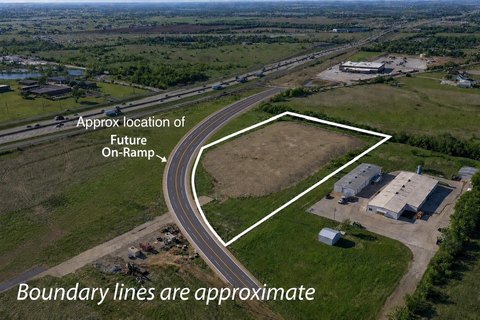
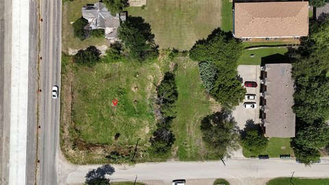
This offering is waterfront land in a scenic setting with a reported 180-degree lake view of Lake Ray Roberts, along with expansive sightlines described as extending for miles. The property adjoins Army Corps of Engineers land that preserves the natural shoreline, with the adjoining area described as encompassing over 440 acres. The tract is approximately 2 acres.
The location provides practical access to water-based and outdoor amenities, including an approximately 2-mile drive to the marina. The remarks also note about 10 minutes to walk and horse trails, and roughly 5 minutes to hunting land. As described, the Army Corps of Engineers property provides a natural area for ongoing exploration.
For buyers seeking a waterfront parcel for personal use, recreation, or outdoor-focused lifestyle, the combination of lake views, preserved shoreline adjacency, and nearby trail and hunting references can be an important fit. The property’s land configuration supports a range of owner-directed uses where proximity to the lake and adjoining conservation land matters to the decision-making process.
Key Highlights
- Lakefront property with beach access and a lake view
- Well water with private water source
- Propane utilities and propane heating
Property Analytics
Location Intelligence
Current Use by Public Records
Waterfront Land
Similar For Sale Nearby


FAQs
What type of property is this?
Waterfront Land - Waterfront land with wide Lake Ray Roberts views and access to nearby marina, trails, and hunting opportunities.
Where is this waterfront land located?
The property is located at 1613 Hillside Drive Sanger, TX.
What is the asking price?
The asking price for this property is $850,000.
What are key features of this property?
This property features: Lakefront property with beach access and a lake view; Well water with private water source; Propane utilities and propane heating


