Lakefront Recreation
1512 Sunrise Drive Sanger, TX 76266


1512 Sunrise Drive, Sanger, TX, 76266
$1,200,000
For Sale
$1,200,000
LAND - Sanger, TX
Lot Size2.28 Acres
Days on Market15
Property Features for 1512 Sunrise Drive
General Information
- Property type
- Land
- Property subtype
- Other
- Vegetation
- Brush, Grassed
- Standard status
- Active
- APN
- R1054473
- Lot size
- 2.28 Acres
Taxes and HOA fees
- Tax Description
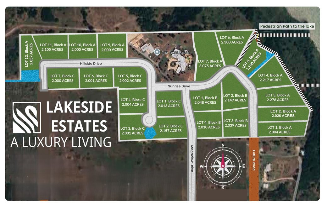
- LAKESIDE ESTATES (SANGER ISD) BLK A LOT 3
- Tax Annual Amount
- 3801
Utilities
- Utilities
- Propane
- Sewer type
- Aerobic Septic, Septic Tank
- Heating system
- Propane (Heating)
- Water source
- Private, Well
- Water front features
- Beach Access
Listing agency
Teifke Real Estate
(512) 870-8184
Listed by
Stephen Barber · License #0679940
(512) 914-4806
Added: Jul 8 Updated: Jul 12 at 3:35AM Checked: Jul 22 at 5:06PM
MLS# 21258043
Copyright © 2026 North Texas Real Estate Information Systems, Inc. All rights reserved. All information provided by the listing agent/broker is deemed reliable but is not guaranteed and should be independently verified.
Investment Insights
Based on property information with market context.
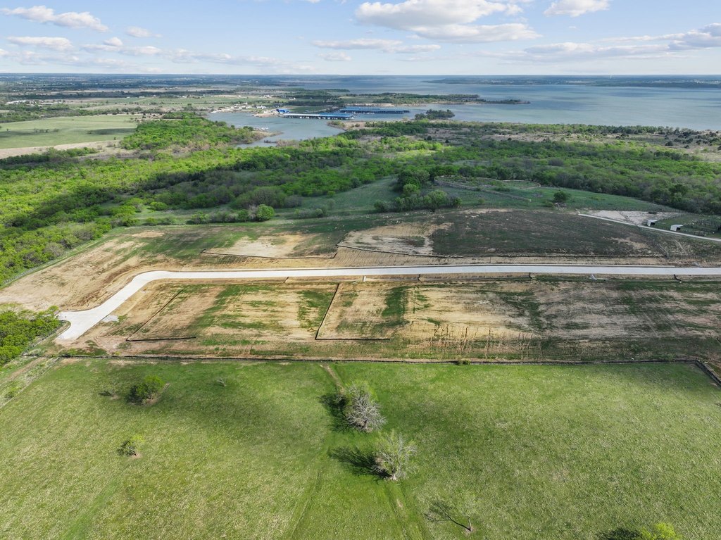
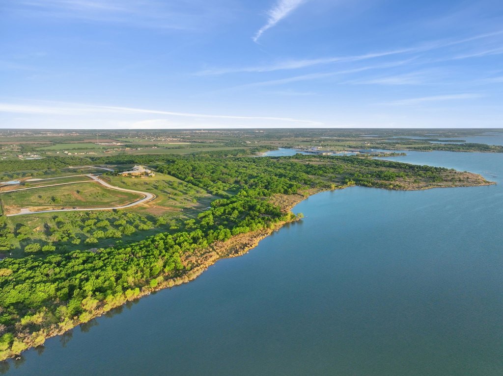
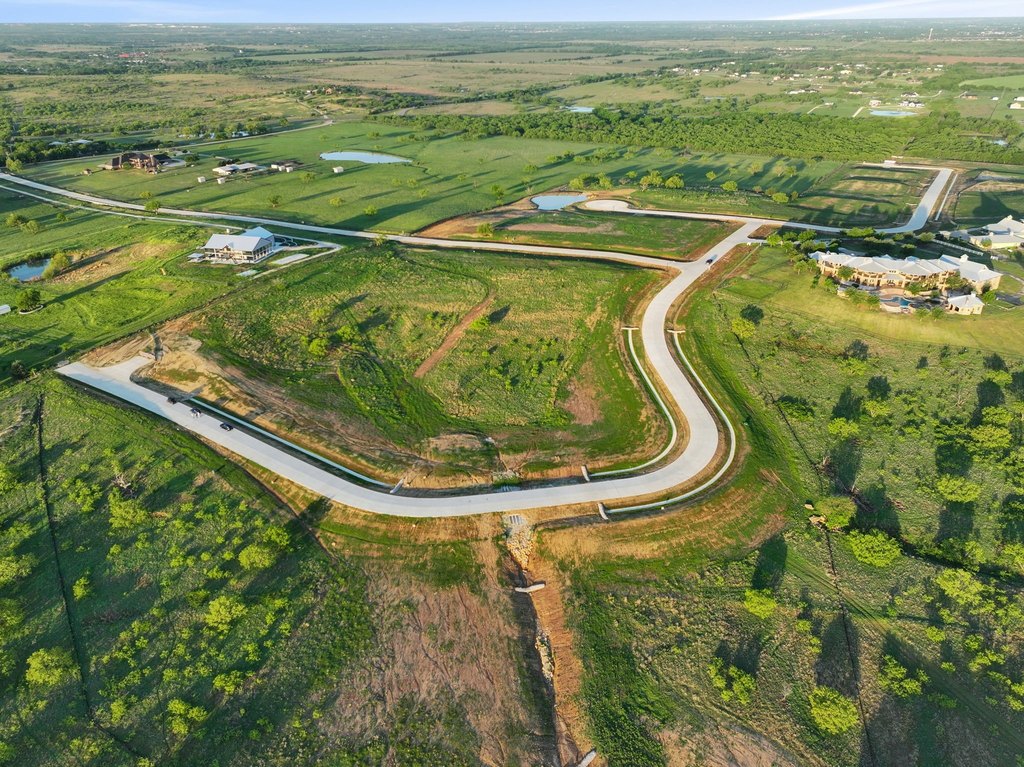
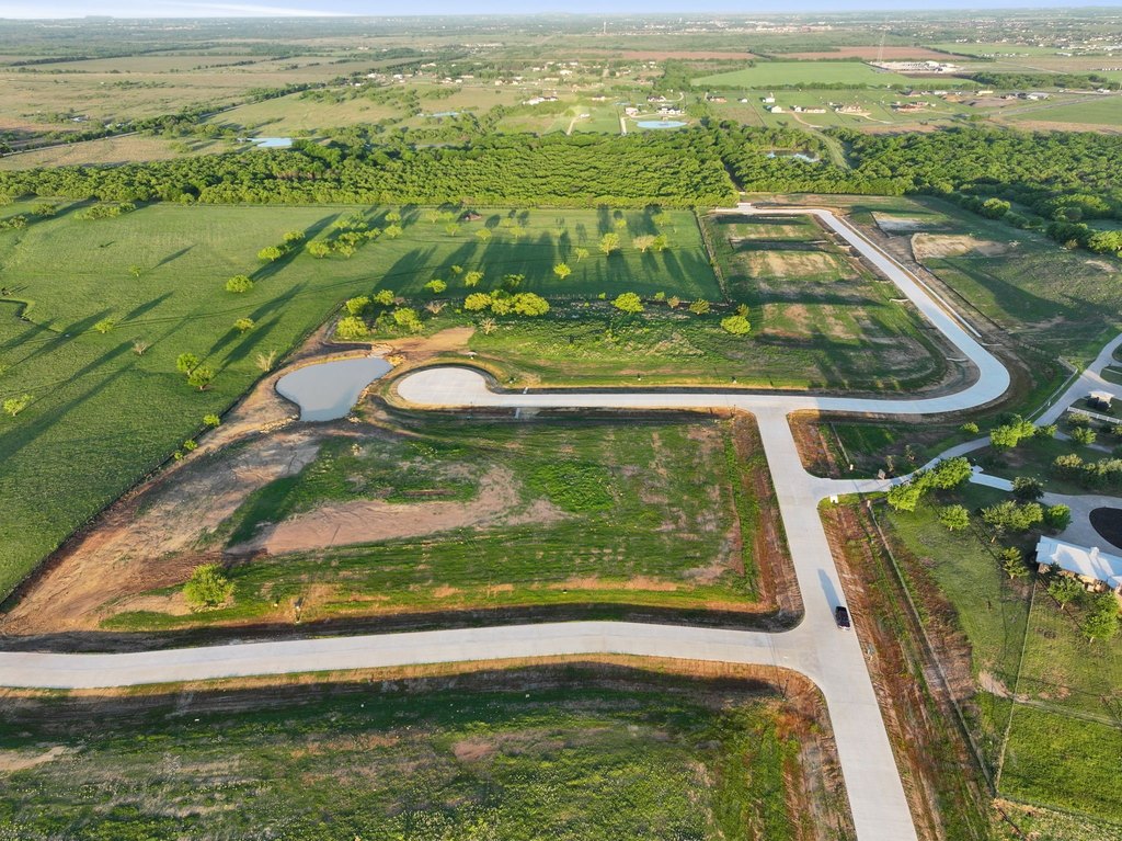
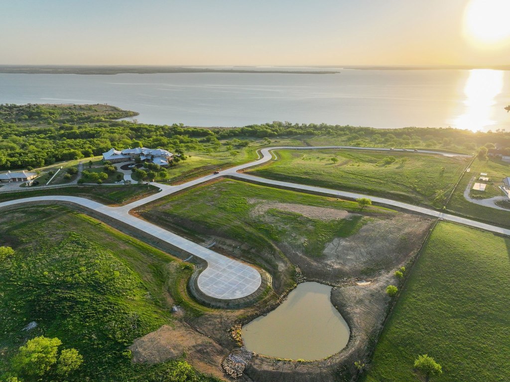
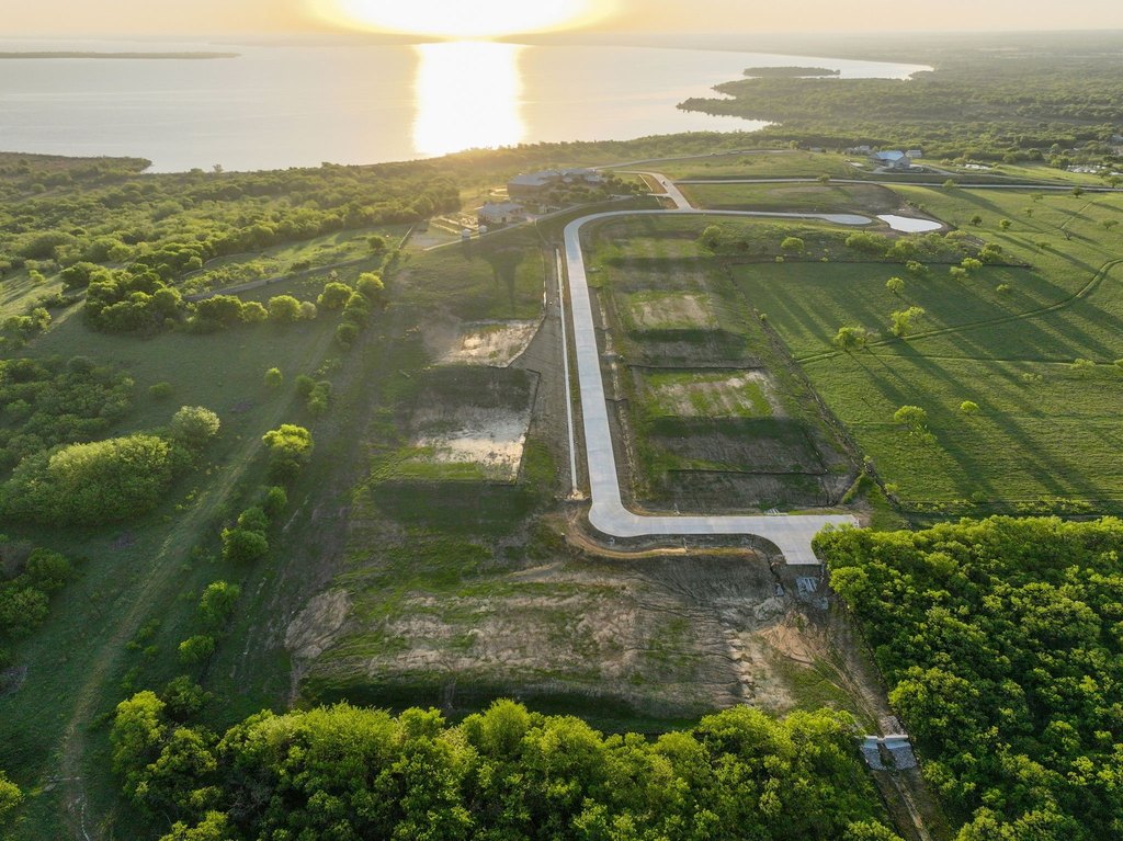
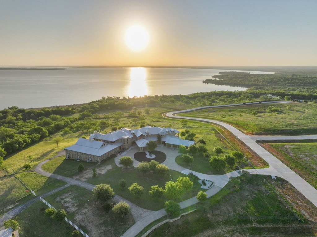
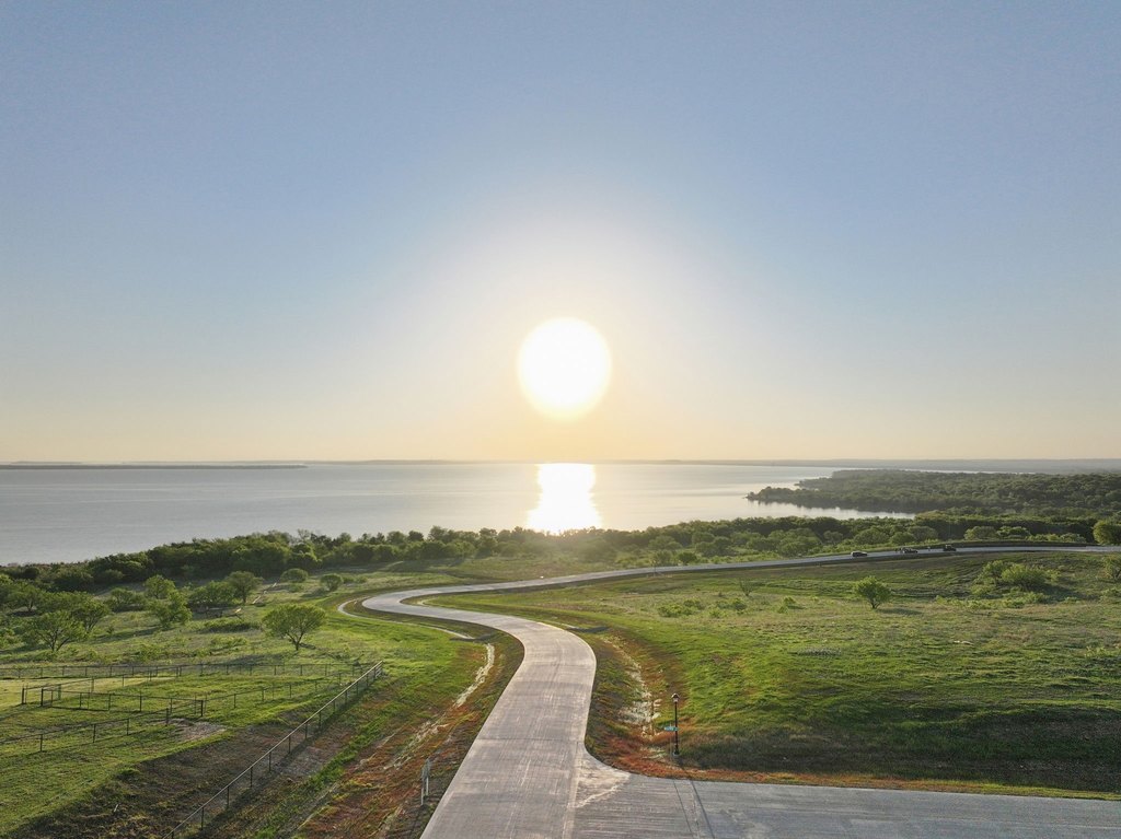
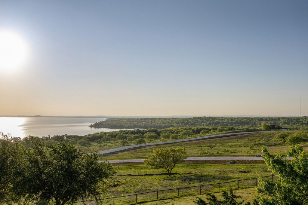
This waterfront land offering features a broad, 180-degree view of Lake Ray Roberts. The property is positioned to capture views across the lake, including sunrise to the east and sunset to the west. The lot size is approximately 2.278 acres.
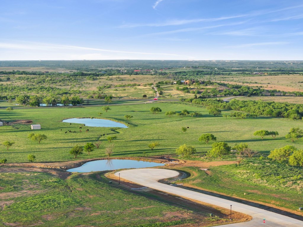
The land adjoins the U.S. Army Corps of Engineers, providing adjacency to preserved natural shoreline and approximately 440 acres of nearby open space to explore. Convenience to recreation is supported by its proximity to a marina, roughly a 2-mile drive away. Outdoor activities nearby include a 20-mile walk and horse trails about 10 minutes from the property, with hunting land reportedly about 5 minutes away.
For buyers looking to build a private lakeside retreat, this combination of waterfront sightlines and nearby outdoor access offers a practical fit for recreation-focused use. The adjacency to the Army Corps property may also appeal to buyers prioritizing long-term natural shoreline context as part of their site selection.
Key Highlights
- Beach access and waterfront setting with views of Lake Ray Roberts
- 180‑degree lake view with sunsets to the west and sunrises over the lake
- Adjoins the Army Corps of Engineers property with 440+ acres and natural shoreline preserves
Property Analytics
Location Intelligence
Current Use by Public Records
Waterfront Land
Similar For Sale Nearby


FAQs
What type of property is this?
Waterfront Land - Waterfront land with 180-degree Lake Ray Roberts views and nearby access to marina and outdoor trails.
Where is this waterfront land located?
The property is located at 1512 Sunrise Drive Sanger, TX.
What is the asking price?
The asking price for this property is $1,200,000.
What are key features of this property?
This property features: Beach access and waterfront setting with views of Lake Ray Roberts; 180‑degree lake view with sunsets to the west and sunrises over the lake; Adjoins the Army Corps of Engineers property with 440+ acres and natural shoreline preserves


