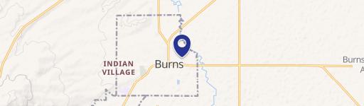
0 Highway 20 Burns, OR 97720
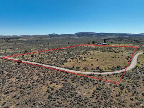
This exceptional .23-acre commercial lot presents a unique investment opportunity in Hines, Oregon. Strategically located on Highway 20, this property boasts high visibility and convenient access for businesses. The lot is zoned for commercial use, providing flexibility for a variety of development options. Its proximity to the Valley Golf Club and the High Desert Partnership adds significant value, offering potential for synergy and increased foot traffic. The property is situated in Harney County, Oregon, with a 97720 zip code. The asking price is $35,000, and the annual property taxes are $292.78. This vacant lot is ready for immediate development, making it an ideal choice for entrepreneurs seeking a prime location to establish their business. The property's size and location make it suitable for a range of commercial ventures, from retail spaces to small offices. Don't miss this chance to secure a piece of prime commercial real estate in a growing area of Eastern Oregon. The coordinates are 43.6138786 latitude and -118.8846617 longitude.
Cap rate
Implied · in-place · derived from last sale + estimated NOIValue
AI, CAP & Alternative Use estimations · Realmo proprietary blendComparables
6 recent transactions · within 1.5 miComparable in this City


Similar Nearby for Sale


Property description
Physical attributes from public recordsZoning & alternative use
No recorded transactions found for this property.
Costs & Benchmarks
Operating expenses, capex projections, utility benchmarks, and submarket comparables — all in one view.
Risks
Flood, climate, environmental, title, and tenant-concentration risk — surfaced with mitigations and source citations.


