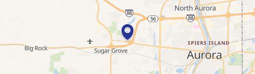
47 Between Galena & Rt 56 Sugar Grove, IL 60554
This exceptional 134-acre commercial land parcel presents a unique investment opportunity in Sugar Grove, Illinois. Currently zoned F - Farming District, the property boasts significant future development potential. The Future Land Use Map designates this area for Town Center Commercial development, allowing for high-density residential and mixed-use projects. Its strategic location directly north of the Settlers Ridge Development and a full access interchange at Route 56 provides unparalleled accessibility. High daily traffic counts on Route 47 (20,000 vehicles), Galena Boulevard (8,900 vehicles), and Route 56 (16,900 vehicles) ensure high visibility and accessibility. The property is served by the Kaneland Community School District 302. Parcel numbers are 14-16-400-013 & 14-16-400-014, and the annual property taxes are $7,752. This is a remarkable opportunity to capitalize on Sugar Grove's growth trajectory and create a thriving commercial development. The property is subject to offer. Contact us for additional information and to explore this exciting prospect.
Cap rate
Implied · in-place · derived from last sale + estimated NOIValue
AI, CAP & Alternative Use estimations · Realmo proprietary blendComparables
6 recent transactions · within 1.5 miComparable in this City


Similar Nearby for Sale


Similar Nearby for Lease


Property description
Physical attributes from public recordsZoning & alternative use
No recorded transactions found for this property.
Costs & Benchmarks
Operating expenses, capex projections, utility benchmarks, and submarket comparables — all in one view.
Risks
Flood, climate, environmental, title, and tenant-concentration risk — surfaced with mitigations and source citations.


