Development-Ready Waterfront Farmland
For Sale
$600,000
Fm 131, Denison, TX 75020
LAND - Other - Denison, TX
Property SizeContact for details
Lot Size11.04 Acres
Days on Market56
Property Features for Fm 131
General Information
Property type
Land
Property subtype
Other
Zoning description
1 Acre Planned Development, 10.04 acres Agriculture
Vegetation
Wooded
Subdivision
County
Lot features
Acreage, Agricultural, Pond On Lot, Many Trees, City Lot
Elementary school
Pottsboro
Middle school
Pottsboro
High school
Pottsboro
Elementary school district
Pottsboro ISD
Middle school district
Pottsboro ISD
High school district
Pottsboro ISD
Directions
Property is on FM 131 directly across from the Cold Creek entrance.
Standard status
Active
APN
113564
Lot size
11.04 Acres
Taxes and HOA fees
Tax Description
G-0433 FARMER DAVID M A-G0433, ACRES 10.04, U
Tax Annual Amount
4
Legal Description
G-0433 FARMER DAVID M A-G0433, ACRES 10.04, U
Utilities
Water front features
Creek
Building Details
Architectural style
Other
Listing Agency:
Easy Life Realty
(903) 224-5171
Listed By:
Brad Rhodes · License #0650119
(903) 224-5171
Added: Jun 9
Changed: Jun 10
Last Checked: Aug 3 at 1:06PM
MLS# 21296312
Copyright © 2026 North Texas Real Estate Information Systems, Inc. All rights reserved. All information provided by the listing agent/broker is deemed reliable but is not guaranteed and should be independently verified.
Investment Insights
Based on property information with market context.
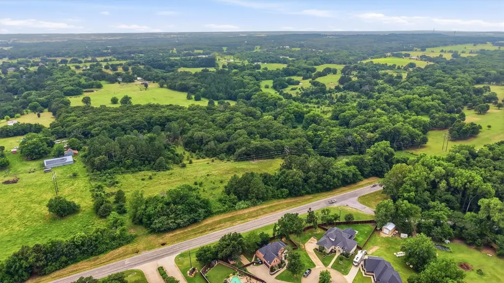
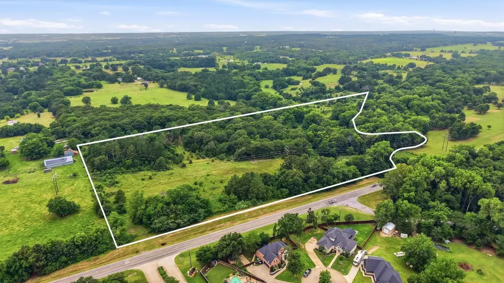
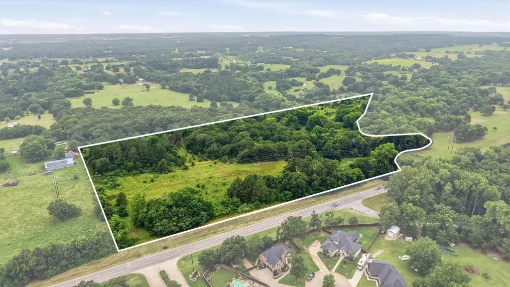
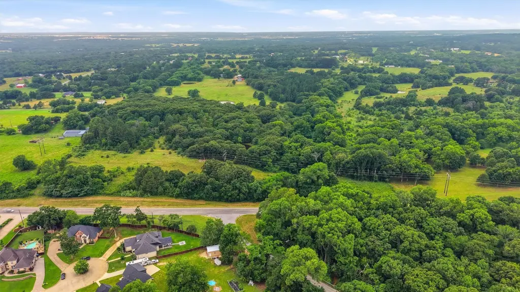
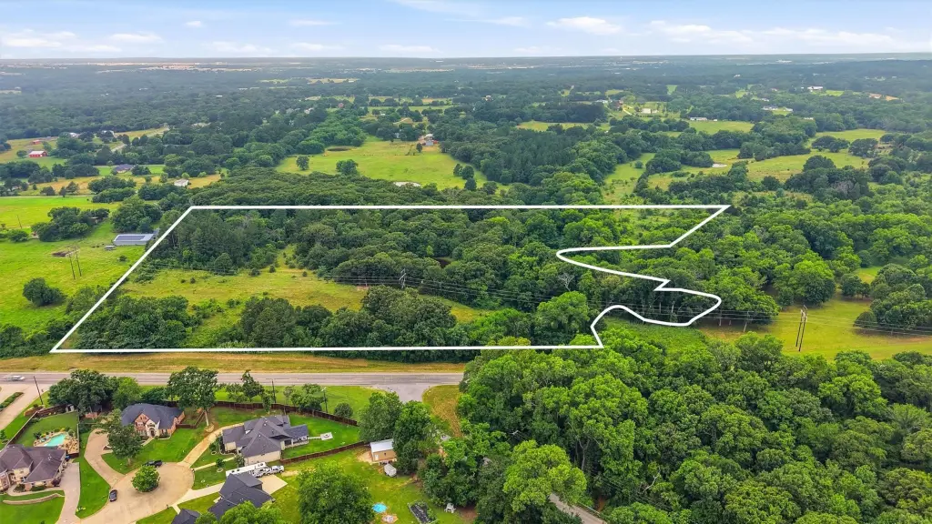
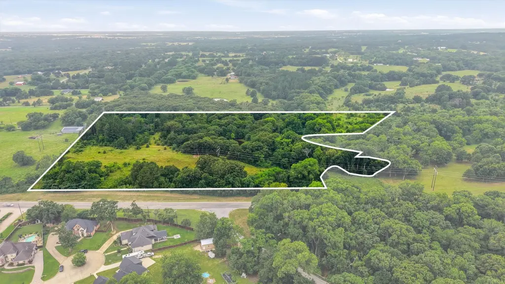
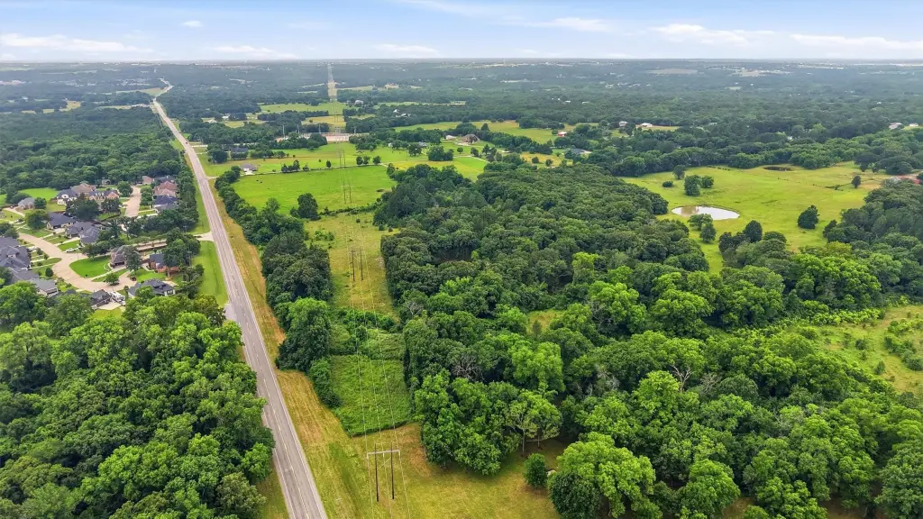
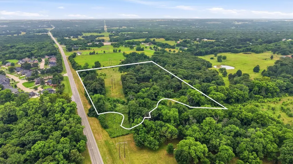
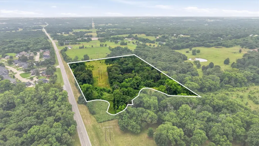
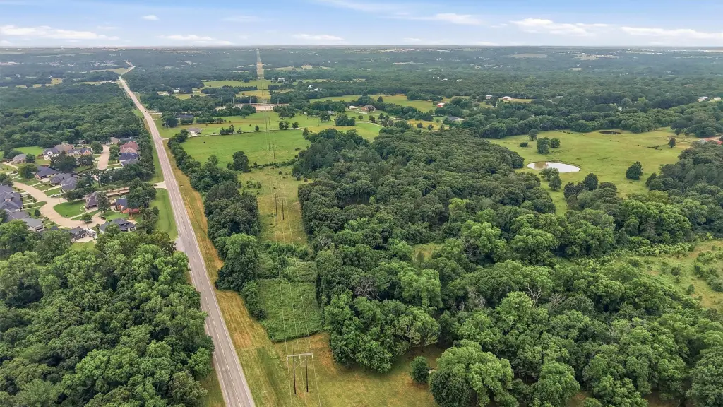
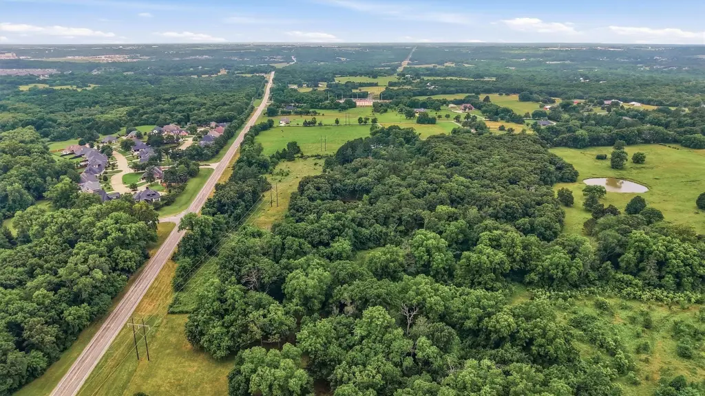
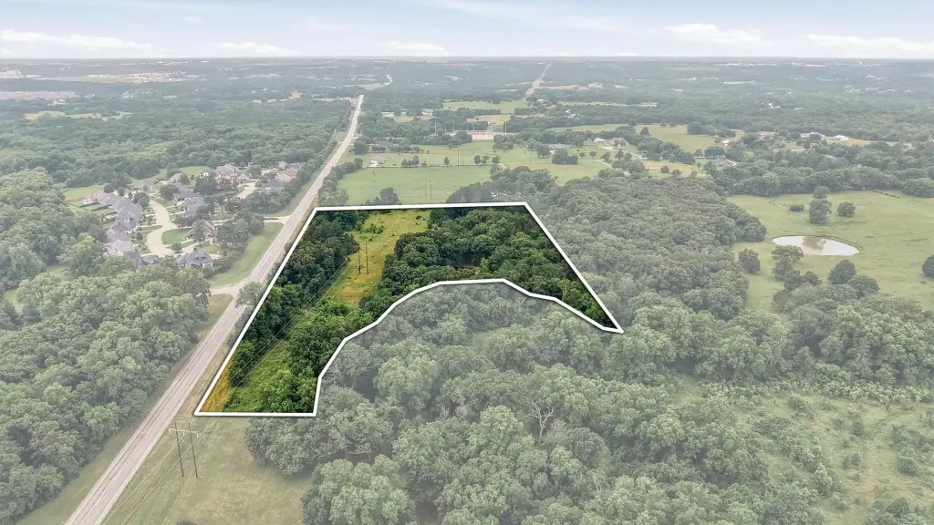
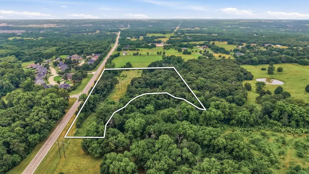
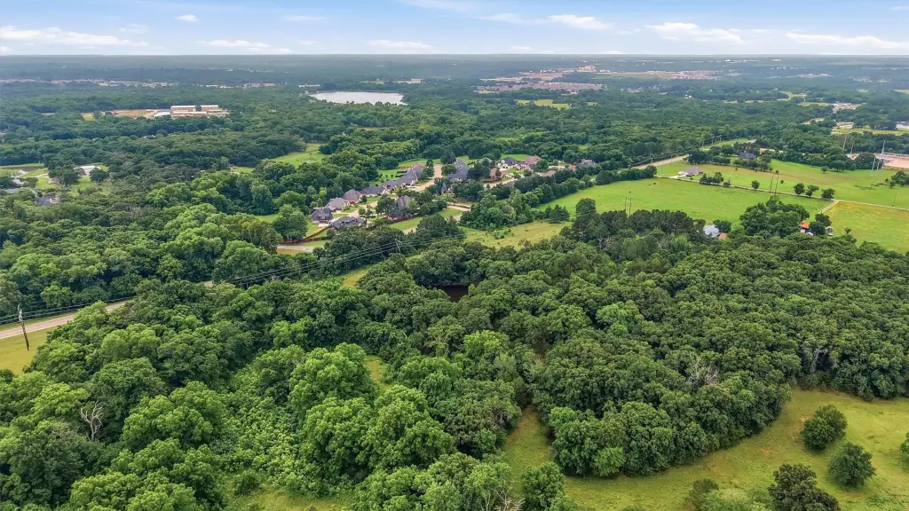
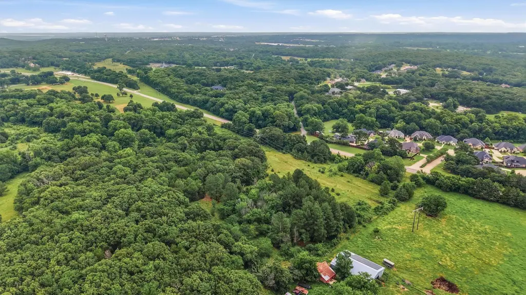
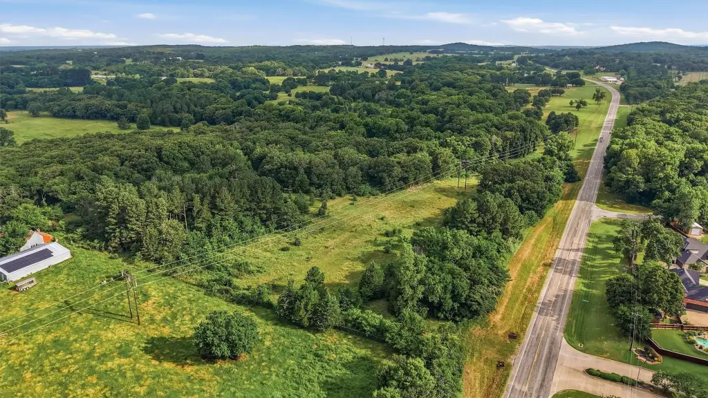
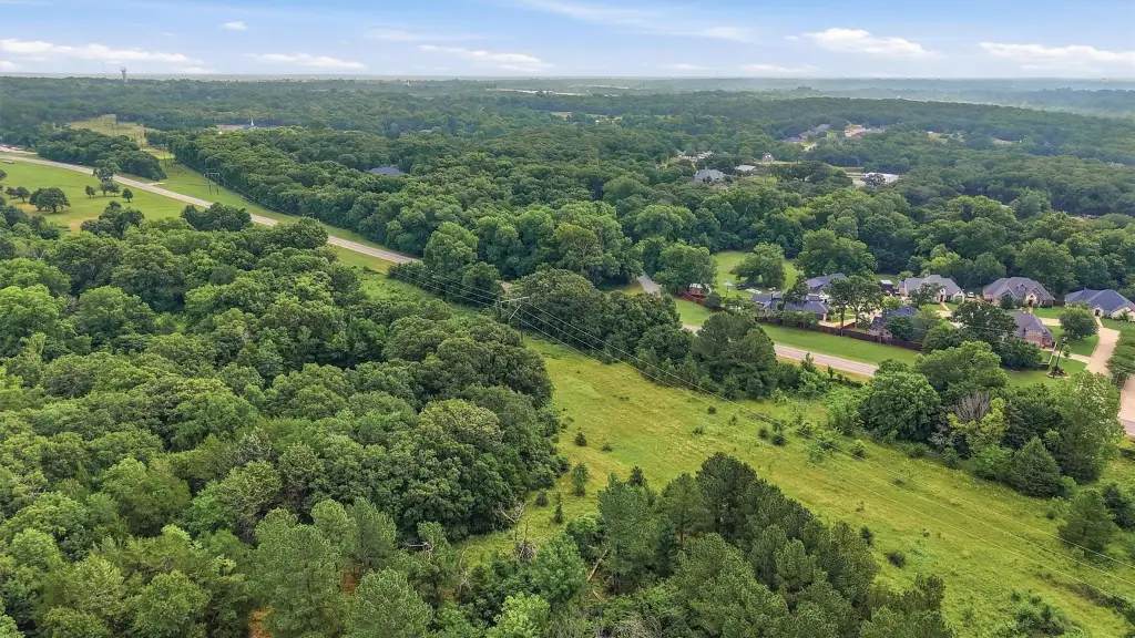
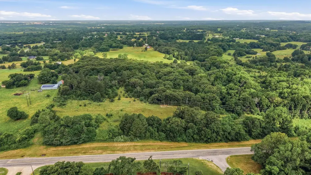
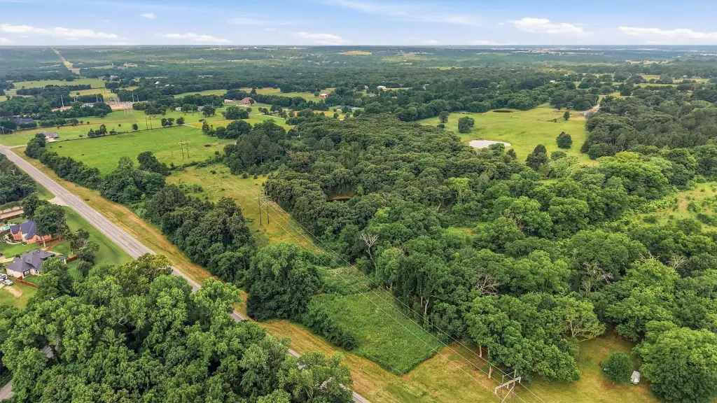
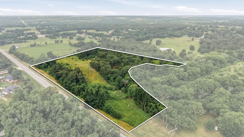
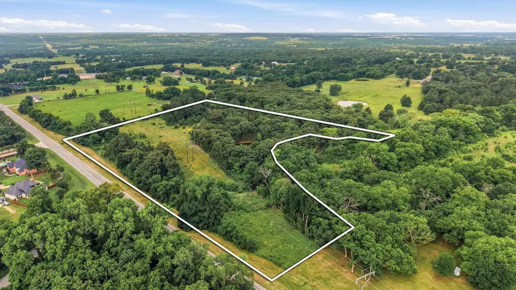
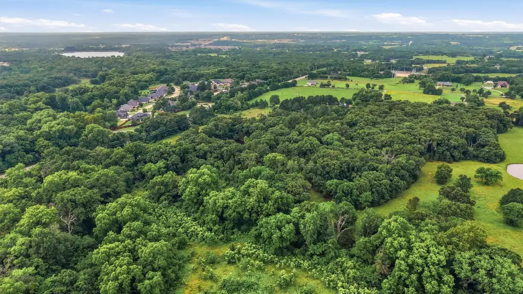
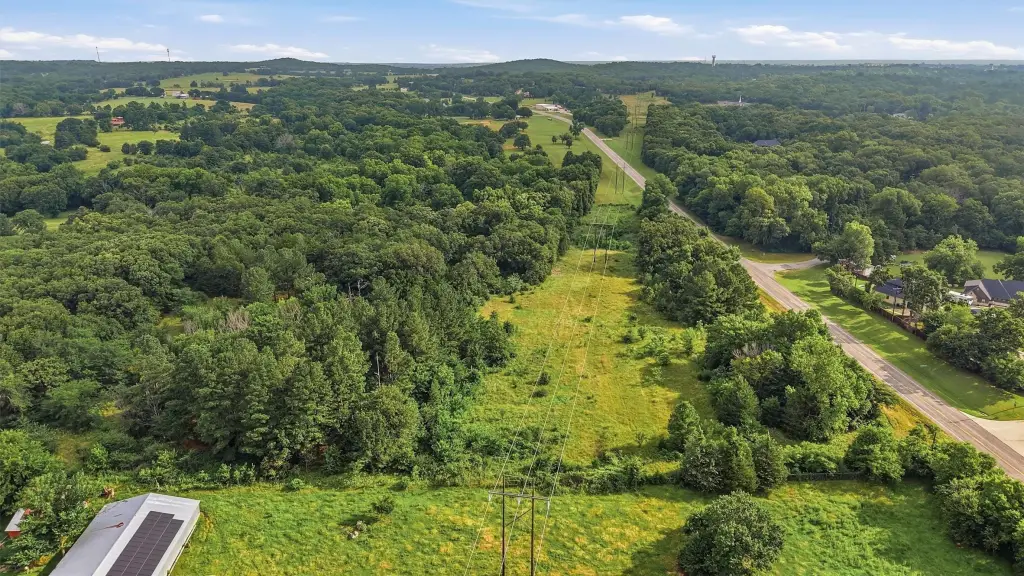
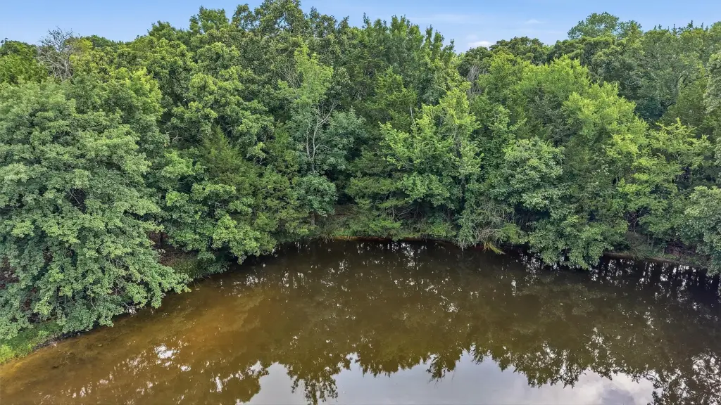
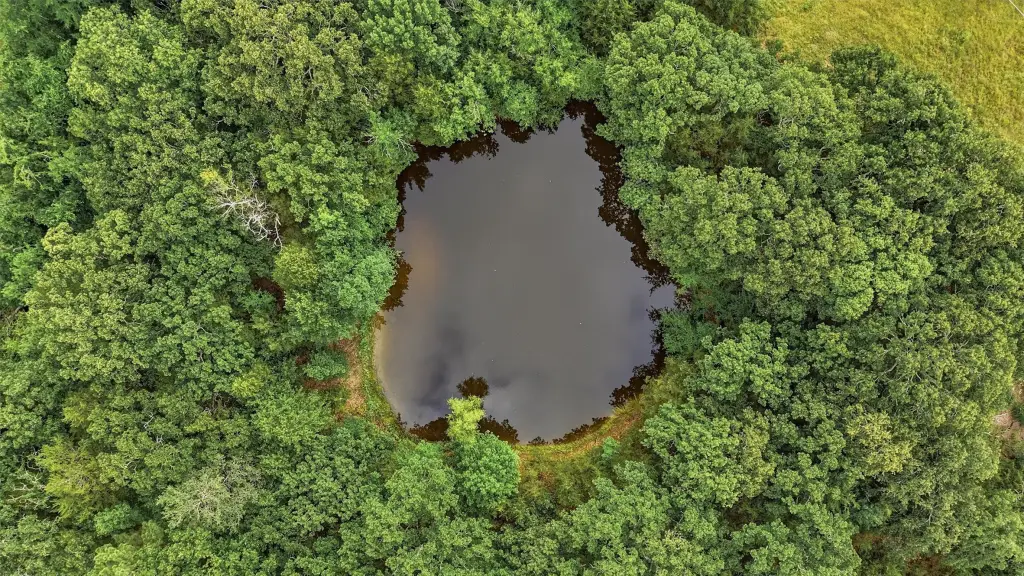
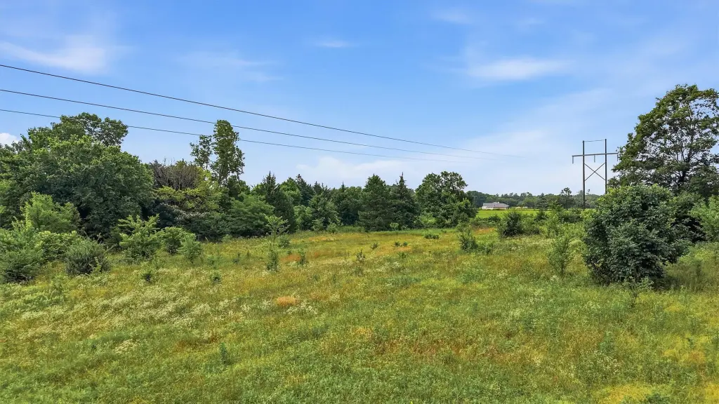
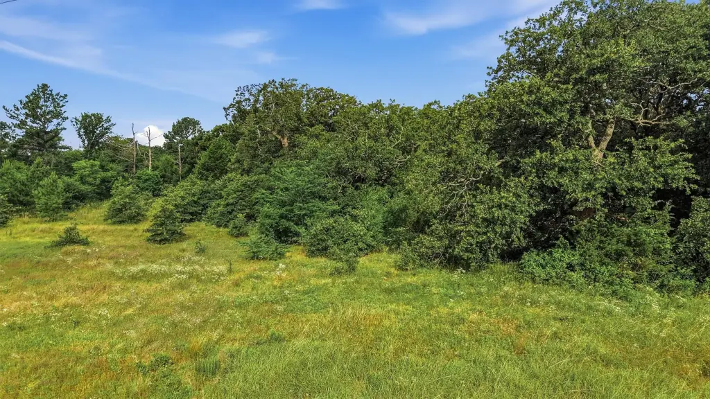
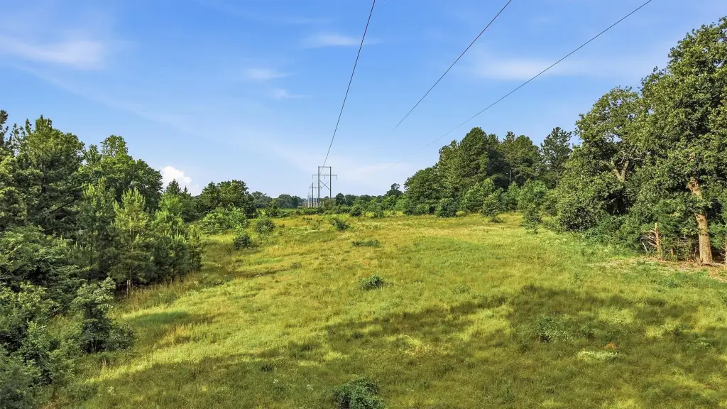
This listing is a for-sale, 11.04-acre multi-parcel property along FM 131 in Denison, Texas. The acreage includes a 1-acre corner tract with approximately 200 feet of frontage on FM 131, zoned Planned Development (PD), and a 10.04-acre tract with over 700 feet of frontage, currently zoned Agricultural. Natural features include mature trees, a pond, and Loy Creek along the north boundary. The property also contains a floodplain and a 200-foot-wide transmission line easement, while retaining substantial usable acreage for a range of potential uses.
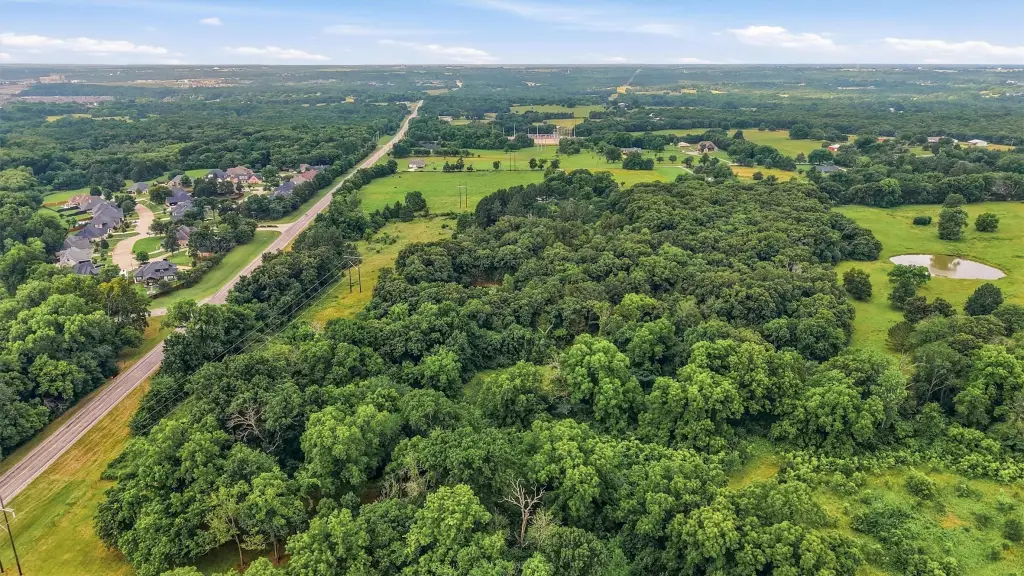
The site’s frontage and access are supported by its location in the City of Denison within Pottsboro ISD. The property is positioned directly across from the entrance to Cold Creek and just south of W. Crawford Street.
For prospective buyers and developers, the combination of PD-zoned frontage at the corner and long Agricultural frontage can support multiple planning approaches, subject to applicable approvals. The presence of the pond and creek may influence site design and drainage considerations, and the floodplain and transmission easement should be reviewed early for feasibility. Mature trees and existing natural conditions may also factor into landscaping and layout planning for future uses.
Key Highlights
- 11.04‑acre property on FM 131 in Denison, within the City of Denison and Pottsboro ISD
- Two parcels: 1‑acre corner tract with approx. 200 ft frontage on FM 131, zoned Planned Development (PD)
- 10.04‑acre tract with 700+ ft frontage, currently zoned Agricultural
Property Analytics
Property Profile
Current Use
Location Intelligence
Trade Area within ½ mile
22
Businesses Nearby
Explore this area
Business Placement
Demographics for 75020, TX
23,782
Population
10,802
Households
2.2
Avg Household Size
42
Median Age
19%
College-Educated
90%
High-School Grad
61.0 sq mi
ZIP Area
390
Density / Sq Mi
$66,308
Median Household Income
$38,656
Median Earnings
$1,136
Median Rent
$187,200
Median Home Value

Questions? Ask Rey
Realmo’s AI knows this listing — price, zoning, demand, history. Ask anything.


Frequently Asked Questions
What type of property is this?
Agricultural land / Farmland - Multi-parcel tract with FM 131 frontage, pond, and creek, offering flexible options for buyers seeking development potential.
Where is this agricultural land / farmland located?
The property is located at Fm 131 Denison, TX.
What is the asking price?
The asking price for this property is $600,000.
What are key features of this property?
This property features: 11.04‑acre property on FM 131 in Denison, within the City of Denison and Pottsboro ISD; Two parcels: 1‑acre corner tract with approx. 200 ft frontage on FM 131, zoned Planned Development (PD); 10.04‑acre tract with 700+ ft frontage, currently zoned Agricultural


