7227 Preston Grove LN lot 5, Fort Smith, AR 72916
- Added:
- Jun 15, 2026
- Days on Market:
- 4
- Last Refresh:
- Jun 18 at 10:06 am
Property Features for 7227 Preston Grove LN lot 5
General Information
- Property type
- Land
- Property subtype
- Other
- Zoning
- Residential
- Standard status
- Active
- APN
- 17525-0005-00000-00
- Lot size
- 0.22 Acres
Taxes and HOA fees
- Tax Description
- Lot 5, Preston Grove
- Tax Annual Amount
- 460
Utilities
- Sewer type
- Public Sewer
Listing agent Carrington Team (479) 782-8911
Listing office Sagely & Edwards Realtors 3101 Rogers Ave., Fort Smith, AR (479) 782-8911
Listing date Jun 15, 2026
Copyright © 2026 Western River Valley Board of REALTORS®. All rights reserved. All information provided by the listing agent/broker is deemed reliable but is not guaranteed and should be independently verified.
HighLights
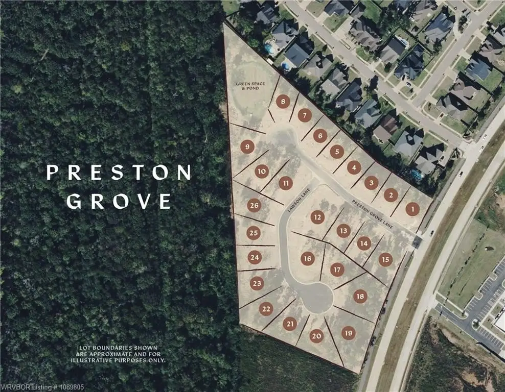
- Preston Grove is a gated community in Chaffee Crossing in Fort Smith, with 26 exclusive homesites.
- Located just off Massard Road, offering nearby shopping, dining, healthcare, and recreation.
- Lot size is approximately 0.225 acres (total platted acreage per the recorded plat).
- Sewer: public sewer.
- Lot boundaries extend to the centerline of Preston Grove Lane, so part of the platted area lies within the street—review the recorded plat for exact lines, setbacks, and easements.
- Open to all builders and the public.
Overview
Preston Grove is described as being located just off Massard Road in Fort Smith, within Sebastian County. The lot boundaries extend to the centerline of Preston Grove Lane, meaning a portion of the platted area lies within the street. As a result, confirming the precise boundary and access considerations through the recorded plat is important prior to site planning.
With a residential zoning designation and placement inside a controlled-access community, this homesite is suited for buyers planning to build a custom home. The property’s key diligence items are understanding the recorded plat boundary-to-centerline note and verifying how setbacks and easements apply to the specific buildable footprint for Lot 5.
Current Use by Public Records
Map
- City
- Fort Smith
- County
- Sebastian
- State
- Arkansas
- Longitude
- -94.3714
- Latitude
- 35.2504