Pensacola Waterfront Land For
For Sale
$179,900
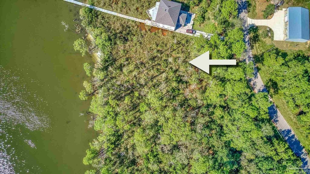
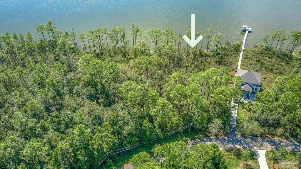
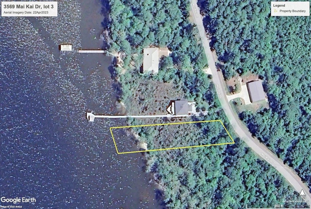
3569 Maikai Dr, Pensacola, FL 32526
LAND - Pensacola, FL
Lot Size0.63 Acres
Days on Market1035
Property Features for 3569 Maikai Dr
General Information
Property type
Land
Property subtype
Other
Zoning description
Res Single
Subdivision
Ramsey Beach
Elementary school
Bellview
Middle school
BELLVIEW
High school
Pine Forest
Directions
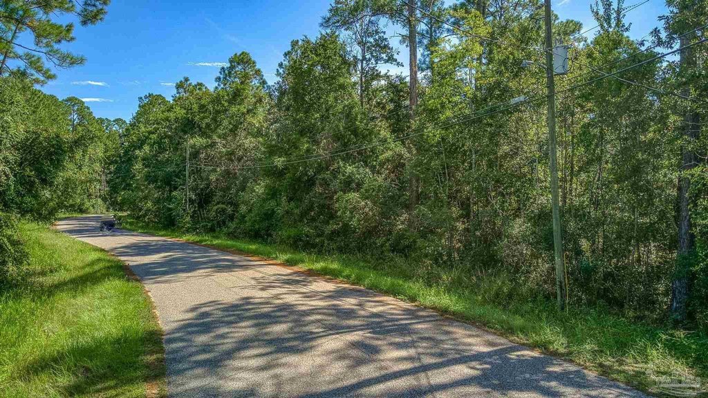
From N Blue Angel Pkwy, take Alekai Drive to dead end. Go right on Mai Kai Drive. Lot is on the left of 3571 Mai Kai Dr.
Standard status
Active
APN
042S311001002016
Lot size
0.63 Acres
Taxes and HOA fees
Tax Description
BEG AT NE COR OF SEC N 72 DEG 2 MIN 12 SEC W 1359 88/ 100 FT TO WLY R/W LI OF MAI KAI DR (66 FT R/W) S 16 DEG 20 MIN E ALG R/W LI 174 88/ 100 FT TO PC OF CIRCULAR CURVE TO LEFT SELY ALG SD CURVE (DELTA 11 DEG 55 MIN 44 SEC R 306 39/100 FT) ARC DIST 63 79/100 FT FOR POB S 86 DEG 6 MIN 56 SEC W 283 50/100 FT CONT S 86 DEG 6 MIN 56 SEC W 15 FT MORE OR LESS TO WATERS EDGE OF PERDIDO BAY & A PT HEREINAFTER REFERRED TO AS PT X RETURN TO POB SELY ALG WLY R/W LI OF MAI KAI DR & CURVE (TANGENT BRG S 28 DEG 2 MIN 12 SEC E DELTA 14 DEG 57 MIN 37 SEC R 306 39/100 FT) ARC DIST 80 FT S 84 DEG 40 MIN 15 SEC W 301 39/100 FT CONT S 84 DEG 40 MIN 15 SEC W 15 FT MORE OR LESS TO WATERS EDGE OF PERDIDO BAY MEANDER NWLY ALG WATERS EDGE TO PT X AND POB OR 5696 P 1450
Legal Description
BEG AT NE COR OF SEC N 72 DEG 2 MIN 12 SEC W 1359 88/ 100 FT TO WLY R/W LI OF MAI KAI DR (66 FT R/W) S 16 DEG 20 MIN E ALG R/W LI 174 88/ 100 FT TO PC OF CIRCULAR CURVE TO LEFT SELY ALG SD CURVE (DELTA 11 DEG 55 MIN 44 SEC R 306 39/100 FT) ARC DIST 63 79/100 FT FOR POB S 86 DEG 6 MIN 56 SEC W 283 50/100 FT CONT S 86 DEG 6 MIN 56 SEC W 15 FT MORE OR LESS TO WATERS EDGE OF PERDIDO BAY & A PT HEREINAFTER REFERRED TO AS PT X RETURN TO POB SELY ALG WLY R/W LI OF MAI KAI DR & CURVE (TANGENT BRG S 28 DEG 2 MIN 12 SEC E DELTA 14 DEG 57 MIN 37 SEC R 306 39/100 FT) ARC DIST 80 FT S 84 DEG 40 MIN 15 SEC W 301 39/100 FT CONT S 84 DEG 40 MIN 15 SEC W 15 FT MORE OR LESS TO WATERS EDGE OF PERDIDO BAY MEANDER NWLY ALG WATERS EDGE TO PT X AND POB OR 5696 P 1450
Utilities
Water source
Public
Water front
1
Listing Agency:
Key Impressions LLC
(850) 776-4580
Listed By:
Beth Sanderson
(850) 776-4580
Added: Oct 4, 2023
Changed: Apr 27
Last Checked: Aug 3 at 9:06AM
MLS# 634373
Copyright © 2026 Pensacola Association of REALTORS. All rights reserved. All information provided by the listing agent/broker is deemed reliable but is not guaranteed and should be independently verified.
Investment Insights
Based on property information with market context.
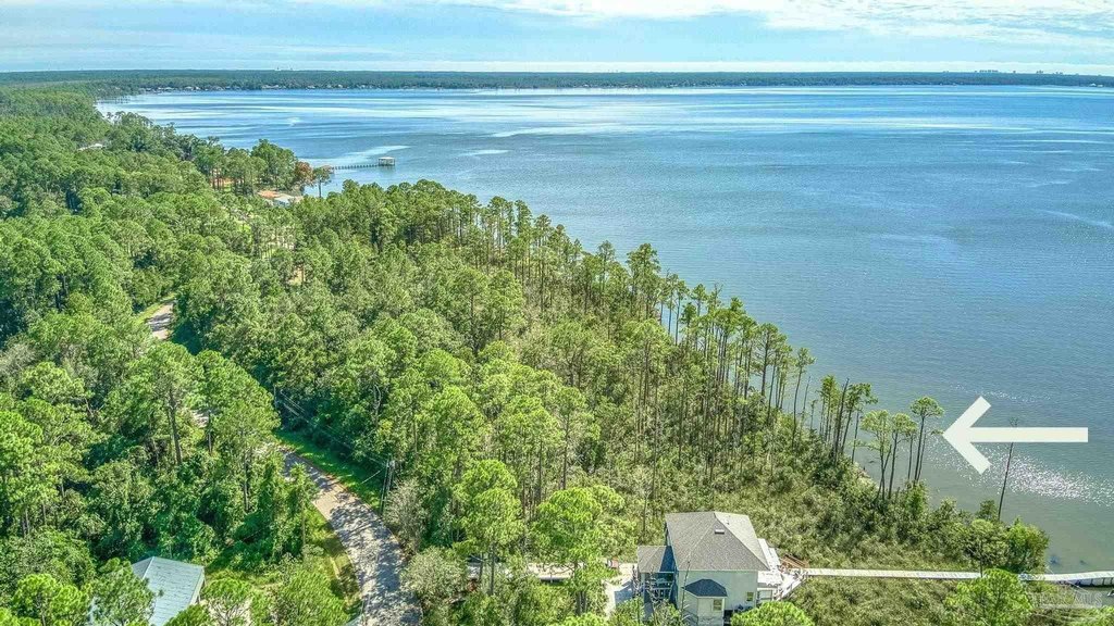
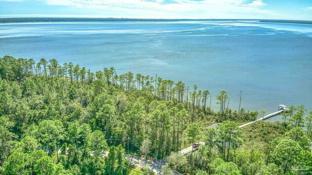
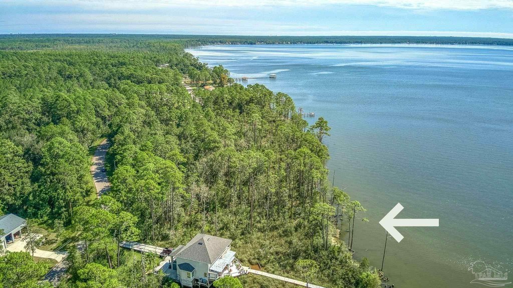
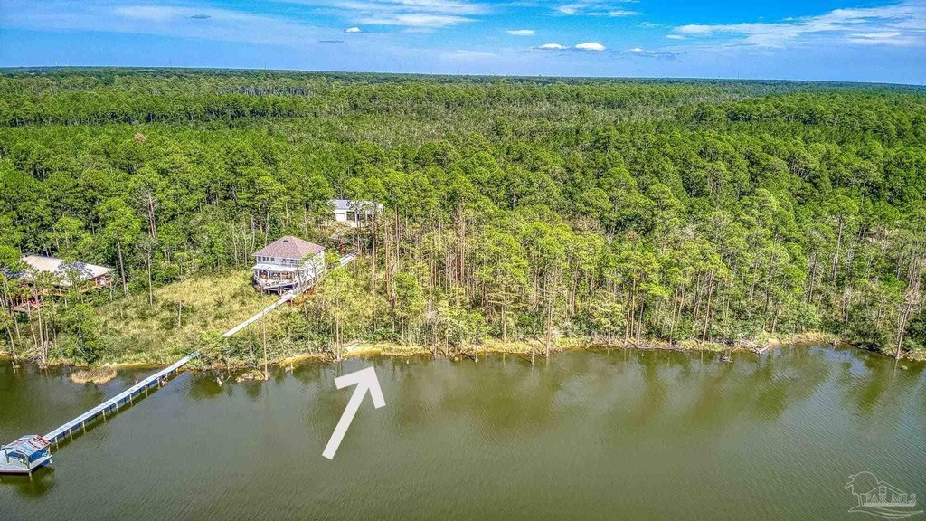
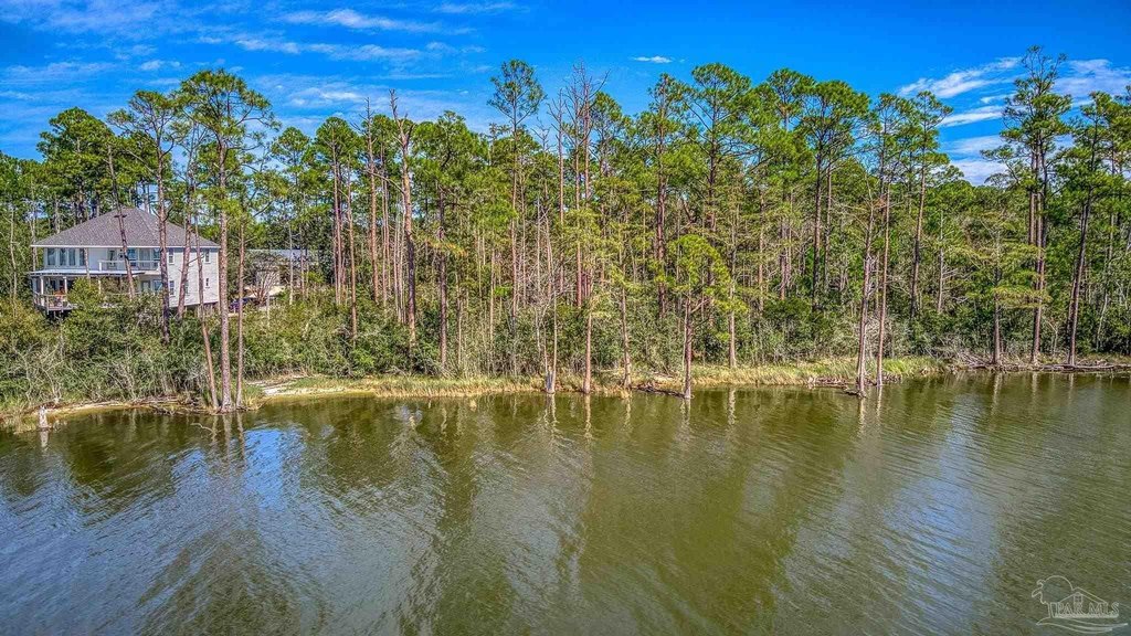
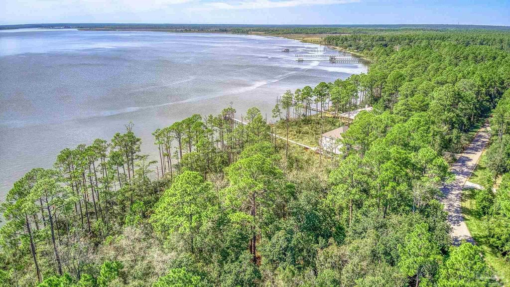
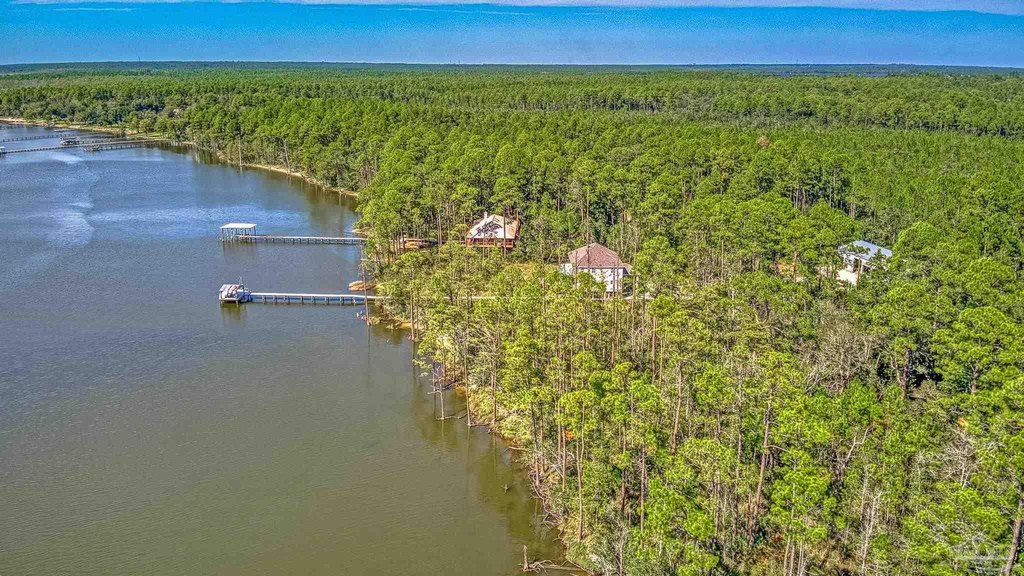
Located in the Ramsey Beach community on Mai Kai Drive in Pensacola, Florida, this 0.63-acre parcel of land offers an opportunity for coastal living on Perdido Bay. The property is positioned to capture sunsets and a waterfront lifestyle. It is suitable for those seeking a peaceful retreat, watersports activities, or investment. The land presents a canvas for realizing aspirations.
Key Highlights
- Breathtaking sunsets over Perdido Bay.
- Rare bayfront parcel in the hidden community of Ramsey Beach.
- Opportunity for a waterfront lifestyle.
Property Analytics
Property Profile
Current Use
Location Intelligence
Trade Area within ½ mile
5
Businesses Nearby
Explore this area
Business Placement
Demographics for 32526, FL
43,029
Population
18,478
Households
2.3
Avg Household Size
41
Median Age
24%
College-Educated
93%
High-School Grad
58.4 sq mi
ZIP Area
737
Density / Sq Mi
$71,651
Median Household Income
$40,565
Median Earnings
$1,287
Median Rent
$230,400
Median Home Value

Questions? Ask Rey
Realmo’s AI knows this listing — price, zoning, demand, history. Ask anything.


Frequently Asked Questions
What type of property is this?
Waterfront Land - Land in Ramsey Beach offers waterfront lifestyle on Perdido Bay.
Where is this waterfront land located?
The property is located at 3569 Maikai Dr Pensacola, FL.
What is the asking price?
The asking price for this property is $179,900.
What are key features of this property?
This property features: Breathtaking sunsets over Perdido Bay.; Rare bayfront parcel in the hidden community of Ramsey Beach.; Opportunity for a waterfront lifestyle.


