Mixed-Use Development Farmland
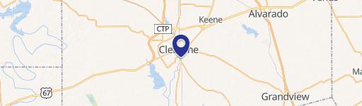
1513 County Road 801b Cleburne, TX 76031
New
1513 County Road 801b, Cleburne, TX, 76031
$4,000,000
For Sale
$4,000,000
LAND - Cleburne, TX
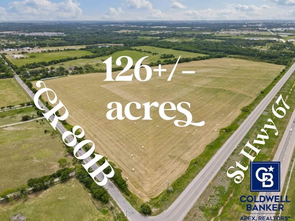
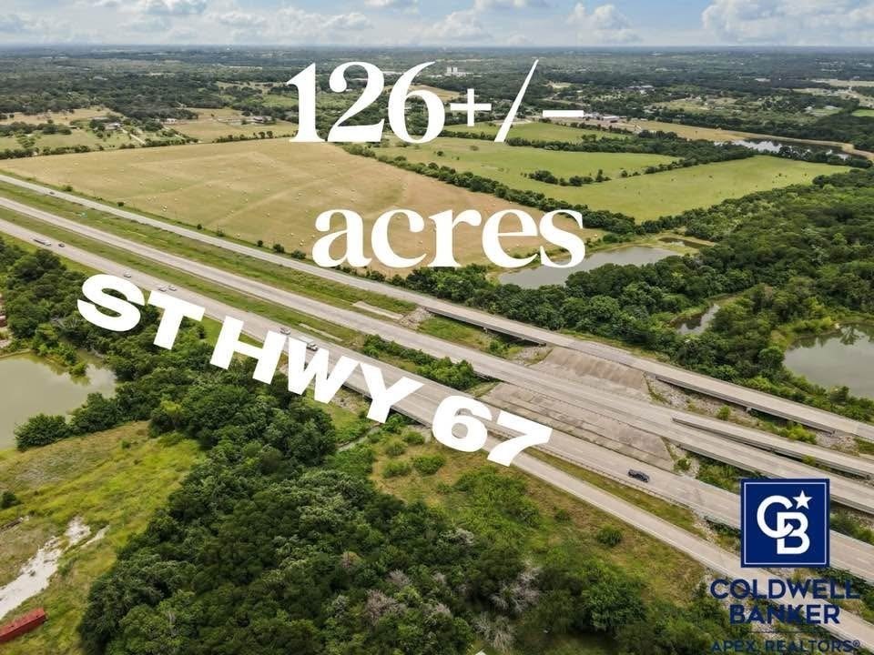
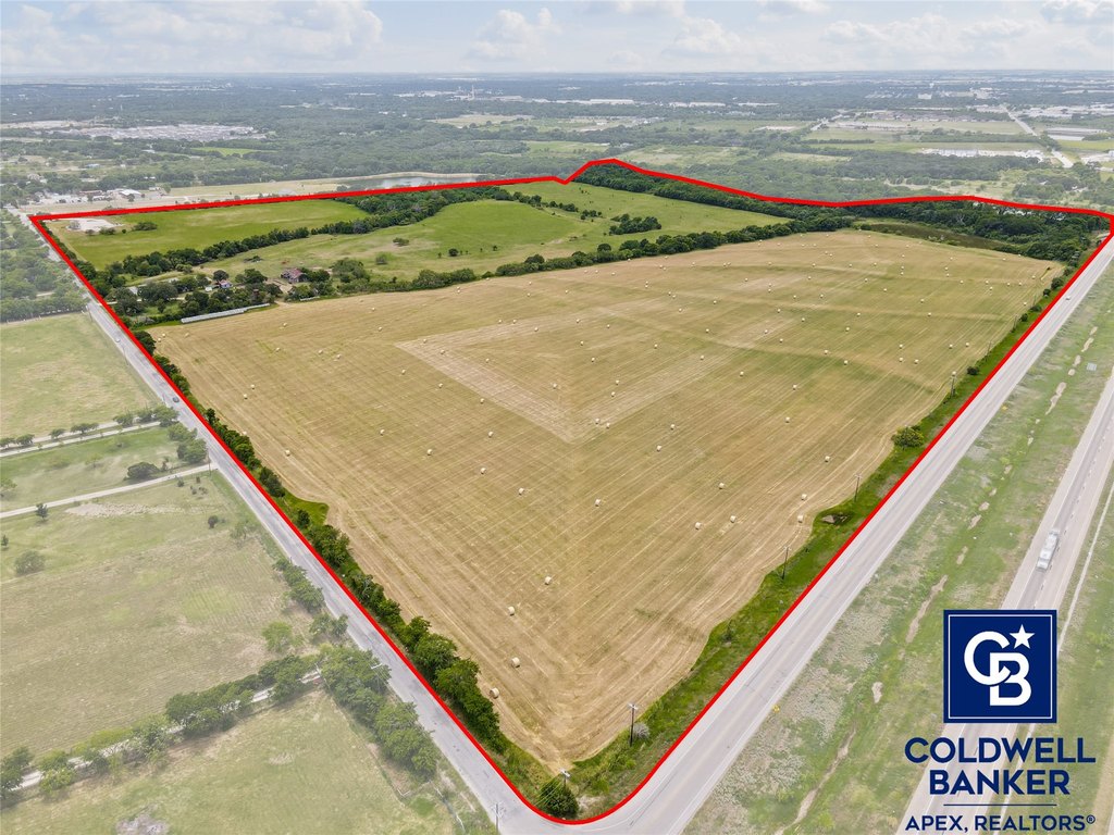
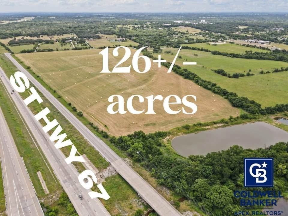
Lot Size126.22 Acres
Days on Market5
Property Features for 1513 County Road 801b
General Information
- Property type
- Land
- Property subtype
- Other
- Standard status
- Active
- APN
- 126056600111
- Lot size
- 126.22 Acres
Taxes and HOA fees
- Tax Description
- ABST 566 TR 17,18 M A MC NEILL
- Tax Annual Amount
- 211
Utilities
- Sewer type
- Septic Tank
- Water source
- Well
- Water front features
- Creek
Listing Agency
Coldwell Banker Apex, REALTORS Cleburne
(817) 641-9873
Cleburne, TX
Listed by
Cheri White
(817) 641-9873
Added: Jul 14 Checked: Jul 18 at 6:06 pm
MLS# 20984433
Listing URL
Copyright © 2026 North Texas Real Estate Information Systems, Inc. All rights reserved. All information provided by the listing agent/broker is deemed reliable but is not guaranteed and should be independently verified.
Investment Insights
Based on property information with market context.
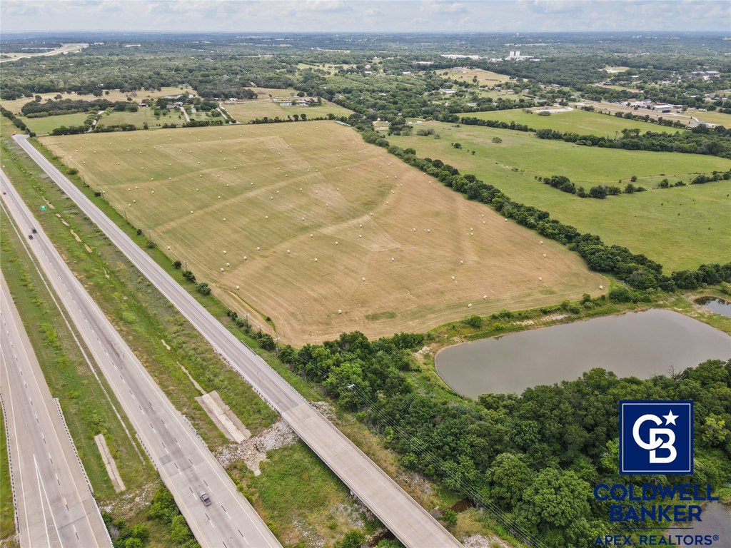
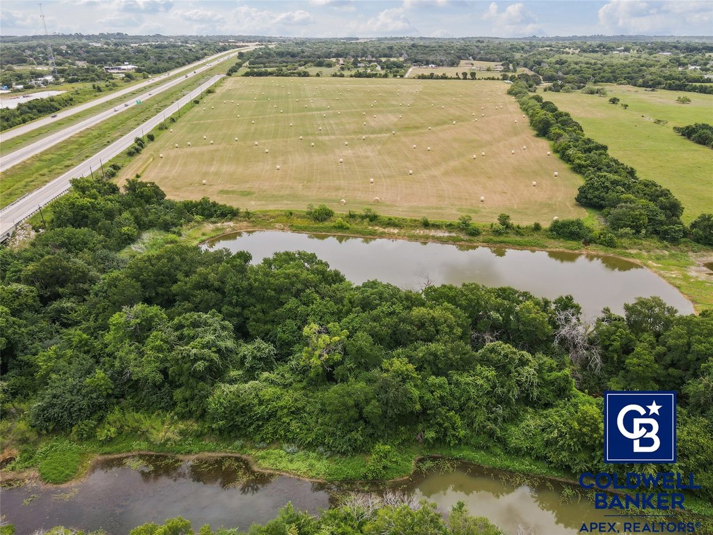
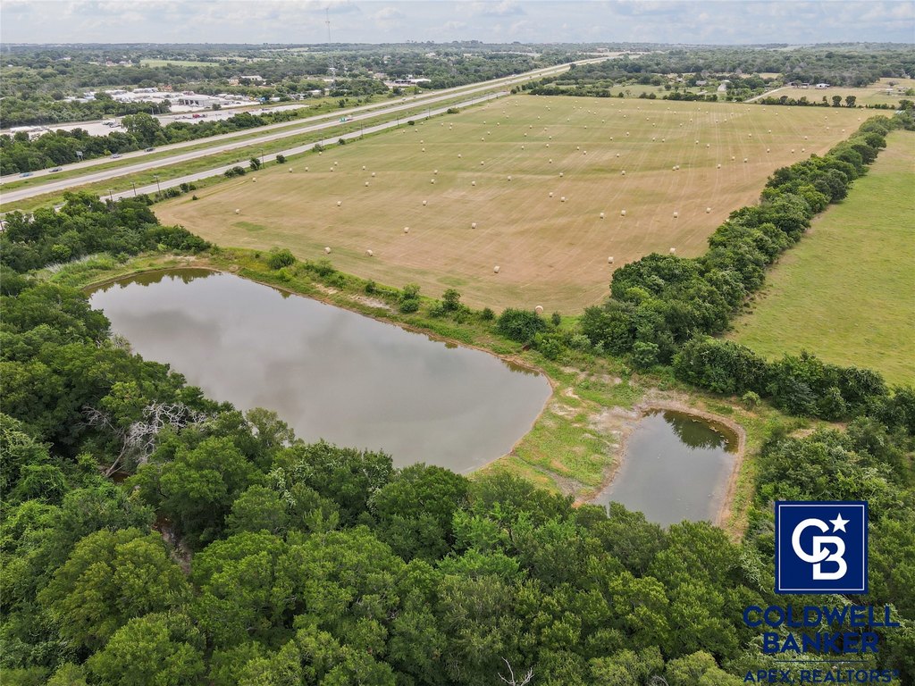
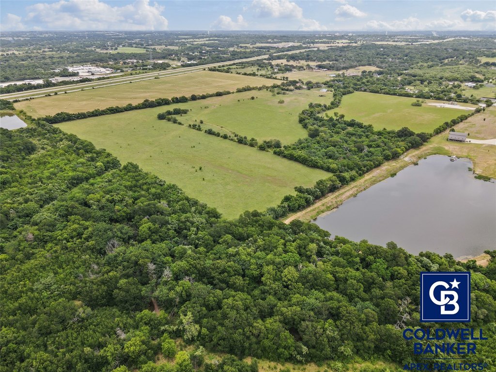
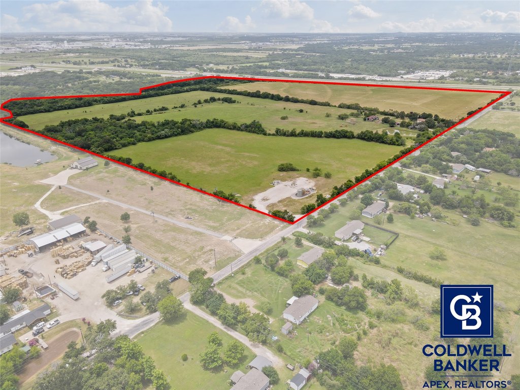
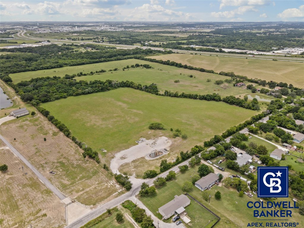
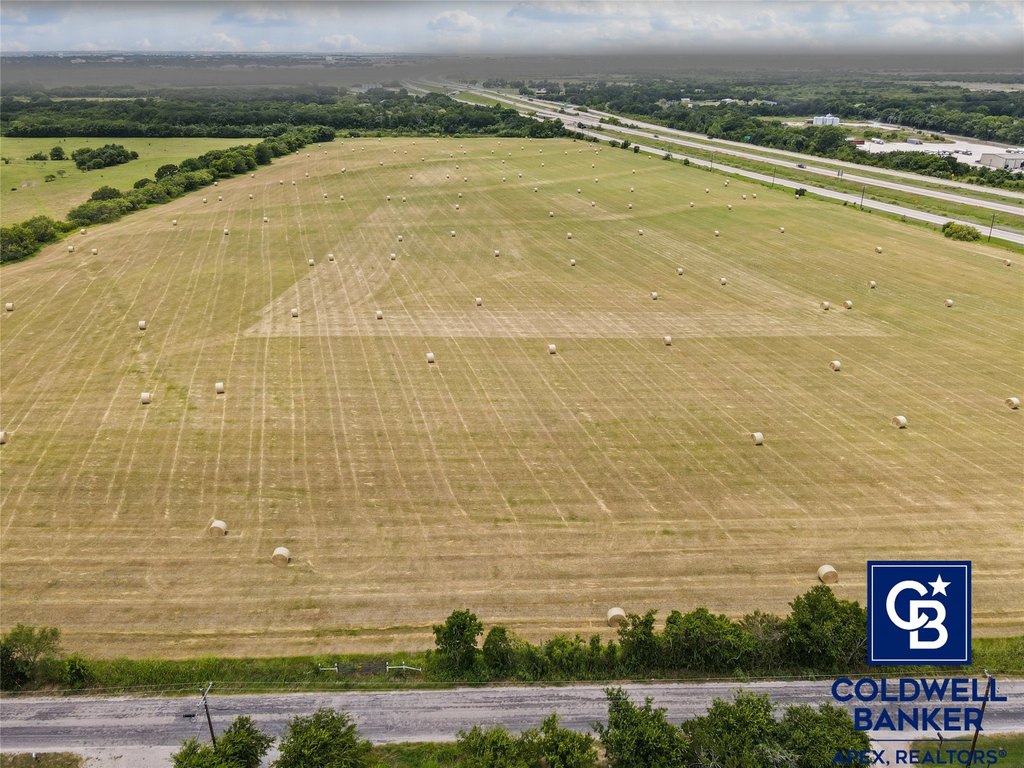
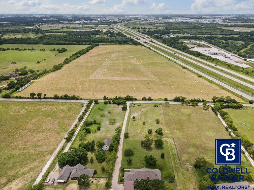
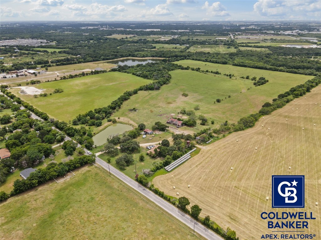
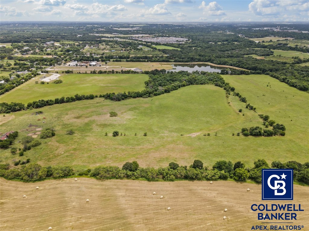
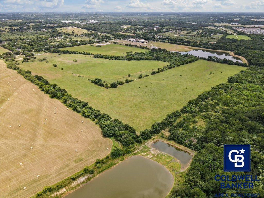
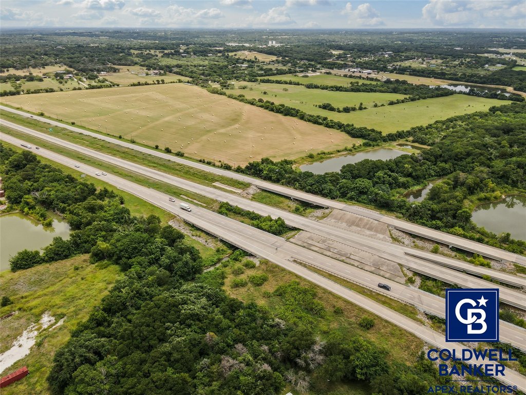
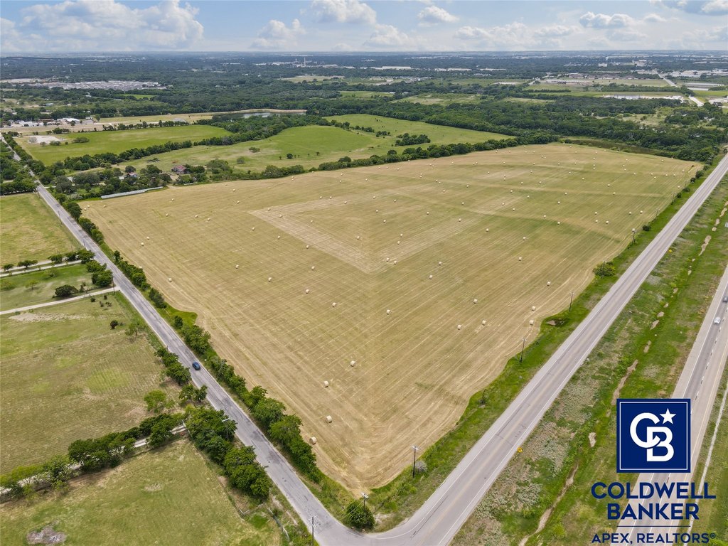
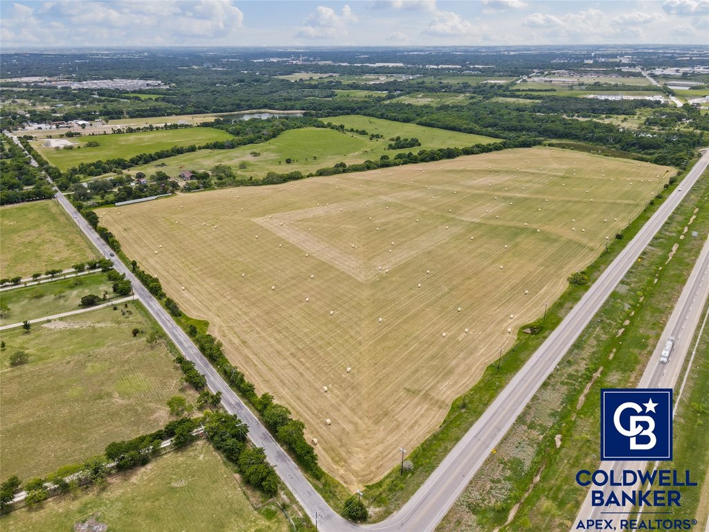
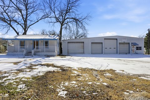
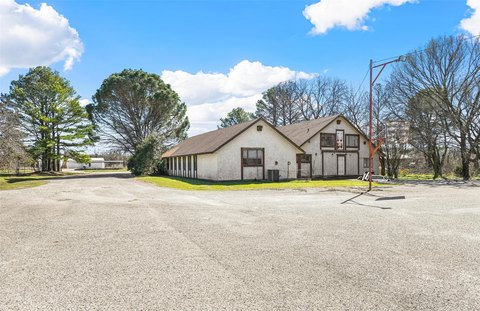
This large tract of agricultural land is offered for sale in the Cleburne ETJ and is currently utilized for cultivation and grazing under an agriculture lease. The property is relatively flat and includes a tenant house constructed in 1952 with approximately 1 acre included in the sale. It has approximately 2,008 feet of frontage along the access road to Hwy 67.
The property is located on the south side of the Hwy 67 loop (E. Katherine Raines Pkwy.), just east of Chisholm Trail Parkway and west of Hwy 174 (N. Main St.) in Cleburne, with a new Atwood’s Ranch & Home Goods store located just to the east. The City of Cleburne’s future land use plan identifies this site as a major corridor on the northern end and low density residential on the southern end, with potential for commercial development along frontage and on a corner.
City information indicates sewer service is available on the west side of Buffalo Creek, with the possibility to tie into a manhole to extend service to the property. Access is described as convenient to Chisholm Trail Parkway, Hwy 174 (Main St.), Hwy 67, and Nolan River Road.
Key Highlights
- Approximately 2,008 ft frontage along the access road to Hwy 67 (E. Katherine Raines Pkwy.) in the Cleburne ETJ
- Future land use plan for City of Cleburne shows major corridor on the north end and low density residential on the south end
- Property includes a tenant house of approx. 1,800 SF built in 1952 on 1 acre
Property Analytics
Property Profile
Location Intelligence
Current Use by Public Records
Commercial land
Similar For Sale Nearby
FAQs
What type of property is this?
Agricultural land / Farmland - Over 2,000 feet of frontage on Hwy 67 access road, currently in cultivation with an included 1952 tenant house.
Where is this agricultural land / farmland located?
The property is located at 1513 County Road 801b Cleburne, TX.
What is the asking price?
The asking price for this property is $4,000,000.
What are key features of this property?
This property features: Approximately 2,008 ft frontage along the access road to Hwy 67 (E. Katherine Raines Pkwy.) in the Cleburne ETJ; Future land use plan for City of Cleburne shows major corridor on the north end and low density residential on the south end; Property includes a tenant house of approx. 1,800 SF built in 1952 on 1 acre


