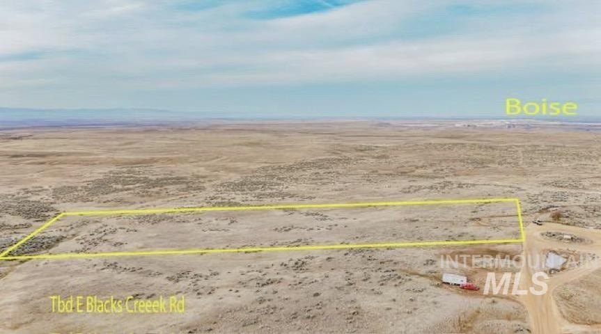
E Blacks Creek Rd, Boise, ID 83716
- Added:
- Dec 23, 2025
- Days on Market:
- 182
- Last Refresh:
- Jun 23 at 9:06 pm
Property Features for E Blacks Creek Rd
General Information
- Property type
- Land
- Property subtype
- Other
- Standard status
- Active
- APN
- S1624438410
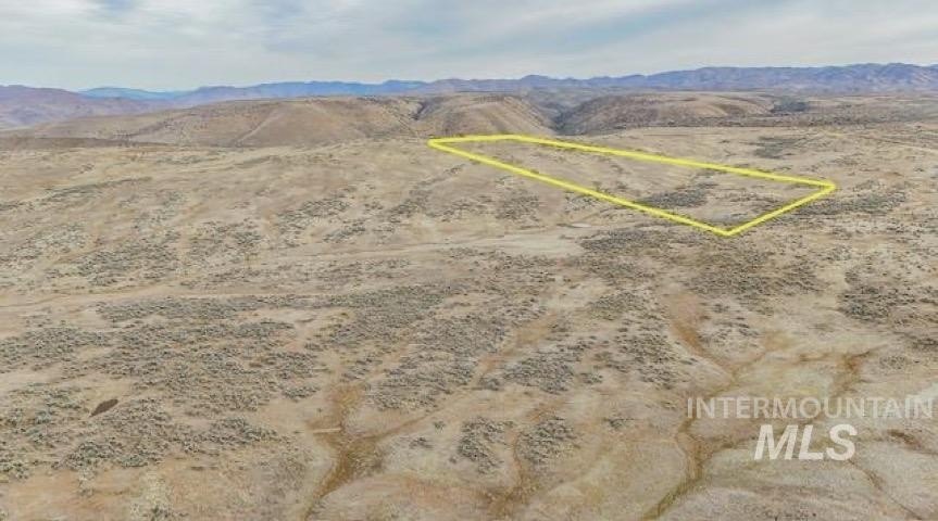
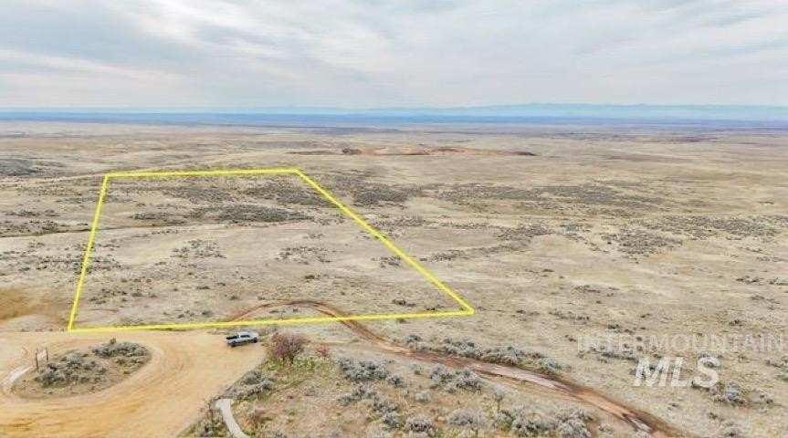
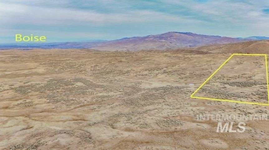
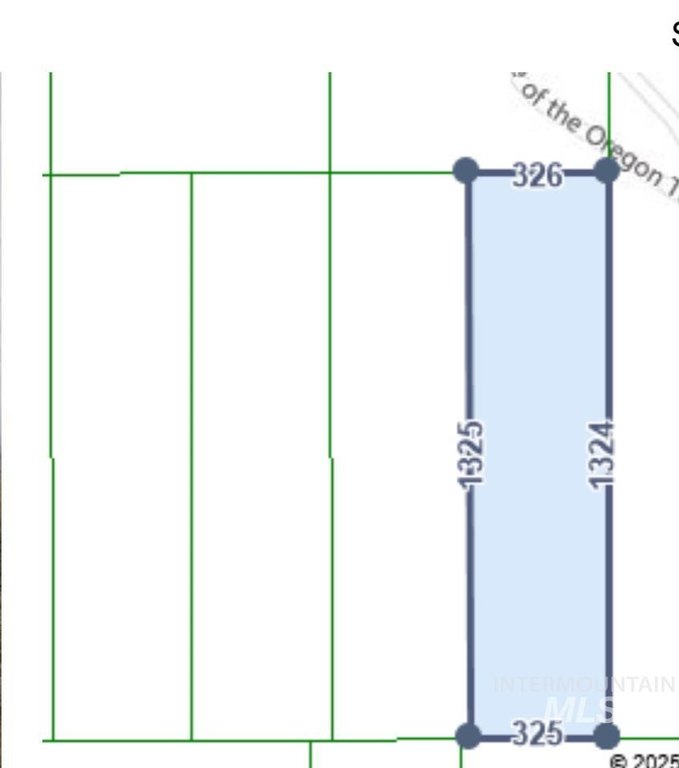
- Lot size
- 10.00 Acres
Taxes and HOA fees
- Tax Year
- 2024
- Tax Description
- E2E2SW4SE4 SEC 24 2N 3E #438400-S
- Tax Annual Amount
- 70
Listing agent Tiffany Clyde License #SP46513 (208) 941-3260
Listing office Homes of Idaho 3597 E Monarch Sky Lane, Nampa, ID (208) 442-8500
Listing date Dec 23, 2025
Copyright © 2026 Intermountain Multiple Listing Service. All rights reserved. All information provided by the listing agent/broker is deemed reliable but is not guaranteed and should be independently verified.
HighLights
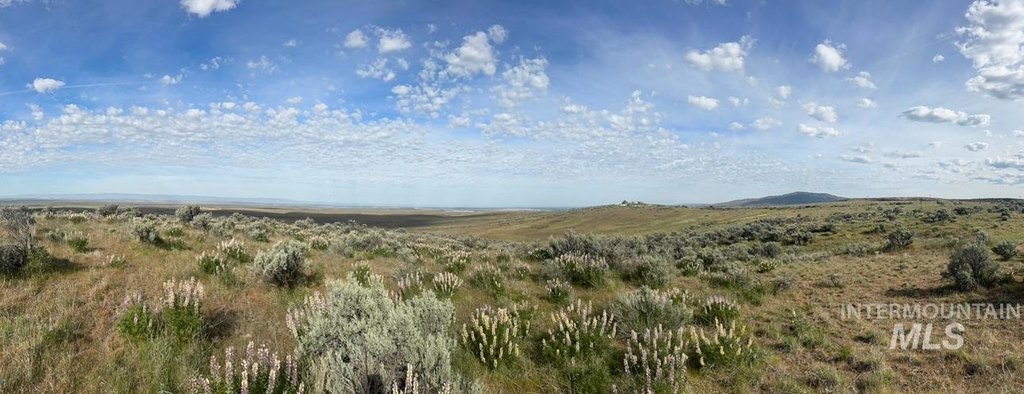
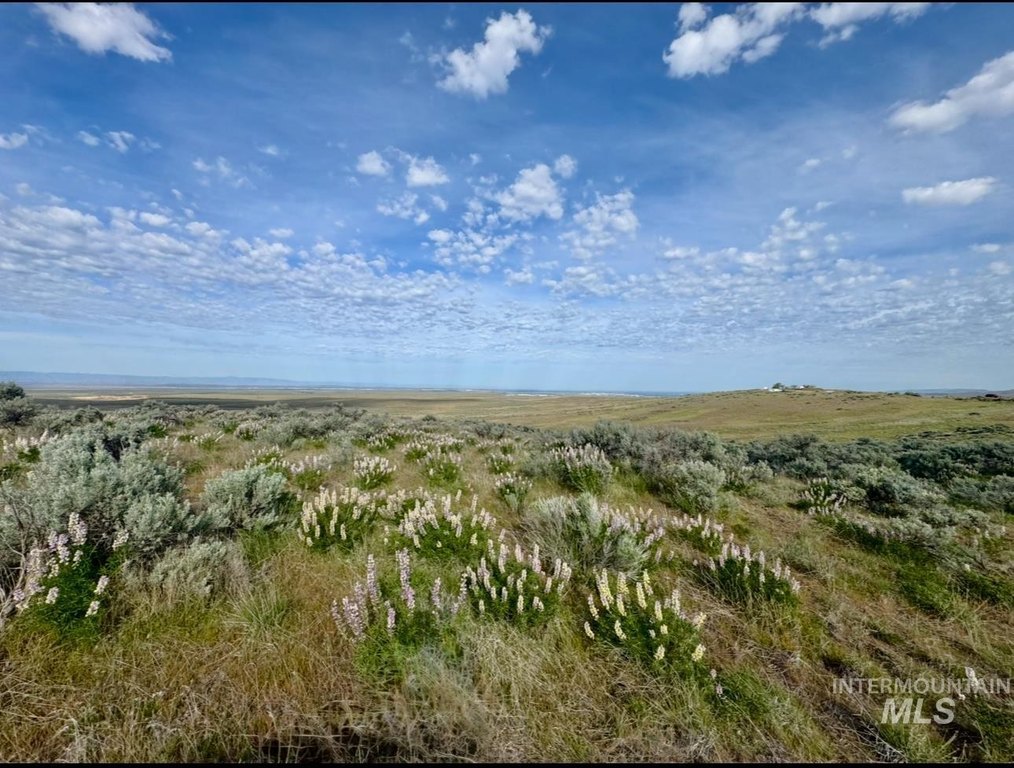
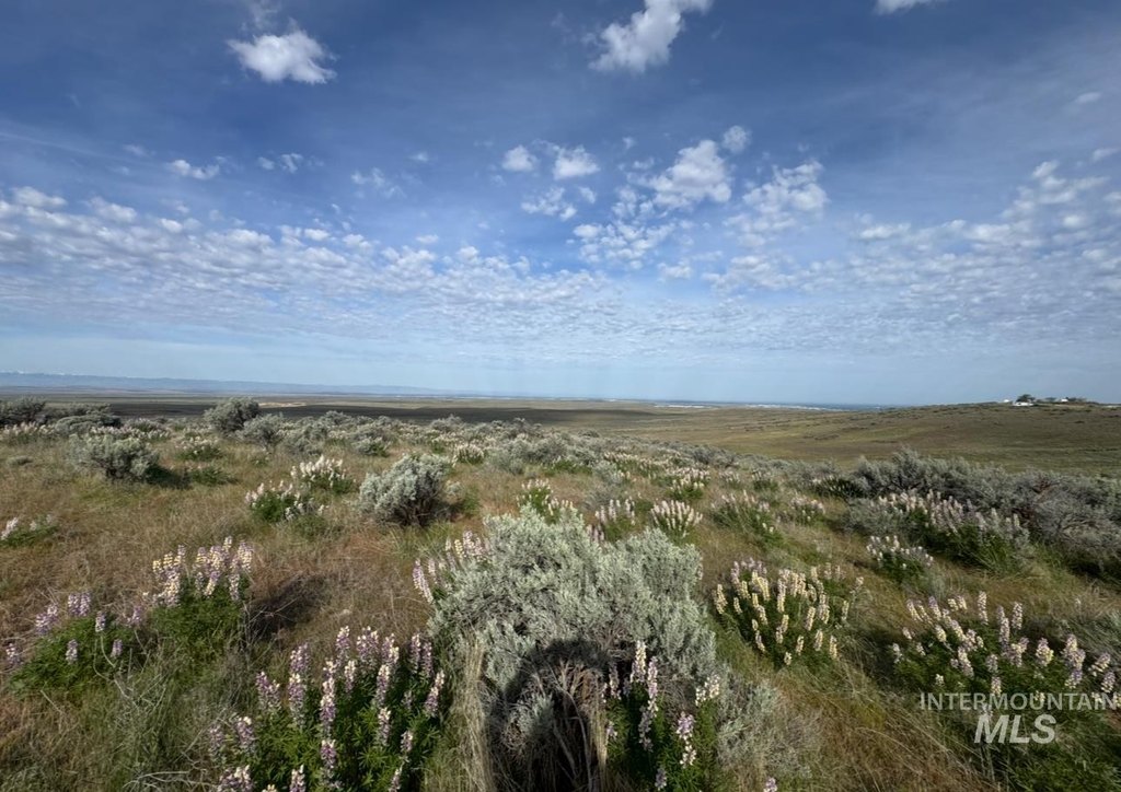
- Unparalleled panoramic views of the entire Treasure Valley, from Eastern Oregon to the Owyhee Mountains and beyond.
- Direct access to the Oregon Trail and vast wildlife habitat right from the property.
- Surrounded by publicly‑owned lands (Ada County, BLM, City of Boise Parks and Recreation) ensuring privacy and access to recreational areas.
- Located adjacent to Bonneville Point in Southeast Boise.
- Electricity service available within a quarter‑mile of the site.
- Conveniently located only 15 minutes from Downtown Boise.
Overview
The parcel is surrounded by publicly owned lands, with Ada County ownership to the west, BLM ownership to the east, and the City of Boise Parks and Recreation owning land to the north. Access to the wider trail system is described in relation to the Lydle Gulch Barclay Parking Area on Lucky Peak Reservoir, approximately 1.7 miles from the adjacent parking lot for the Bonneville Point Historical Site. The listing states the property is about 15 minutes from Downtown Boise.
For buyers seeking a buildable land setting with established access to outdoor recreation and long-term adjacency to public lands, this parcel offers a remote, view-oriented platform. With electricity nearby and the property sold as-is, it may suit investors or owner-users planning to evaluate site conditions and utility connections as part of their development or planning process.
Current Use by Public Records
Map
- City
- Boise
- County
- Ada
- State
- Idaho
- Longitude
- -116.0405512
- Latitude
- 43.48944443