Back to Search
Property profile & analytics
OFF-MARKET
Estimated value
$1,820,000
Warehouses
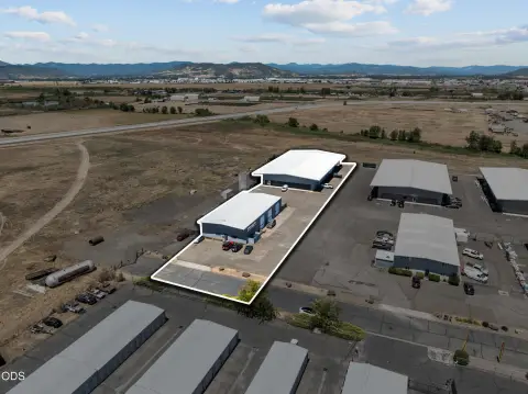
5113 Table Rock Rd Central Point, OR 97502-3225
Individually Owned
20-yr Hold
Absentee Owner
Free & Clear
Property ID
US71-0933805
Property profile
Verified
Property type
Warehouses
Use group
MINI-WAREHOUSE, STORAGE
Year built
2007
Total area
15,100 SF
Lot
2.19 ac (95,396 SF)
Zoning code
AD-MU
APN
1-0194130
UPID
US71-0933805
Cap rate & NOI
Priority signal for investors
Implied cap rate, NOI & suggested price
Cap rate vs submarket · NOI estimate · 3 price anchors
Implied cap rate, NOI & suggested price
Cap vs submarket · NOI estimate · 3 price anchors
Value estimations
Realmo proprietary · 4 methods
AI Approach
AI
by Request
CAP Approach
CAP
$1.97M
Comparable Approach
Comparable
$2.13M
Blend (final)
Blend
$1.82M
Owner & transaction history
Robert Reiter · 20 yrs held
Robert Reiter
since 2005
7 recorded transactions
Zoning & alternative use
AD-MU · Central Point, OR
Permitted uses
Permitted uses
Allowed · conditional · prohibited
Top alternative use upside
Auto repair, garage
$2.4M
+72.9%
Retail stores
$2.4M
+69.9%
Commercial (general)
$2.2M
+55.2%
Cap rate
Implied · in-place · derived from last sale + estimated NOI
Implied Cap rate
#1
Implied · in-place · NOI ÷ last sale
In-place · derived from last sale + estimated NOI
Cap rate, NOI & submarket benchmark
Implied cap rate vs Central Point submarket · NOI estimate · Typical band, median & reading
Implied cap rate, NOI & submarket benchmark
Cap vs Central Point submarket · NOI estimate · typical band, median & reading
Refine your cap rate
8-question underwriting flow
1.
Property current status — Going-In vs Stabilized
2.
Price for denominator — asking / offer / market
3.
Leasing status & lease structure (NNN / Gross)
4.
Tenant risk profile & vacancy assumption
5.
Upload T12 / rent roll / OM (optional)
Refine in 60 seconds, get exact suggested price
T12 upload · Submarket benchmarks · Sensitivity grid
Suggested price · 3 cap rate anchors
Income approach @ 5% / 7% / 9% — aggressive / typical / conservative
Suggested price at 5% / 7% / 9% cap
Aggressive / typical / conservative · Implied $/SF per anchor · Sensitivity grid
Suggested price at 5% / 7% / 9% cap
Aggressive / typical / conservative · implied $/SF · sensitivity
Value
AI, CAP & Alternative Use estimations · Realmo proprietary blendValue Estimations
Based on Realmo’s proprietary methodology
AI Approach
Method
Estimation
Statistic approach
by Request
ML approach
by Request
CAP Approach
CAP Return
Estimation
6%
$2,130,000
6.5%
$1,965,000
7%
$1,825,000
Alternative Use
Use
Estimation
WAREHOUSE, STORAGE
$1,415,000
Current use
AUTO REPAIR, GARAGE
$2,445,000
Change: +73% · Conversion: Easy
RETAIL STORES
$2,400,000
Change: +70% · Conversion: Moderate
COMMERCIAL (GENERAL)
$2,195,000
Change: +55% · Conversion: Difficult
INDUSTRIAL (GENERAL)
$1,470,000
Change: +4% · Conversion: Easy
Blend value · Realmo final
$1.82M
Range $1.64M – $2.00M · ±10%
Realmo estimate · informational only.
These numbers are calculated by our models from public records and may not reflect actual market value.
Not an appraisal.
Verify with a licensed appraiser before transacting. Realmo accepts no liability for divergence from real-world outcomes.
View the full estimation — every method, every assumption
Confidence drivers & risk notes · Custom comparable set · Free for first 3 / day
Full estimation methodology
Every method · every assumption · confidence drivers
Price per SF
Sale + rent benchmarks
Subject property
$121 / SF
Submarket sale & rent benchmarks
Median sale $/SF · Asking & closed rent · Submarket vacancy
Submarket sale & rent benchmarks
Median sale $/SF · asking & closed rent · submarket vacancy
Property tax & assessments
Tax year 2023Property tax & assessments
Tax year 2023
Tax billed
$19,451
Tax year 2023
Assessed value
$1,543,730
Assessed 2023
Previous assessed
$1,498,770
+3.0% YoY
Effective rate
1.26%
On assessed value
Assessed land
$367,000
Assessed improvement
$1,176,730
Land market value
$342,240
Improvement market value
$1,625,650
Total market value
$1,967,890
Applied tax rate
628.0000
Comparables
6 recent transactions · within 1.5 miComparable in this city
6 recent transactions
Comparable in this City


Similar Nearby for Sale


Similar Nearby for Lease


Recent comparable sales
Sale price & price/SF · Sale date & distance · Adjustments & confidence
Recent comparable sales
Sale price & $/SF · sale date & distance · adjustments
Property description
Physical attributes from public recordsBuilding & lot
Public records
Property type
Warehouses
Use group
MINI-WAREHOUSE, STORAGE
Status
Off-Market
Year built
2007
Heating
NONE
Buildings
3
Total area
15,100 SF
Lot
2.19 ac (95,396 SF)
Zoning code
AD-MU
APN
1-0194130
UPID
US71-0933805
Jurisdiction
JACKSON
Zoning & alternative use
AD-MU · Central Point, ORZoning AD-MU · permitted uses
AD-MU · Central Point, OR
Permitted & conditional uses
Allowed uses · Special-permit conditions · Prohibited uses
Permitted & conditional uses
Allowed · special-permit conditions · prohibited
Alternative use value scenarios
Repositioning upside vs current use
WAREHOUSE, STORAGE Current
Est. value
$1.4M
AUTO REPAIR, GARAGE
Est. value
$2.4M
RETAIL STORES
Est. value
$2.4M
COMMERCIAL (GENERAL)
Est. value
$2.2M
INDUSTRIAL (GENERAL)
Est. value
$1.5M
WAREHOUSE, STORAGE Current
AUTO REPAIR, GARAGE
RETAIL STORES
COMMERCIAL (GENERAL)
INDUSTRIAL (GENERAL)
Alternative use deep dive — conversion cost, permits, timeline
Conversion cost estimate · Permit path & risks · Stabilized NOI per option
Alternative use deep dive
Conversion cost · permit path · stabilized NOI per option
Building & site characteristics
From public records
Year built
2007
Heating
NONE
Buildings
3
Lot
2.19 ac
Current owner
From public records · entity-resolved
Robert Reiter
Individual
Free & Clear · 20 yrs held
Mailing address
2259 HWY 234, EAGLE POINT, OR 97524-7839
Mailing matches property
Different — outreach signal
Owner-occupied
No
Ownership since
2005
Owner contacts — direct phone, email, and related entities
Decision-maker phone · Verified email · Related entities & filings
Owner contacts
Email · phone · related entities
Sales History
9 recorded events · public records
Date
Price
Buyer
Seller
Deed Type
Mortgage
Dec 24, 2019
—
4 Comers Mini-storage LLC
—
Deed
related
$795,130 · Us Bk
Nov 21, 2016
—
4 Corners Mini Storage LLC
—
Deed
related
$500,000 · Us Bank NA
Nov 23, 2005
—
Robert Reiter
American Exchange Services INC
Grant Deed
—
Jun 21, 2005
—
American Exchange Services INC
Kamp Velt Trust
Warranty Deed
—
Feb 16, 2005
—
Veltkamp,clarence W Tr
Velt-kamp Clarence W
Affidavit Of Death
related
—
Feb 15, 1991
—
Clarence W Trste Velt Kamp
Velt,kamp Clarence W & Marie
Grant Deed
related
—
Feb 8, 1988
$16,480
Kamp Clarence W
Federal Deposit Ins Corp
Grant Deed
related
—
Jun 1, 1987
—
Velt,kamp Clarence W
Velt,kamp Clarence W & Marie
Grant Deed
related
—
—
—
4 Comers Mini-storage LLC
—
Loan Modification
related
$795,130 · Us Bk
Coming soon
Costs & Benchmarks
Operating expenses, capex projections, utility benchmarks, and submarket comparables — all in one view.
Coming soon
Risks
Flood, climate, environmental, title, and tenant-concentration risk — surfaced with mitigations and source citations.
Try Rey
Ask anything about this address in plain English.
“Is 15.6% cap rate sustainable?” · “Best tenant mix for BU1?” · “What’s the redev upside?”
You own 5113 Table Rock Rd?
List it free. Reach 20,000 daily buyers.
We’ve already pulled the facts. Confirm photos + price and you’re live in 2 minutes.
List this address →
Full reports are paid
Unlock the full Property Analytics report
Start free for 7 days — no card required. Full owner contacts, all 4 valuations with methodology, refine flow, comparable adjustments, foot-traffic deep dive, export to PDF / CSV.


