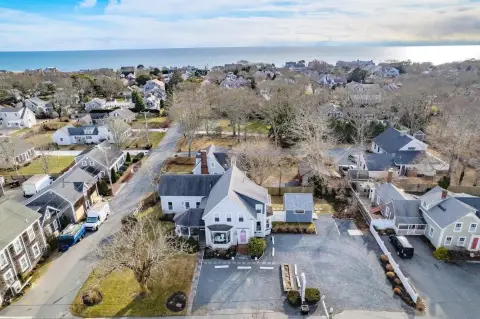
504 Rte 28 Harwich Port, MA 02646-1817
Property profile & analytics
504 Rte 28, Harwich Port, MA 02646-1817
- Investment properties
- 2,062 SF
- 0.19 lot acres
Property ID
US38-1833238
The Realmo ID is a unique identifier assigned to every property, incorporating country codes and precise geo-coordinates for 300x300-foot land blocks. It enables standardized data collection and seamless integration of disparate sources such as ownership, tax, title data and physical specifications. By aggregating current and historical records, the Realmo ID powers advanced analytics and delivers deep, verifiable insights for real estate professionals.
Location Intelligence
Current Use by Public Records
- Investment properties
Property Details for 504 Rte 28
- Year built
- 1915
- Construction
- FRAME
- Lot size
- 0.19 lot acres
- Zone code
- R
- Property type
- Investment properties
- Property subtype
- Live-work space
- APN
- HARW M:14 P:R6
- APU
- HARWM14PR6
Sales History
| Date | Price | Buyer | Seller | Deed Type | Mortgage |
|---|---|---|---|---|---|
| Jun 11, 1997 | $155,000 | Hilary S Gagnon | Woelfel,francis E | Grant Deed | $124k · Thomas M Sykes |
| Jun 11, 1997 | $1,200 | Francis E Woelfel | Ellis,judith | Grant Deed · related | — |
| Jun 11, 1997 | — | Hilary S Gagnon | — | Deed Of Trust · related | $16k · Zuckerman Family Nomi |
| Dec 7, 1990 | $16,434 | Francis E Woelfel | Hubay,bernice | Grant Deed | — |
| Apr 27, 1987 | $50,000 | Francis E Woelfel | Speakman,janice A | Grant Deed | — |
Value Estimations
based on Realmo’s proprietary methodology
-
CAP approach
- CAP Return
- Estimation
- 6%
- $480,000
- 6.5%
- $445,000
- 7%
- $410,000
-
Comparable approach
- Method
- Estimation
- AI Estimate
- $524,000
Market price range: $144k - $762k
Get a detailed, property-specific estimation — fast and free
Location Insight
- Map
- Local Demand
- City
- Harwich Port
- County
- Barnstable
- State
- Massachusetts
- Longitude
- -70.0787
- Latitude
- 41.668
- CBSA code
- 12700
- CBSA name
- BARNSTABLE TOWN, MA METROPOLITAN STATISTICAL AREA
Property Tax & Assessments
Tax date
Tax Amount
Assessed Land Value
Assessed Improvement Value
Total Assessed Value
Applied Tax Rate
Land Market Value
Improvement Market Value
Total Market Value
2024
$3,361
$287,700
$269,600
$557,300
-
$0.00
$0.00
$0.00