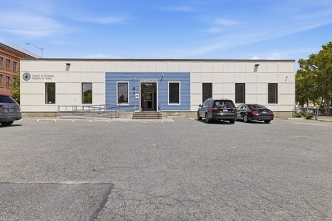
490 Frst Ave Brockton, MA 02301-5749
Property profile & analytics
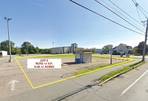
490 Frst Ave, Brockton, MA 02301-5749
- Office buildings
- 11,808 SF
- 0.48 lot acres
Property ID
US38-0876572
The Realmo ID is a unique identifier assigned to every property, incorporating country codes and precise geo-coordinates for 300x300-foot land blocks. It enables standardized data collection and seamless integration of disparate sources such as ownership, tax, title data and physical specifications. By aggregating current and historical records, the Realmo ID powers advanced analytics and delivers deep, verifiable insights for real estate professionals.
Location Intelligence
Current Use by Public Records
- Massachusetts Registry of Motor Vehicles / Department Of Motor Vehicles / Driver'S License Office
- MVR / Government Office
- Brockton Rmv Service Center / Department Of Motor Vehicles
Property Details for 490 Frst Ave
- Year built
- 1974
- Lot size
- 0.48 lot acres
- Zone code
- C2
- Property type
- Office buildings
- APN
- BROC M:026 R:100 S:
- APU
- BROCM026R100S
Sales History
| Date | Price | Buyer | Seller | Deed Type | Mortgage |
|---|---|---|---|---|---|
| Dec 30, 2021 | — | 490 Forest Ave LLC | Carney Ft | Quit Claim Deed · related | $1.5M · North Easton Savings Bank |
| Apr 29, 2002 | — | Liberty RT | — | Deed Of Trust · related | $3.7M · Rockland Trust Co |
| Aug 25, 1995 | — | Carney Ft | — | Deed Of Trust · related | $1.5M · Braintree Savings Bank |
Value Estimations
based on Realmo’s proprietary methodology
-
Comparable approach
- Method
- Estimation
- Statistic Estimate
- $2,106,000
Market price range: $814k - $6.44M -
Alternative Use
- Use
- Estimation
- RESTAURANT
- $3,115,000
Get a detailed, property-specific estimation — fast and free
Location Insight
- Map
- Local Demand
- City
- Brockton
- County
- Plymouth
- State
- Massachusetts
- Longitude
- -71.0414
- Latitude
- 42.0702
- CBSA code
- 14460
- CBSA name
- BOSTON-CAMBRIDGE-QUINCY, MA-NH METROPOLITAN STATISTICAL AREA
Property Tax & Assessments
Tax date
Tax Amount
Assessed Land Value
Assessed Improvement Value
Total Assessed Value
Applied Tax Rate
Land Market Value
Improvement Market Value
Total Market Value
2024
$35,976
$320,100
$1,175,800
$1,495,900
-
$0.00
$0.00
$0.00