 For Sale
1 / 25
For Sale
1 / 25
Property summary
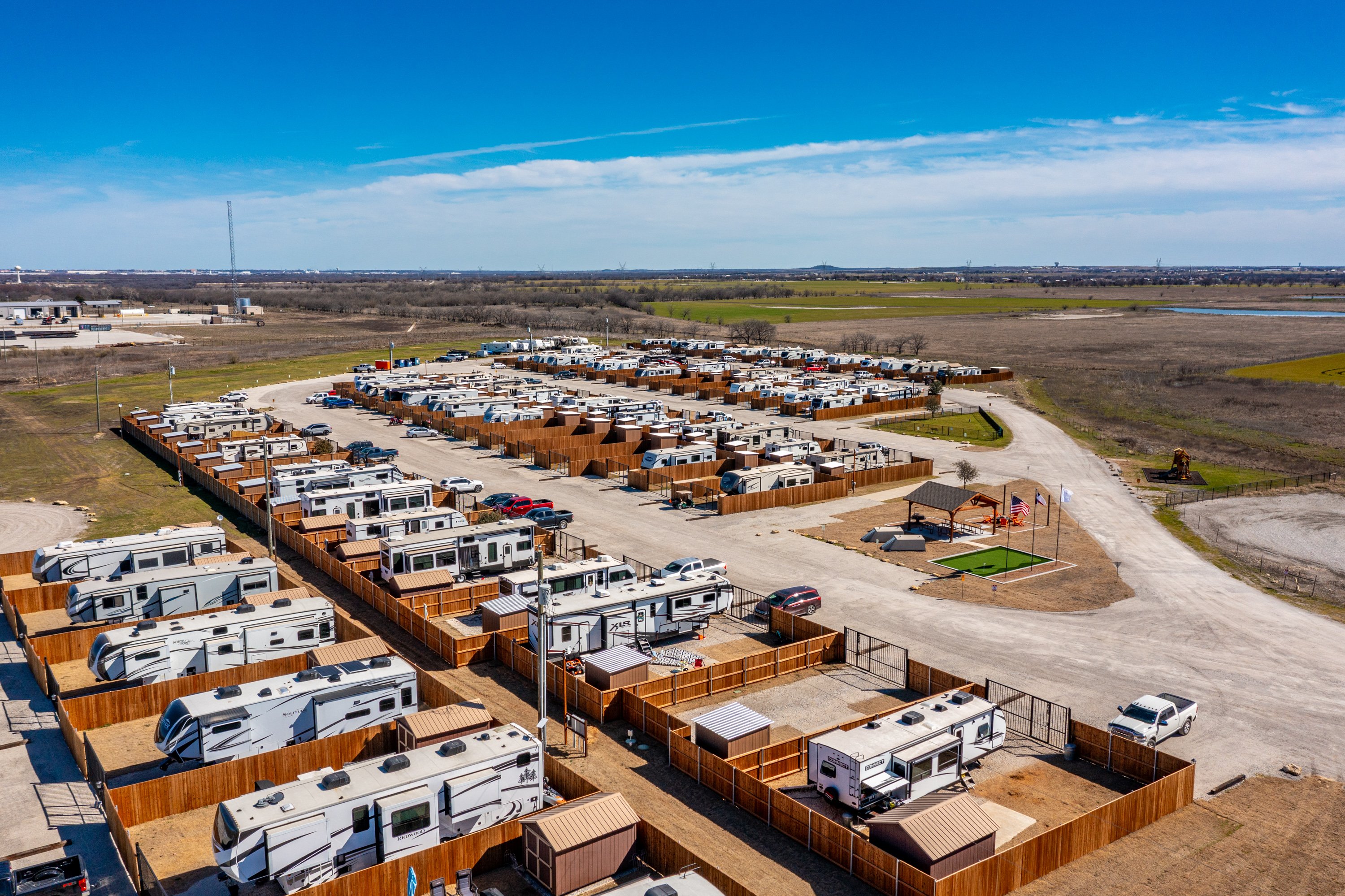
This exceptional 20-acre commercial land parcel presents a unique investment opportunity in Ponder, Texas. Strategically located at the intersection of Highway 380 and George Owens Road, this vacant land offers unparalleled visibility and accessibility. Its expansive size allows for a multitude of development possibilities, including retail, truck stops, apartment complexes, office buildings, gas stations, storage facilities, or RV parks. The property's location within the rapidly growing Denton County, part of the expansive DFW Metroplex, ensures significant future growth potential. Ponder itself boasts a population of 2,394 residents, while the larger Denton County population stands at 972,605, reflecting a dynamic and expanding market. The proximity to Denton, a city of 139,734 residents and home to two major universities, further enhances the property's appeal. This prime location offers exceptional potential for high returns on investment, making it an ideal opportunity for developers and investors seeking a foothold in a thriving North Texas market. The land is priced at $80,000 per acre, presenting a compelling value proposition given its size, location, and development potential. This is a rare chance to acquire a significant commercial land holding in one of Texas's fastest-growing regions. Don't miss this opportunity to capitalize on the burgeoning growth of Denton County.
Property profile
VerifiedCap rate & NOI
Current use
-
Campground & RV Park
-
Car Rental Facility
-
Propane Supplier
Location
Value estimations
Owner & transaction history
Comparables
6 recent transactions · within 1.5 miComparable in this City


Similar Nearby for Sale



Similar Nearby for Lease




Value estimation
Instant AI valuation built from comps, income signals, and proprietary benchmarks. A defensible range, not a single guess.
from $99/month
Cap rate
Cap rate calculated from real income and expense signals, benchmarked against sales of similar assets nearby.
from $99/month
Property description
Physical attributes from public recordsZoning & alternative use
Zoning
The recorded zoning designation, what the district officially allows, and the municipal source it comes from.
No zoning code is on file for this parcel. Zoning coverage grows with every catalog release — check back, or open Location Intelligence for use analysis of this corner.
Find the owner behind the property.
Unlock the evidence behind ownership: portfolio, transactions, debt and signals that help you decide who to contact next.
Registration is required before any owner information is shown.
- Full Property Data
- Historical Records
- Value Estimation
- NOI Potential
- Cap Rate Calculation
- Ownership
- Location Insight
- Alternative use
- Local Zoning Insight
Cancel anytime.
- 30 reports a month
- Location Analytics
- Market Trends
- Full Property Data
- Historical Records
- Value Estimation
- NOI Potential
- Cap Rate Calculation
- Ownership
- Location Insight
- Alternative use
- Local Zoning Insight
Cancel anytime.
- 300 reports a month
- Location Analytics
- Market Trends
- Full Property Data
- Historical Records
- Value Estimation
- NOI Potential
- Cap Rate Calculation
- Ownership
- Location Insight
- Alternative use
- Local Zoning Insight
and get 1 Light Report
- Property Information
- Historical Records
- Value Estimation
- NOI Potential
- Cap Rate Potential
- Location Insight
- Alternative use
- Local Zoning Insight


