210 Signal Dr Rock Springs, WY 82901-3349
Property profile & analytics
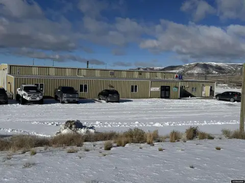
210 Signal Dr, Rock Springs, WY 82901-3349
- Warehouses
- 3,036 SF
- 0.50 lot acres
Property ID
US95-0293737
The Realmo ID is a unique identifier assigned to every property, incorporating country codes and precise geo-coordinates for 300x300-foot land blocks. It enables standardized data collection and seamless integration of disparate sources such as ownership, tax, title data and physical specifications. By aggregating current and historical records, the Realmo ID powers advanced analytics and delivers deep, verifiable insights for real estate professionals.
Location Intelligence
Current Use by Public Records
- Praxair Inc / Industrial Manufacturer / Production Facility
- Independence Enterprises Inc / Financial Advisor
Property Details for 210 Signal Dr
- Year built
- 1976
- Lot size
- 0.50 lot acres
- Property type
- Warehouses
- APN
- 1905-09-4-34-023-00
- APU
- 19050943402300
Sales History
| Date | Price | Buyer | Seller | Deed Type | Mortgage |
|---|---|---|---|---|---|
| Aug 23, 2023 | — | Mark B Sweet | Mark B Sweet | Intrafamily Transfer · related | — |
Value Estimations
based on Realmo’s proprietary methodology
-
AI approach
-
CAP approach
-
Comparable approach
-
Alternative Use
Get a detailed, property-specific estimation — fast and free
Location Insight
- Map
- Local Demand
- City
- Rock Springs
- County
- Sweetwater
- State
- Wyoming
- Longitude
- -109.259
- Latitude
- 41.6333
- CBSA code
- 40540
- CBSA name
- ROCK SPRINGS, WY MICROPOLITAN STATISTICAL AREA
Property Tax & Assessments
Tax date
Tax Amount
Assessed Land Value
Assessed Improvement Value
Total Assessed Value
Applied Tax Rate
Land Market Value
Improvement Market Value
Total Market Value
2023
$1,086
$3,332
$11,064
$14,396
-
$35,072
$116,465
$151,537