12660 Stafford Rd, Unit 264 Stafford, TX 77477-3540
Property profile & analytics
12660 Stafford Rd, Unit 264, Stafford, TX 77477-3540
- Garden apartment buildings
- 32,571 SF
- 22.65 lot acres
Property ID
US82-2037641
The Realmo ID is a unique identifier assigned to every property, incorporating country codes and precise geo-coordinates for 300x300-foot land blocks. It enables standardized data collection and seamless integration of disparate sources such as ownership, tax, title data and physical specifications. By aggregating current and historical records, the Realmo ID powers advanced analytics and delivers deep, verifiable insights for real estate professionals.
Location Intelligence
Current Use by Public Records
- Madison on the Meadow / Real Estate Agency
- Mesprosoft / (Bike/Boat/Book/etc) Store / Corporate Office
Property Details for 12660 Stafford Rd
- Year built
- 2004
- Construction
- BRICK
- Lot size
- 22.65 lot acres
- Property type
- Garden apartment buildings
- APN
- 1256880010001
- APU
- 1256880010001
Sales History
| Date | Price | Buyer | Seller | Deed Type | Mortgage |
|---|---|---|---|---|---|
| Dec 30, 2019 | — | Wrpv Xiii Mm Stafford LLC | Madison On The Meadow LP | Grant Deed · related | — |
| — | — | Madison On The Meadow LP | — | Deed Of Trust · related | $21.5M · Lincoln National Life Ins |
Value Estimations
based on Realmo’s proprietary methodology
-
AI approach
-
CAP approach
-
Comparable approach
-
Alternative Use
Get a detailed, property-specific estimation — fast and free
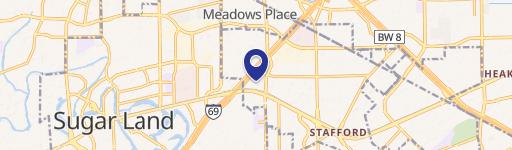
Location Insight
- Map
- Local Demand
- City
- Stafford
- County
- Harris
- State
- Texas
- Longitude
- -95.542
- Latitude
- 29.6399
- CBSA code
- 26420
- CBSA name
- HOUSTON-SUGAR LAND-BAYTOWN, TX METROPOLITAN STATISTICAL AREA
Property Tax & Assessments
Tax date
Tax Amount
Assessed Land Value
Assessed Improvement Value
Total Assessed Value
Applied Tax Rate
Land Market Value
Improvement Market Value
Total Market Value
2022
$525,764
$2,376,706
$27,237,976
$29,614,682
-
$2,376,706
$27,237,976
$29,614,682