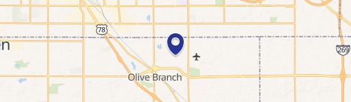
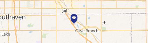
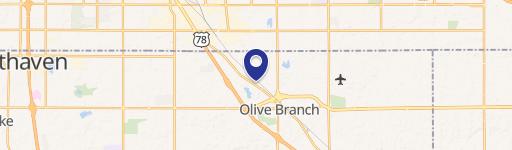
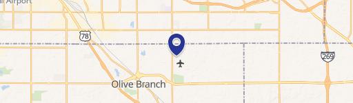
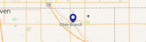
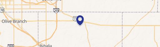
10600 Rdg Wood Dr Olive Branch, MS 38654-3917
Property profile & analytics
10600 Rdg Wood Dr, Olive Branch, MS 38654-3917
- Warehouses
- 52,946 SF
- 5.36 lot acres
Property ID
US50-0018069
The Realmo ID is a unique identifier assigned to every property, incorporating country codes and precise geo-coordinates for 300x300-foot land blocks. It enables standardized data collection and seamless integration of disparate sources such as ownership, tax, title data and physical specifications. By aggregating current and historical records, the Realmo ID powers advanced analytics and delivers deep, verifiable insights for real estate professionals.
Location Intelligence
Current Use by Public Records
- Warehouses
Property Details for 10600 Rdg Wood Dr
- Year built
- 1986
- Construction
- TILT-UP CONCRETE
- Lot size
- 5.36 lot acres
- Zone code
- M-2
- Property type
- Warehouses
- APN
- 1-06-6-23-03-0-00028-00
- APU
- 1066230300002800
Sales History
| Date | Price | Buyer | Seller | Deed Type | Mortgage |
|---|---|---|---|---|---|
| Aug 14, 2018 | — | Moore Family Properties LLC | — | Deed · related | $885k · First Savings Bank |
| Apr 24, 2015 | — | Moore Family Properties LLC | William H Thomas JR | Special Warranty Deed | — |
Value Estimations
based on Realmo’s proprietary methodology
-
AI approach
-
CAP approach
-
Comparable approach
-
Alternative Use
Get a detailed, property-specific estimation — fast and free
Location Insight
- Map
- Local Demand
- City
- Olive Branch
- County
- Desoto
- State
- Mississippi
- Longitude
- -89.803
- Latitude
- 34.9813
- CBSA code
- 32820
- CBSA name
- MEMPHIS, TN-MS-AR METROPOLITAN STATISTICAL AREA
Property Tax & Assessments
Tax date
Tax Amount
Assessed Land Value
Assessed Improvement Value
Total Assessed Value
Applied Tax Rate
Land Market Value
Improvement Market Value
Total Market Value
2023
$35,846
$0.00
$0.00
$262,646
-
$138,250
$1,612,723
$1,750,973