Mountain Recreation & Hunting
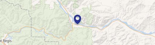
W Fork Combest Creek Road Plains, MT 59859
W Fork Combest Creek Road, Plains, MT, 59859
$1,500,000
For Sale
$1,500,000
LAND - MT
Lot Size312.96 Acres
Days on Market47
Property Features for W Fork Combest Creek Road
General Information
- Property type
- Land
- Property subtype
- Other
- Standard status
- Active
- APN
- 31850
- Lot size
- 312.96 Acres
Taxes and HOA fees
- Tax Description
- S06, T19 N, R26 W, C.O.S. 3940, ACRES 312.96, PLAT C, E2SW, TRACT 1
- Tax Annual Amount
- 822
Listing Agency
Corder and Associates LLC
(406) 622-3224
1312 Front Street, Fort Benton, MT
Listed by
Trampus Corder · License #RRE-BRO-LIC-38039
(406) 622-3224
Added: Jun 2 Checked: Jul 18 at 3:06 pm
MLS# 356014
Listing URL
Copyright © 2026 Billings Association of Realtors. All rights reserved. All information provided by the listing agent/broker is deemed reliable but is not guaranteed and should be independently verified.
Investment Insights
Based on property information with market context.
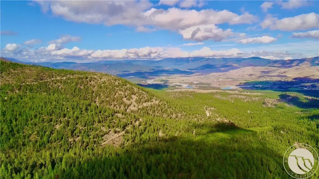
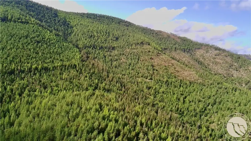
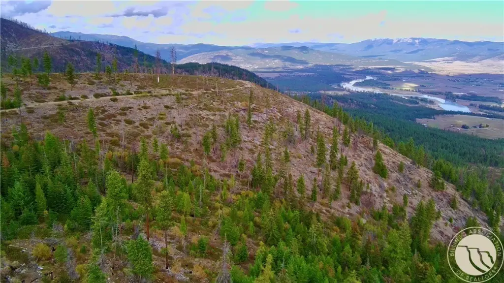
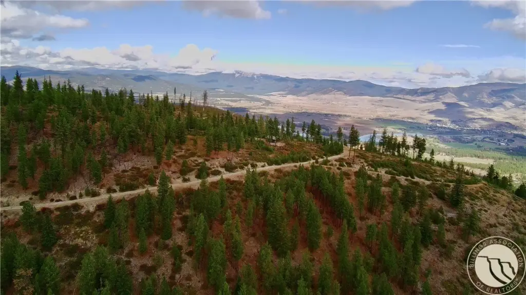
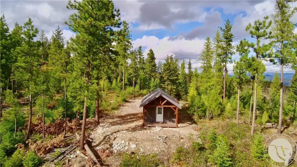
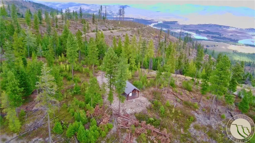
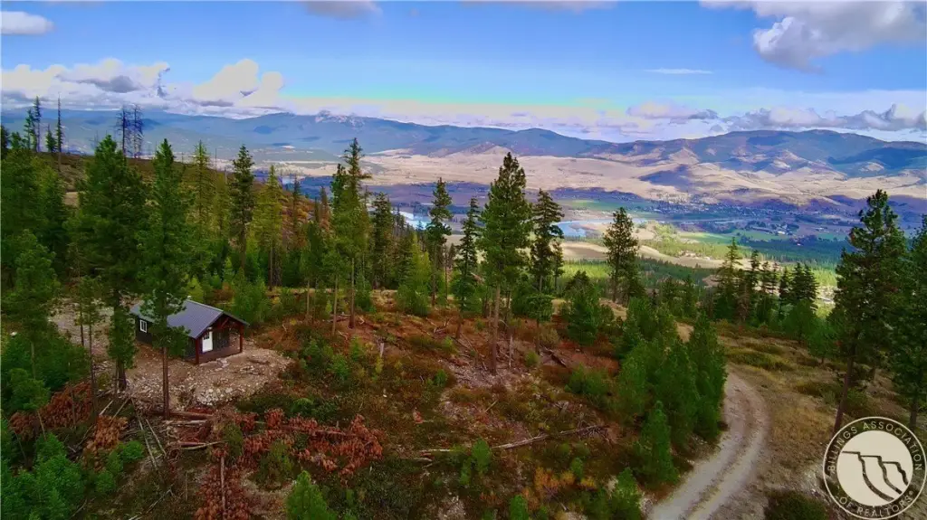
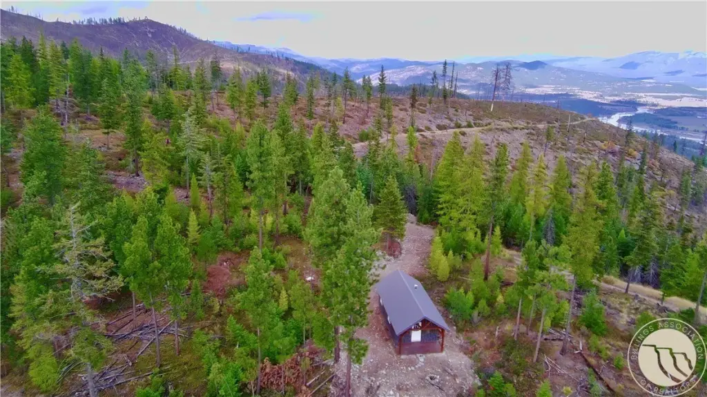
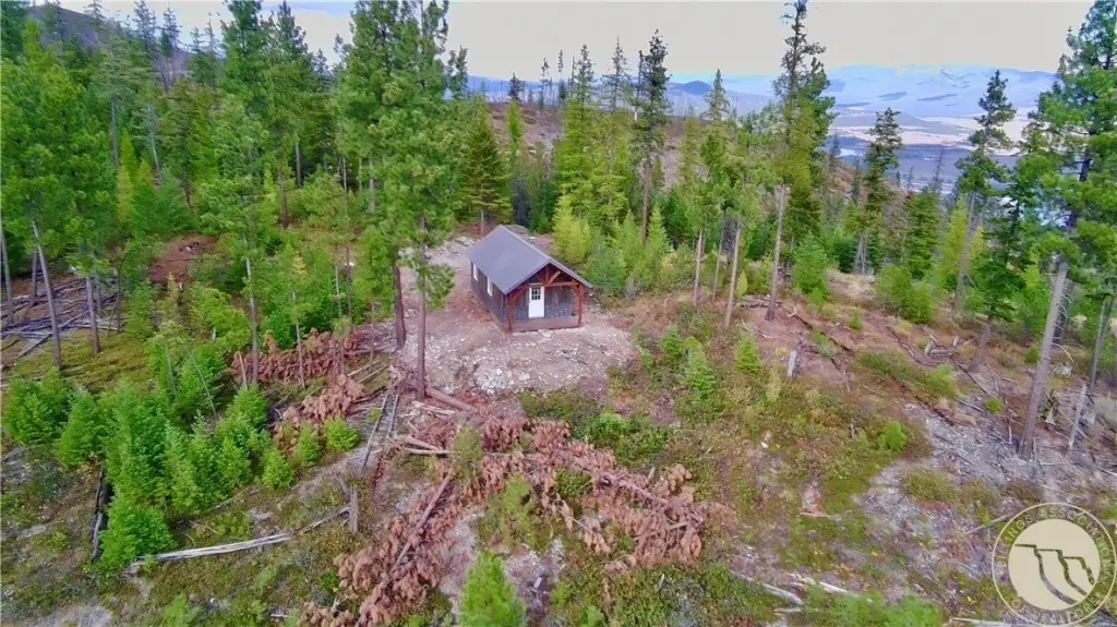
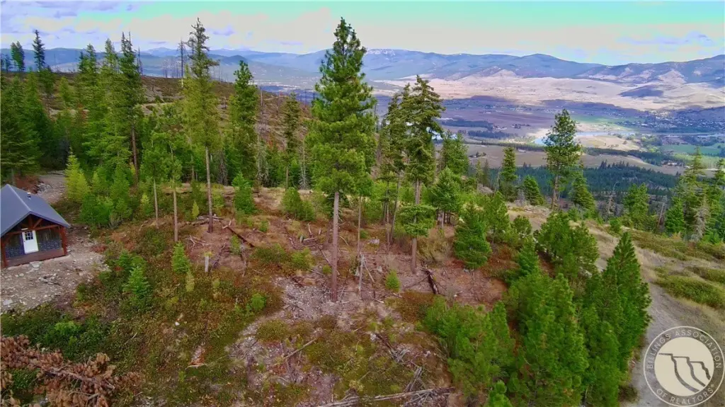
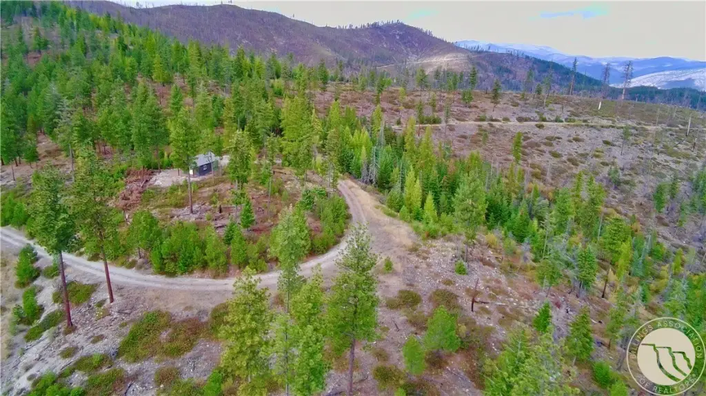
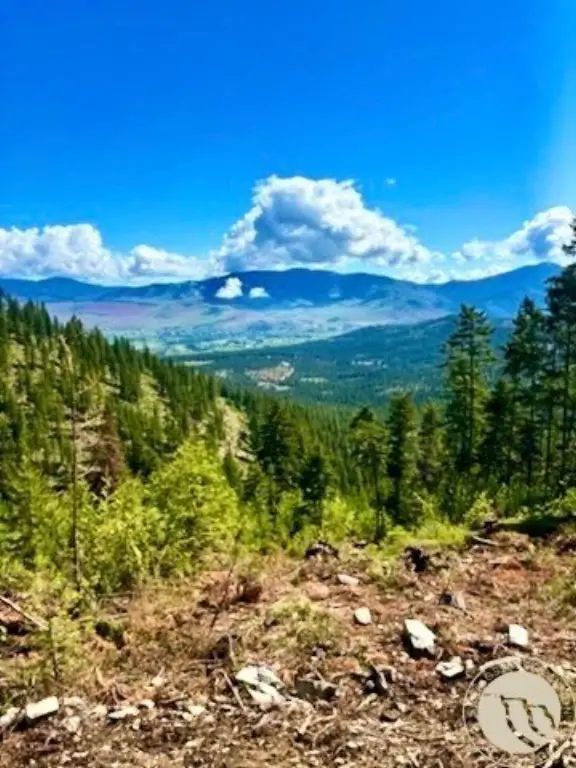
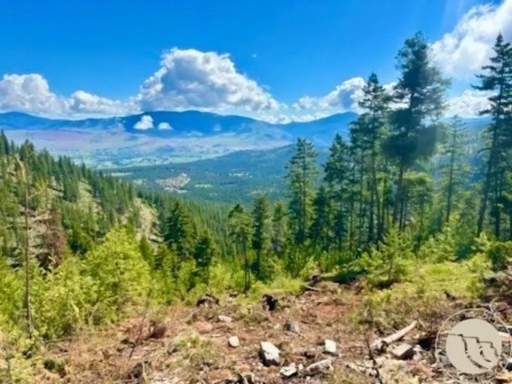
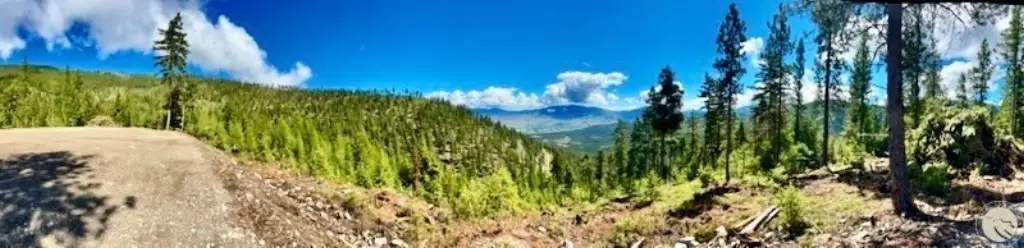
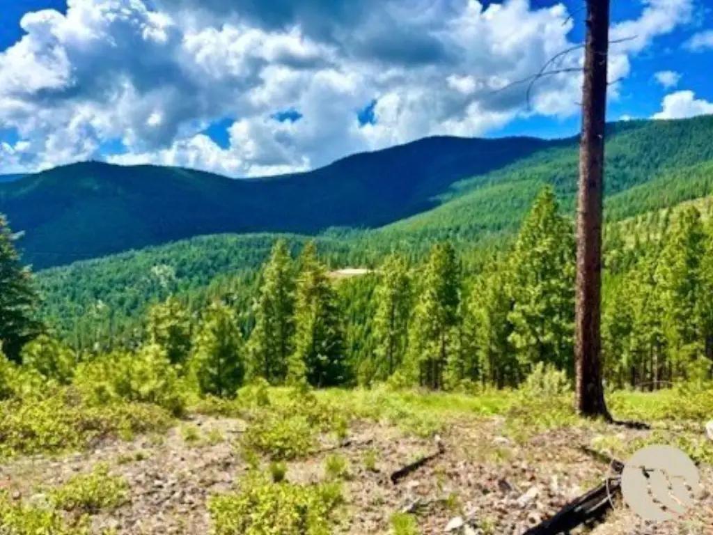
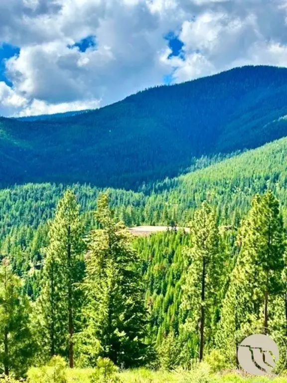
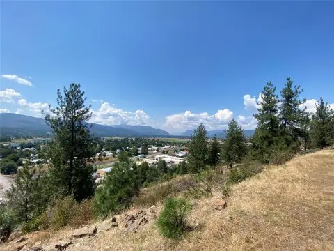
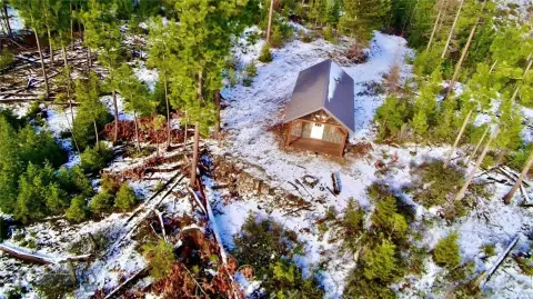
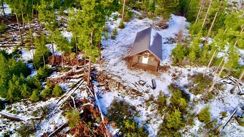
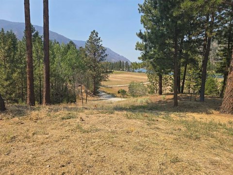
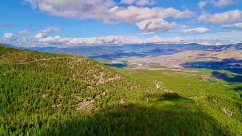
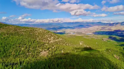
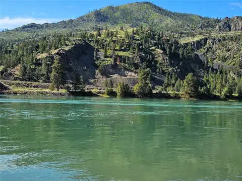
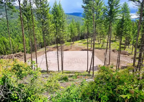
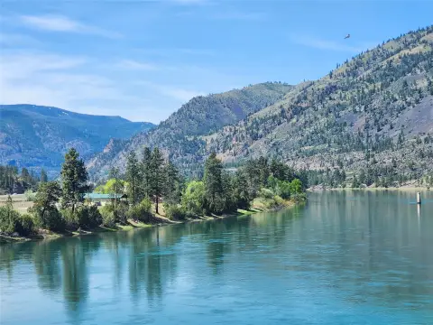
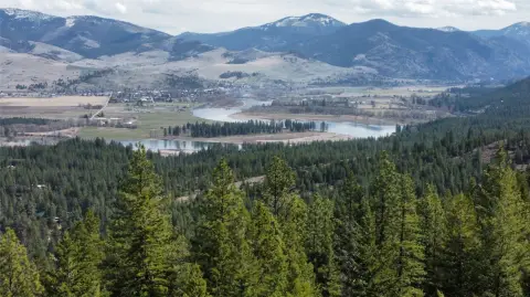
Set on 312.96 acres in Montana, this recreation and hunting parcel features rolling, wilderness-leaning terrain and panoramic views toward Paradise Valley. The property includes a fully finished dry cabin, providing an established base for extended stays and time in the outdoors.
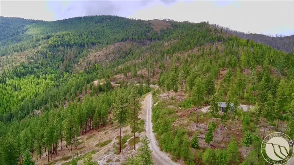
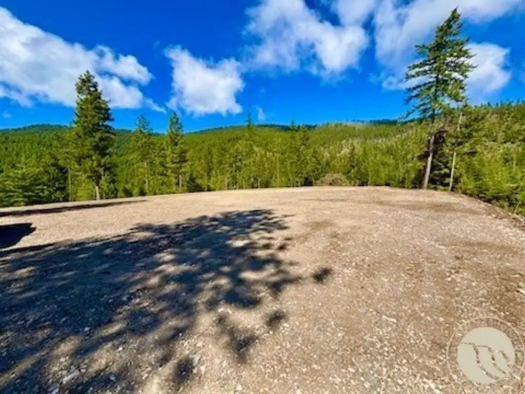
The land borders millions of acres of the Lolo National Forest, creating a natural backdrop for exploration and recreation. With wildlife present across the property and open space for land-based activity, it’s positioned for buyers looking for privacy and a true out-of-town setting. Access is available via W Fork Combest Creek Road (as provided).
This offering is well suited to buyers seeking a private hunting basecamp, a remote recreational retreat, or a long-term land investment with wilderness adjacency. The cabin supports immediate use as-is, while the property’s terrain and forest proximity make it practical for on-foot scouting, horseback riding, or ATV use. For buyers who want a Montana setting defined by space, views, and surrounding national forest, this tract provides a straightforward path to getting started outdoors.
Key Highlights
- 312.96‑acre Montana retreat with panoramic views of Paradise Valley
- Property borders millions of acres of Lolo National Forest
- Fully finished dry cabin on‑site
Property Analytics
Location Intelligence
Current Use by Public Records
Hunting land
Similar For Sale Nearby

FAQs
What type of property is this?
Hunting land - Remote Montana acreage with a finished dry cabin, rugged terrain, and direct access to national-forest surroundings.
Where is this hunting land located?
The property is located at W Fork Combest Creek Road Plains, MT.
What is the asking price?
The asking price for this property is $1,500,000.
What are key features of this property?
This property features: 312.96‑acre Montana retreat with panoramic views of Paradise Valley; Property borders millions of acres of Lolo National Forest; Fully finished dry cabin on‑site