Flat Land Parcel with Red Rock
Coal Pits Parcel 1156-A-HV Rd, Virgin, UT 84779
For Sale


$543,653
Land, Virgin, UT
Property Size908,226 SF
Lot Size20.84 Acres
Price / SF$0.60
Days on Market216
Property Features for Coal Pits Parcel 1156-A-HV Rd
General Information
Property type
Property subtype
Zoning description
Lot features
Elementary school
Middle school
High school
Subdivision
Standard status
APN
Size
Lot size
Taxes and HOA fees
Tax Annual Amount
Listing Agency:
ERA BROKERS CONSOLIDATED SG
(435) 628-1606
Listed By:
JEFFREY G STAPLES
(435) 619-0189
Added: Apr 8
Changed: Oct 3
Last Checked: Nov 9 at 6:06AM
MLS# 26-271477
Copyright © 2026 Washington County Board of Realtors. All rights reserved. All information provided by the listing agent/broker is deemed reliable but is not guaranteed and should be independently verified.

Ask AI about this property
Review the available facts, identify missing information and prepare questions for the agent.
Investment Insights
Based on property information with market context.
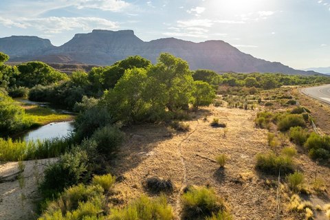
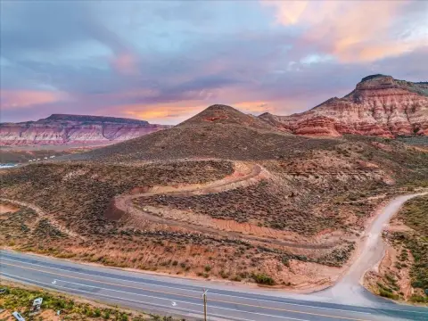
This 20.84-acre land parcel in Virgin, Utah encompasses approximately 908,226 square feet of mostly flat, usable terrain. The property offers broad views of the surrounding red rock landscape and may appeal to buyers seeking a large-scale rural or recreational holding. Mineral rights are available, subject to buyer verification.
The parcel is located minutes from State Route 9 and approximately 15 minutes from the entrance to Zion National Park. St. George, its regional airport, downtown area, golf, and recreation destinations are about a 45-minute drive away. The combination of substantial acreage, accessible regional positioning, and open terrain provides a defined land opportunity in Washington County.
The parcel is located minutes from State Route 9 and approximately 15 minutes from the entrance to Zion National Park. St. George, its regional airport, downtown area, golf, and recreation destinations are about a 45-minute drive away. The combination of substantial acreage, accessible regional positioning, and open terrain provides a defined land opportunity in Washington County.
Key Highlights
- 20.84 acres of land in Virgin, UT
- Approximately 908,226 square feet
- Mostly flat and usable terrain
Property Analytics
Who owns this building?
See the owner, sales and loan history
Open Analytics
Location Intelligence
Trade Area within ½ mile
4
Businesses Nearby
Explore this area
Business Placement
Demographics for 84779, UT
730
Population
574
Households
1.3
Avg Household Size
44
Median Age
26%
College-Educated
90%
High-School Grad
232.0 sq mi
ZIP Area
3
Density / Sq Mi
$80,625
Median Household Income
$27,857
Median Earnings
$466,300
Median Home Value
Check the figures for this property
Cap Rate, Value Estimation, Potential NOI and more
View Realmo Analytics
Market
Average Price Trend$/SF for Land in Virgin, UT
Properties on Market for Land in Virgin




Frequently Asked Questions
What type of property is this?
Land - Mostly usable acreage with panoramic red rock views near Zion National Park and State Route 9.
Where is this land located?
The property is located at Coal Pits Parcel 1156-A-HV Rd Virgin, UT.
What is the asking price?
The asking price for this property is $543,653.
What are key features of this property?
This property features: 20.84 acres of land in Virgin, UT; Approximately 908,226 square feet; Mostly flat and usable terrain