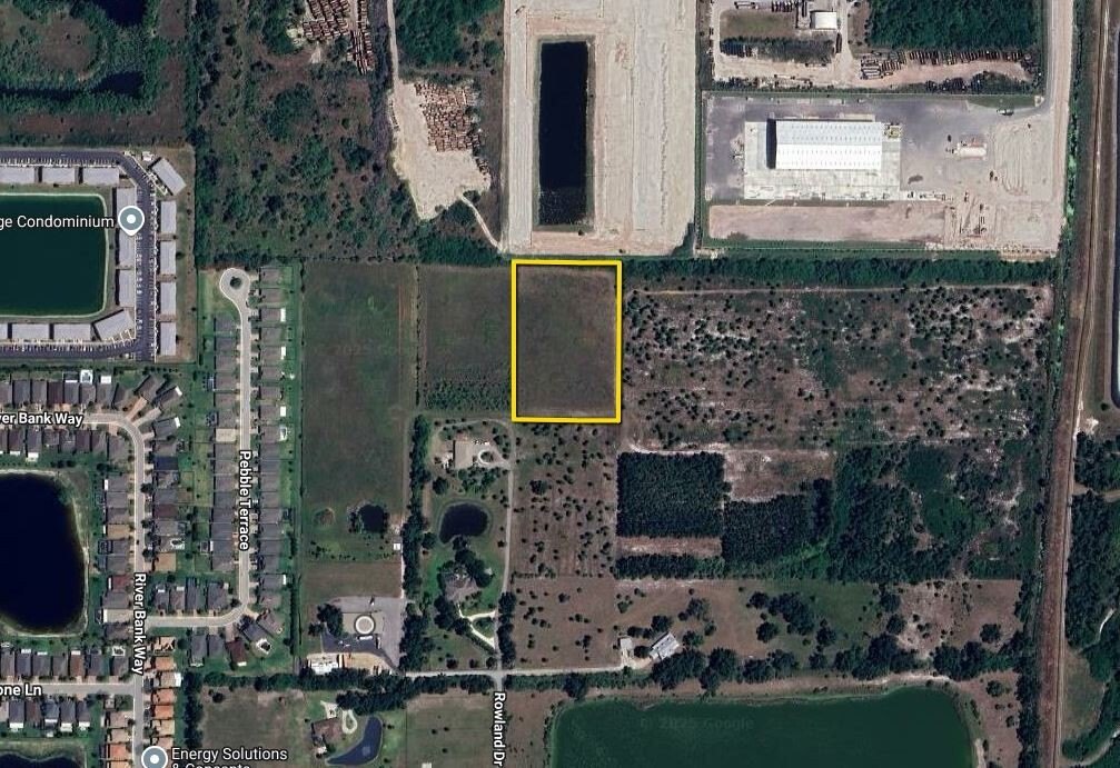
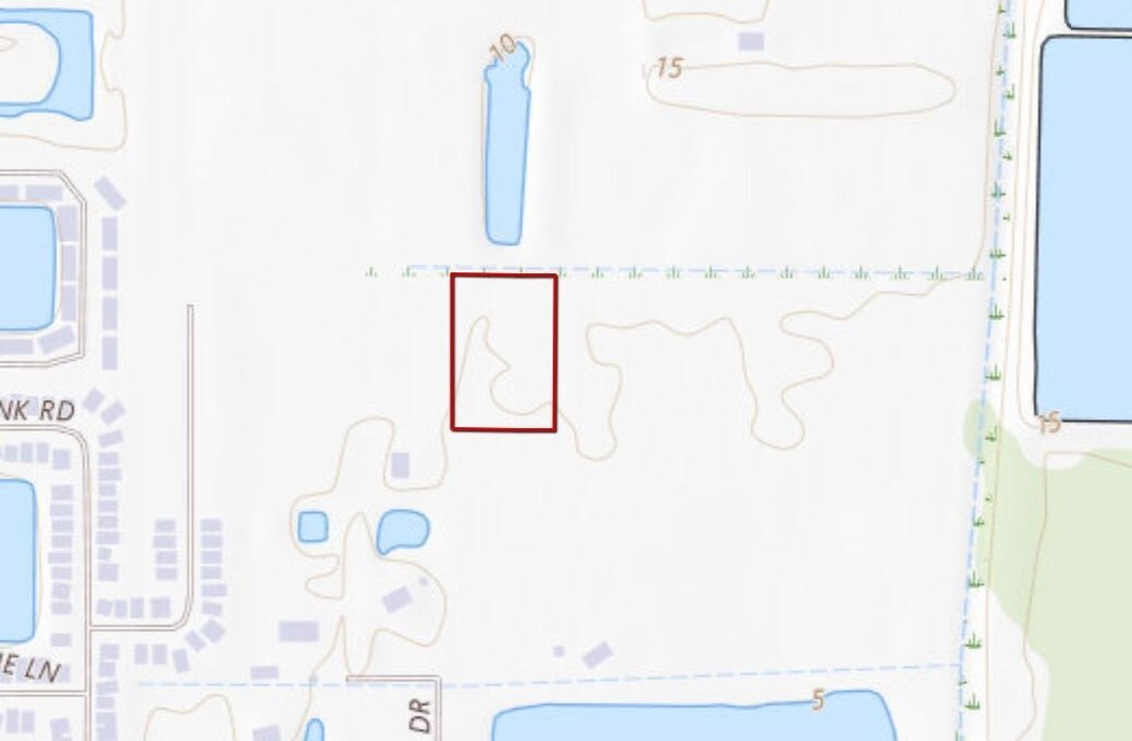
Rowland Drive Tract C, Port Charlotte, FL 33980
- Added:
- Aug 1, 2025
- Days on Market:
- 339
- Last Refresh:
- Jul 5 at 12:06 pm
Property Features for Rowland Drive Tract C
General Information
- Property type
- Land
- Property subtype
- Other
- Standard status
- Active
- Lot size
- 3.73 Acres

Listing agent Justus Koester License #BK3458696 (855) 384-5263
Listing office National Land Realty, Tampa, FL 2909 N. Nebraska Avenue, Fort Myers, FL (855) 384-5263
Listing date Aug 1, 2025
Copyright © 2026 My State MLS. All rights reserved. All information provided by the listing agent/broker is deemed reliable but is not guaranteed and should be independently verified.
HighLights
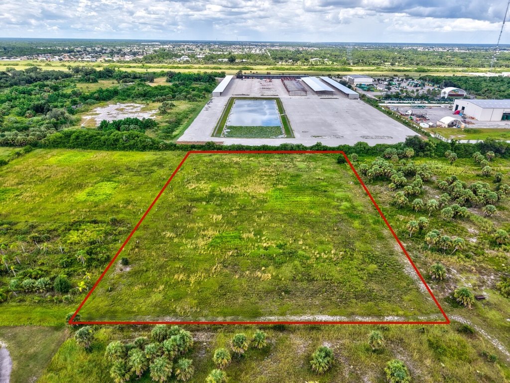
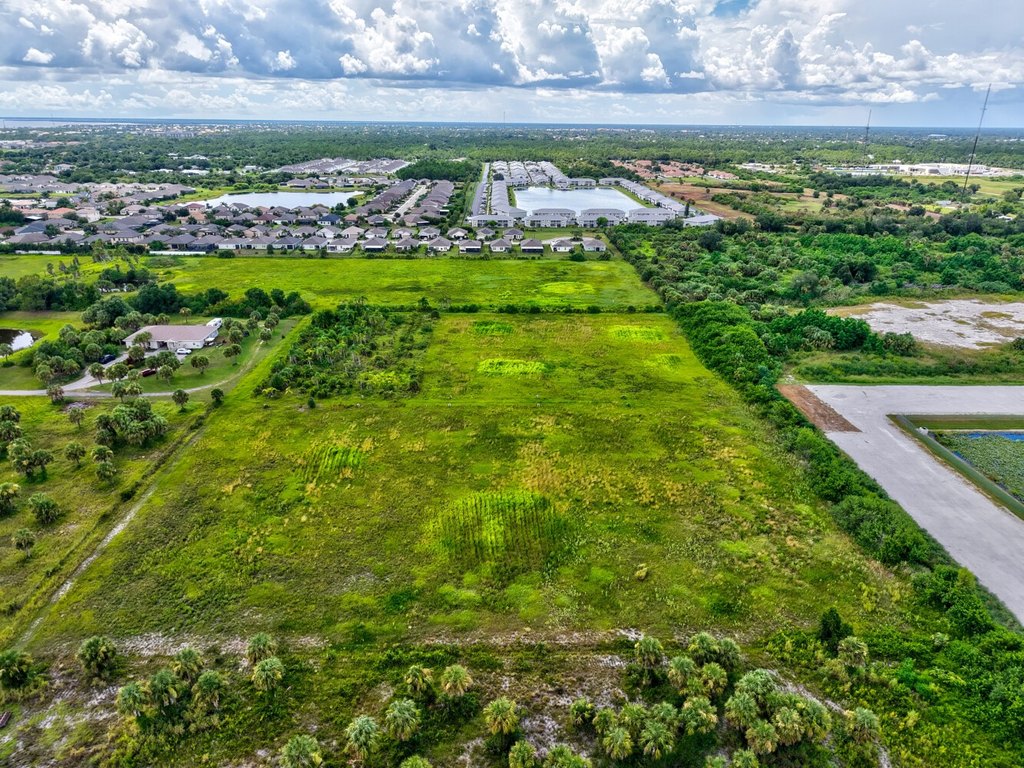
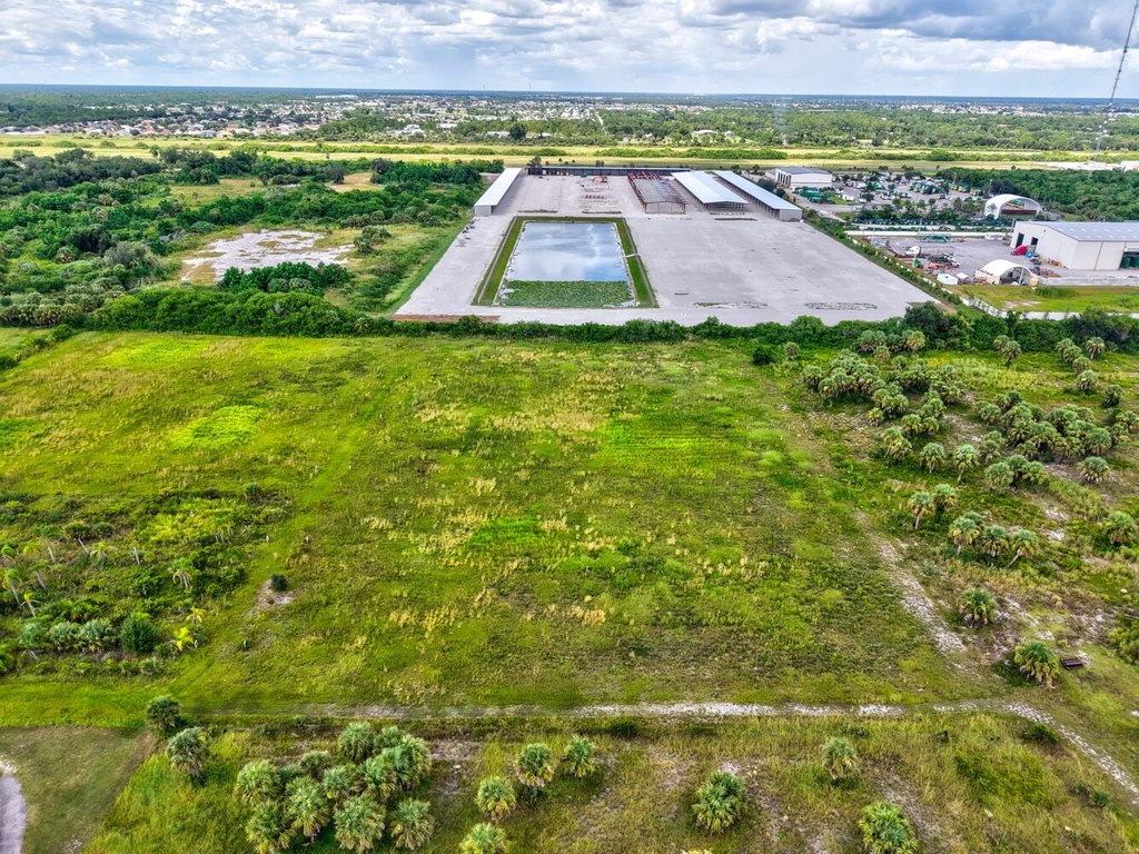
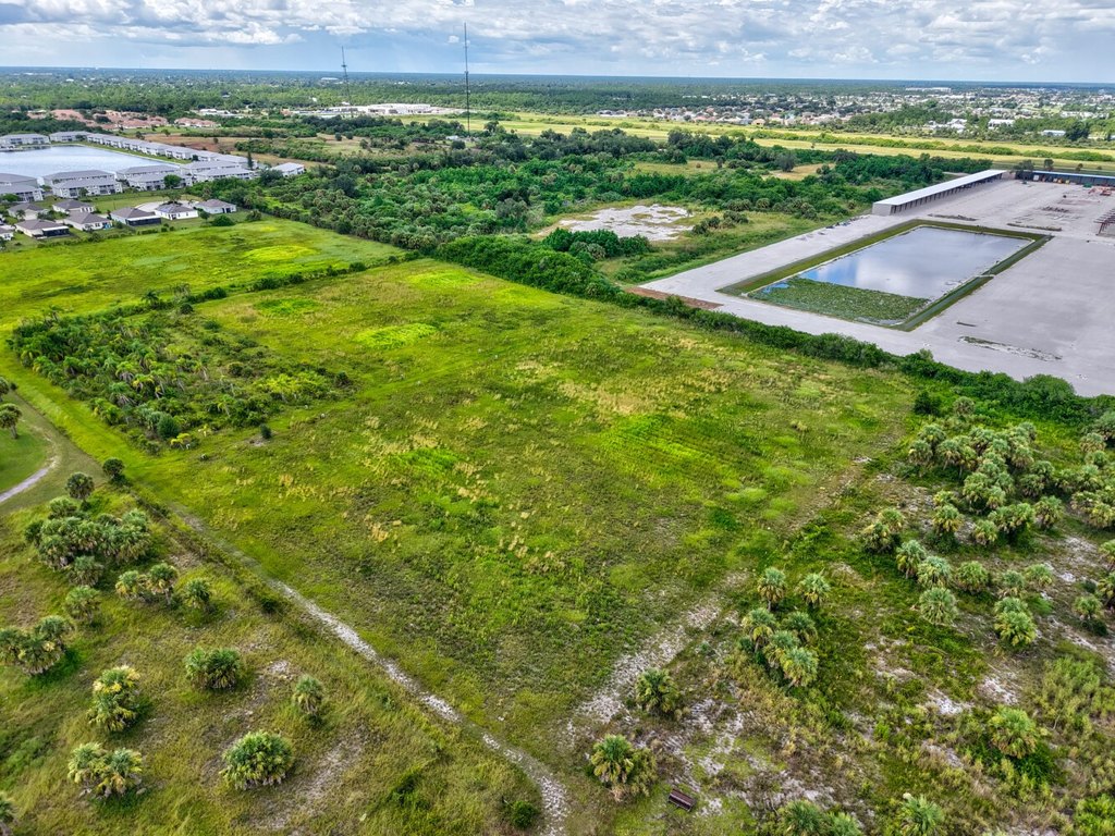
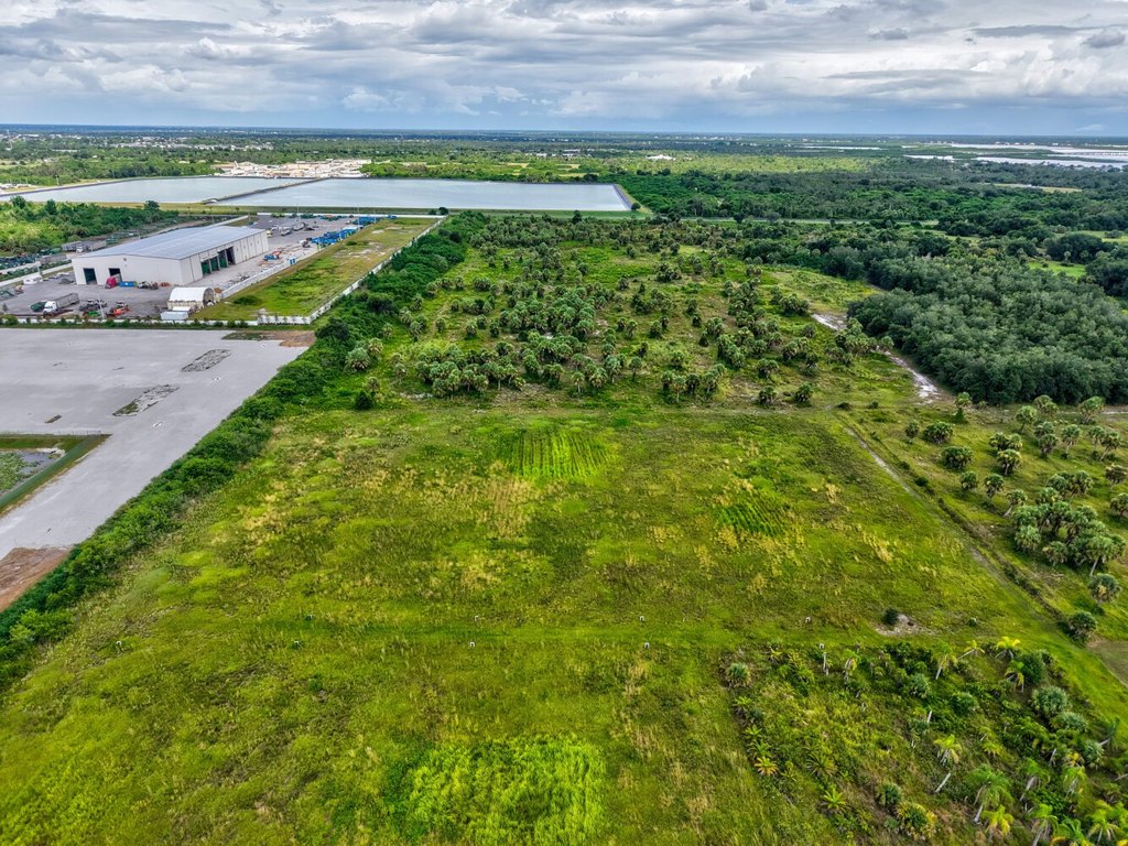
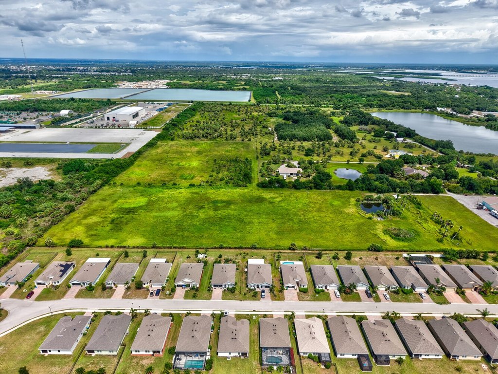
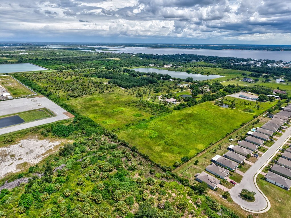
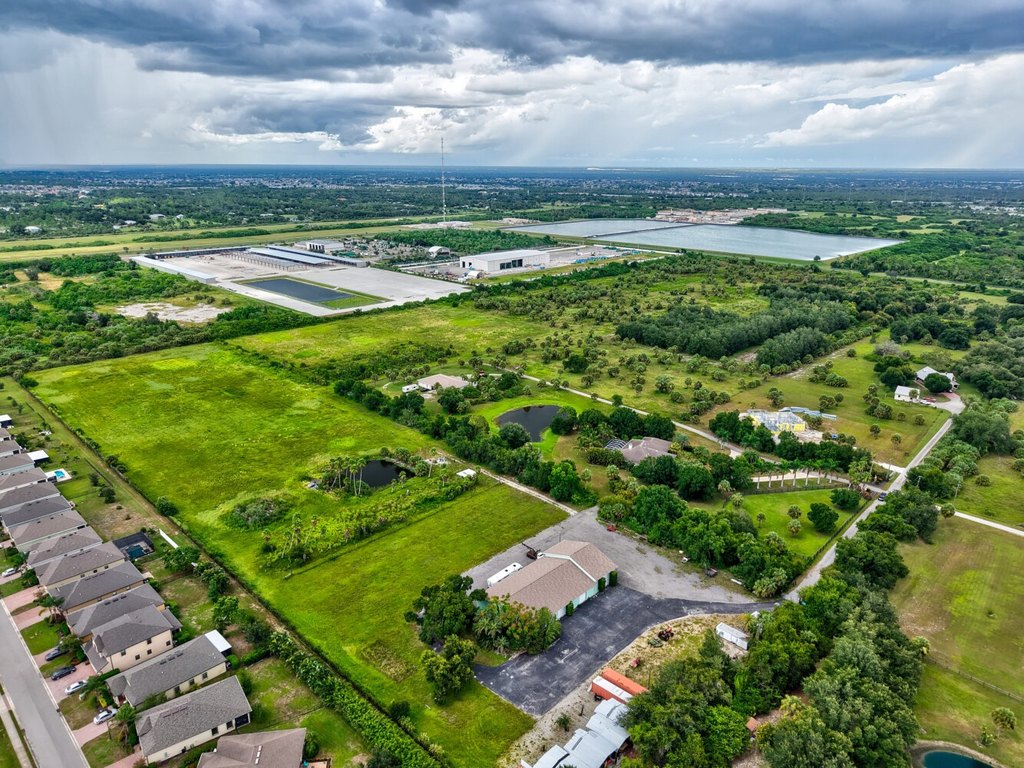
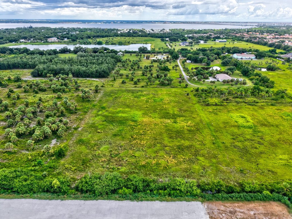
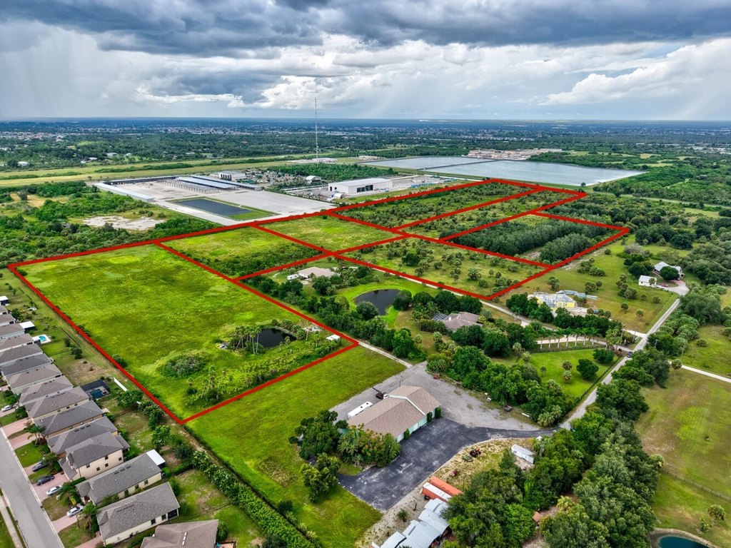
- 3.73‑acre tract (330 x 492.8) in Southwest Florida with sandy‑loam soil and irrigation for hay, fodder, and specialty crops
- Currently zoned RE‑1 while retaining original grandfathered AE zoning for agricultural, equestrian, livestock, and commercial agricultural ventures
- No wetlands or stormwater set‑asides reported, with every acre usable
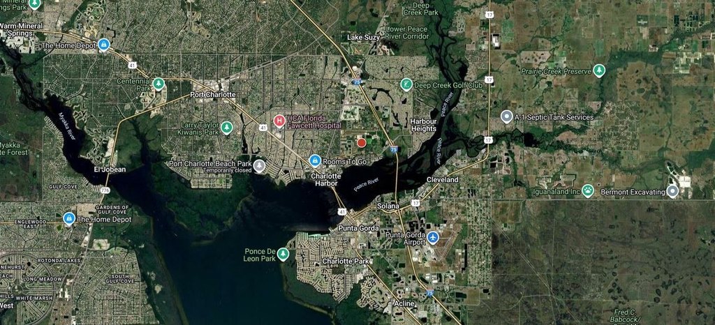
- Minutes to Port Charlotte, I‑75, and US‑41 for quick access to shopping, dining, and Gulf Coast beaches
- Owner financing available; one of seven parcels offered, totaling up to 45 acres if purchased together
- Former tree farm property suitable for crops, pasture, horses, or cattle
Overview
The land is located just minutes from Port Charlotte and major routes, including I-75 and US-41, supporting day-to-day access for operations and commuting. The listing also notes that a nearby vacant lot on Harborview Rd. is available, which may be considered for signage or an office location.
For tenants, buyers, and operators seeking a small-farm or nursery-style property, the combination of irrigation, agricultural zoning treatment, and usable acreage can fit a range of agricultural and equestrian plans. The property may also serve as a private home site for buyers looking for country-style privacy with quick access to I-75 and US-41. Owner financing is available, and the listing indicates up to seven parcels may be available if purchased together for a larger total land package.
Current Use by Public Records
Map
- City
- Port Charlotte
- County
- Charlotte
- State
- Florida
- Longitude
- -82.046004
- Latitude
- 26.980065