Deep Water Waterfront
Mill Street lot 284 285 & 62 Templeton, MA 01436
For Sale
$91,500
LAND - Templeton, MA
Lot Size1.60 Acres
Days on Market489
Property Features for Mill Street lot 284 285 & 62
General Information
- Property type
- Land
- Property subtype
- Other
- Zoning
- Village District
- Standard status
- Active
- Lot size
- 1.60 Acres
Utilities
- Sewer type
- Public Sewer
- Water source
- Public
- Water front
- 1
Listing Agency:
K&G Realty Services, Inc.
(978) 407-3054
Listed By:
Karissa Moore · License #9516125
(978) 407-3054
Added: Mar 25, 2025
Changed: Jun 10
Last Checked: Jul 26 at 5:06AM
MLS# 5033403
Copyright © 2026 PrimeMLS. All rights reserved. All information provided by the listing agent/broker is deemed reliable but is not guaranteed and should be independently verified.
Investment Insights
Based on property information with market context.
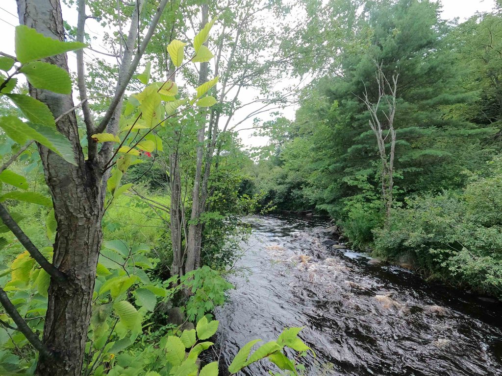
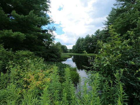
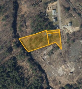
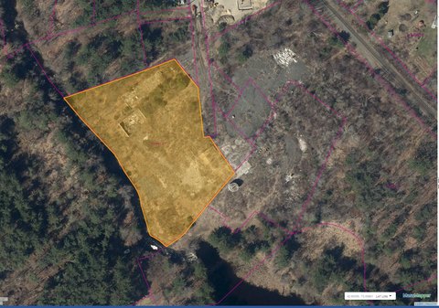
This for-sale waterfront land offering is being sold as a package consisting of Parcel Map 1-4.1, Lots 284 and 285, along with Parcel Map 5, Block 5, Lot 62. The combined parcels are described as meeting current zoning minimum dimensional requirements of 1 acre and 150 feet of road frontage, and the package includes approximately 195 feet of direct deep water frontage on the Otter River. The listing also notes that an additional tax lien exists on the property.
The parcels are located in Baldwinville, a village of Templeton, Massachusetts, in a quiet neighborhood setting. The property is understood to be within the Village District zoning designation.
According to the Town’s online zoning district description, Village District uses include single and two family structures, retail sales, personal service shops, professional offices, financial institutions, liquor store, ice cream stand, and home occupation (minor), by right. Approximately 8 additional acres are also described as available. This configuration may appeal to buyers seeking a waterfront development or mixed-use site that aligns with the stated zoning criteria and frontage requirements.
Key Highlights
- Package includes Parcel Map 1‑4.1 Lot 284, Parcel Map 1‑4.1 Lot 285, and Parcel Map 5 Block 5 Lot 62
- Meets current zoning minimums of 1‑acre lots and 150 ft of road frontage
- Approximately 195 ft of direct deep water frontage on the Otter River
Property Analytics
Location Intelligence
Current Use by Public Records
Waterfront Land


FAQs
What type of property is this?
Waterfront Land - Package of parcels with direct Otter River frontage in Village District, with road frontage meeting minimum dimensional requirements.
Where is this waterfront land located?
The property is located at Mill Street lot 284 285 & 62 Templeton, MA.
What is the asking price?
The asking price for this property is $91,500.
What are key features of this property?
This property features: Package includes Parcel Map 1‑4.1 Lot 284, Parcel Map 1‑4.1 Lot 285, and Parcel Map 5 Block 5 Lot 62; Meets current zoning minimums of 1‑acre lots and 150 ft of road frontage; Approximately 195 ft of direct deep water frontage on the Otter River


