Agricultural Land with Live
For Sale
$375,000
NE County 1475 Road, Gainesville, FL 32609
Land, Gainesville, FL
Property SizeContact for details
Lot Size41.58 Acres
Days on Market8
Property Features for NE County 1475 Road
General Information
Property type
Land
Property subtype
Other
Zoning
A1
Subdivision
Not on List
Lot features
Acreage, Multiple Lots, Trees
Directions
Take NE US HWY 301 to NE 160th Ave, then turn right onto NE County 1475 Rd; the property is on the left.
Standard status
Active
APN
17093-000-000
Lot size
41.58 Acres
Taxes and HOA fees
Tax Year
2025
Tax Description
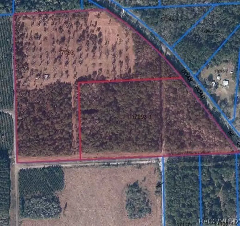
THE NORTH HALF OF THE NE 1/4 OF SECTION 15, TOWNSHIP 8 SOUTH, RANGE 21 EAST, ALACHUA COUNTY, FLORIDA, AS LIES WEST OF NE COUNTY ROAD NO. 1475 (PREVIOUSLY KNOWN AS S-200A) SAID LANDS BEING MORE PARTICULARLY DESCRIBED AS FOLLOWS: BEGIN AT A CONCRETE MONUMENT, "RAYONIER" MARKING THE NW CORNER OF THE NE 1/4 OF SECTION 15, TOWNSHIP 8 SOUTH, RANGE 21 EAST, ALACHUA COUNTY, FLORIDA, AND THENCE N.87 DEGREES 08'29"E., ALONG THE MONUMENTED NORTH LINE OF SAID NE 1/4, A DISTANCE OF 821.29 FEET TO A 5/8" IRON ROD, LS 4708, ON THE WESTERLY RIGHT-OF-WAY LINE OF NE COUNTY ROAD NO. 1475 (PREVIOUSLY KNOWN AS S-200A), SAID WESTERLY RIGHT-OF-WAY LINE BEING DEFINED BY A CURVE CONCAVE SOUTHWESTERLY AND HAVING A RADIUS OF 2814.79 FEET AND A CENTRAL ANGLE OF 20 DEGREES 09'55" AND BEING SUBTENDED BY A CHORD HAVING A BEARING OF S.47 DEGREES 38'13"E. AND A CHORD LENGTH OF 985.57 FEET; THENCE SOUTHEASTERLY ALONG THE ARC OF SAID CURVE AN ARC DISTANCE OF 990.67 FEET TO A CONCRETE MONUMENT, "SRO", MARKING THE END OF SAID CURVE; THENCE S.37 DEGREES 33'15"E., STILL ALONG SAID WESTERLY RIGHT-OF-WAY LINE, 770.63 FEET TO A 5/8" IRON ROD, LS 4708, ON THE SOUTH LINE OF THE NORTH 1/2 OF SAID NE 1/4; THENCE S.87 DEGREES l 8'29"W., ALONG SAID SOUTH LINE, 674.69 FEET TO A CONCRETE MONUMENT, "RAYONIER", MARKING THE SE CORNER OF THE NW 1/4 OF THE NE 1/4 OF SAID SECTION 15; THENCE CONTINUE S.87 DEGREES 18'29"W., STILL ALONG SAID SOUTH LINE, 1315.14 FEET TO A 5/8" IRON ROD, LS 4708, MARKING THE SW CORNER OF SAID NORTH 1/2 OF THE NE 1/4; THENCE N. 01 DEGREES l 9'09"W., 1327.89 FEET TO THE POINT OF BEGINNING. DESCRIBED LANDS ARE THE SAME AS THOSE LANDS DESCRIBED IN OFFICIAL RECORDS BOOK 2294, PAGE 798 OF THE OFFICIAL RECORDS OF ALACHUA COUNTY, FLORIDA, AND CONTAIN IN THEIR ENTIRETY THOSE LANDS DESCRIBED IN OFFICIAL RECORDS BOOK 1715, PAGE 495 OF THE OFFICIAL RECORDS OF ALACHUA COUNTY, FLORIDA. DESCRIBED LANDS CONTAIN 45.07 ACRES, MORE OR LESS. SUBJECT TO EXISTING POWER LINE EASEMENTS OF RECORD OR BY OCCUPATION.
Tax Annual Amount
3028
Legal Description
THE NORTH HALF OF THE NE 1/4 OF SECTION 15, TOWNSHIP 8 SOUTH, RANGE 21 EAST, ALACHUA COUNTY, FLORIDA, AS LIES WEST OF NE COUNTY ROAD NO. 1475 (PREVIOUSLY KNOWN AS S-200A) SAID LANDS BEING MORE PARTICULARLY DESCRIBED AS FOLLOWS: BEGIN AT A CONCRETE MONUMENT, "RAYONIER" MARKING THE NW CORNER OF THE NE 1/4 OF SECTION 15, TOWNSHIP 8 SOUTH, RANGE 21 EAST, ALACHUA COUNTY, FLORIDA, AND THENCE N.87 DEGREES 08'29"E., ALONG THE MONUMENTED NORTH LINE OF SAID NE 1/4, A DISTANCE OF 821.29 FEET TO A 5/8" IRON ROD, LS 4708, ON THE WESTERLY RIGHT-OF-WAY LINE OF NE COUNTY ROAD NO. 1475 (PREVIOUSLY KNOWN AS S-200A), SAID WESTERLY RIGHT-OF-WAY LINE BEING DEFINED BY A CURVE CONCAVE SOUTHWESTERLY AND HAVING A RADIUS OF 2814.79 FEET AND A CENTRAL ANGLE OF 20 DEGREES 09'55" AND BEING SUBTENDED BY A CHORD HAVING A BEARING OF S.47 DEGREES 38'13"E. AND A CHORD LENGTH OF 985.57 FEET; THENCE SOUTHEASTERLY ALONG THE ARC OF SAID CURVE AN ARC DISTANCE OF 990.67 FEET TO A CONCRETE MONUMENT, "SRO", MARKING THE END OF SAID CURVE; THENCE S.37 DEGREES 33'15"E., STILL ALONG SAID WESTERLY RIGHT-OF-WAY LINE, 770.63 FEET TO A 5/8" IRON ROD, LS 4708, ON THE SOUTH LINE OF THE NORTH 1/2 OF SAID NE 1/4; THENCE S.87 DEGREES l 8'29"W., ALONG SAID SOUTH LINE, 674.69 FEET TO A CONCRETE MONUMENT, "RAYONIER", MARKING THE SE CORNER OF THE NW 1/4 OF THE NE 1/4 OF SAID SECTION 15; THENCE CONTINUE S.87 DEGREES 18'29"W., STILL ALONG SAID SOUTH LINE, 1315.14 FEET TO A 5/8" IRON ROD, LS 4708, MARKING THE SW CORNER OF SAID NORTH 1/2 OF THE NE 1/4; THENCE N. 01 DEGREES l 9'09"W., 1327.89 FEET TO THE POINT OF BEGINNING. DESCRIBED LANDS ARE THE SAME AS THOSE LANDS DESCRIBED IN OFFICIAL RECORDS BOOK 2294, PAGE 798 OF THE OFFICIAL RECORDS OF ALACHUA COUNTY, FLORIDA, AND CONTAIN IN THEIR ENTIRETY THOSE LANDS DESCRIBED IN OFFICIAL RECORDS BOOK 1715, PAGE 495 OF THE OFFICIAL RECORDS OF ALACHUA COUNTY, FLORIDA. DESCRIBED LANDS CONTAIN 45.07 ACRES, MORE OR LESS. SUBJECT TO EXISTING POWER LINE EASEMENTS OF RECORD OR BY OCCUPATION.
Utilities
Sewer type
Septic Needed
Water source
Well Needed
Listing Agency:
Tropic Shores Realty
(352) 503-4780
Listed By:
Christa Vivolo · License #3320710
(727) 641-8349
Added: Sep 21
Changed: Sep 25
Last Checked: Sep 28 at 1:06AM
MLS# 858058
Copyright © 2026 REALTORS Association of Citrus County, Inc. All rights reserved. All information provided by the listing agent/broker is deemed reliable but is not guaranteed and should be independently verified.
Investment Insights
Based on property information with market context.
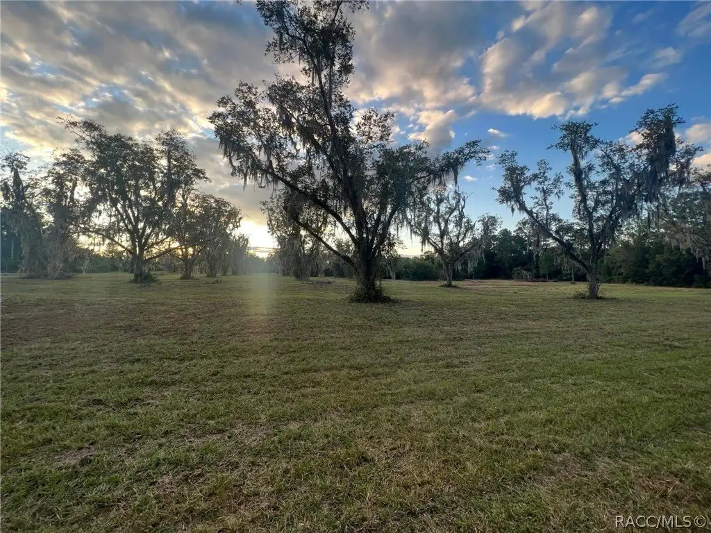
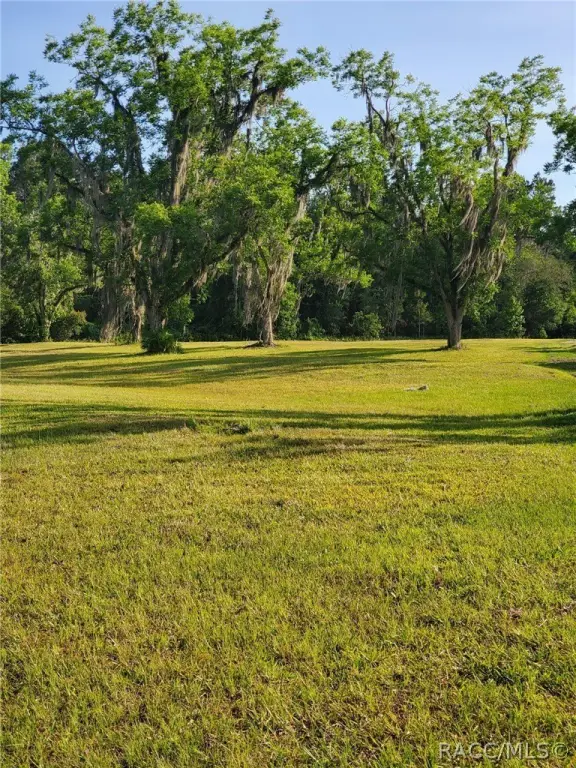
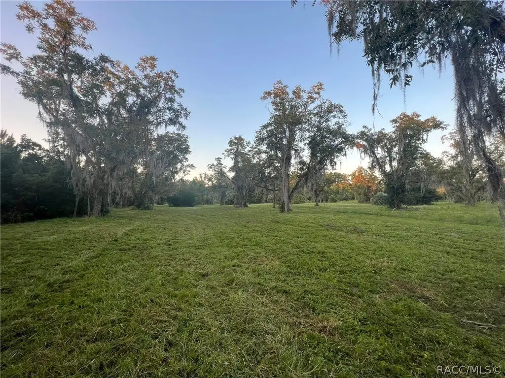
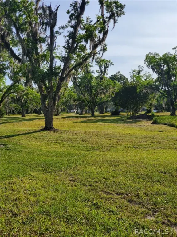
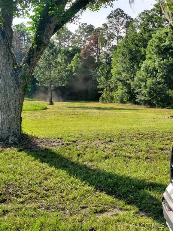
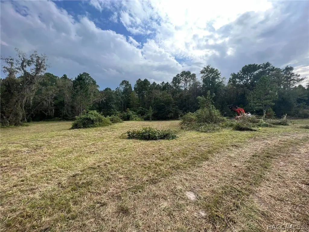
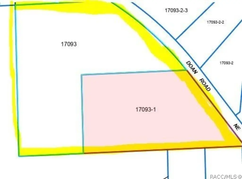
This 41.58-acre agricultural land offering consists of two contiguous parcels along NE County 1475 Road in Gainesville. The property includes open green pasture as well as mature, shaded areas populated by live oaks and Spanish moss. Agricultural land use supports a range of rural applications, including homestead, livestock, equestrian, and other agricultural plans, subject to applicable requirements.
The tract is positioned near the University of Florida, UF Health Shands, and downtown Gainesville, combining a countryside setting with access to the city’s major institutions and services. Zoning is identified as A1. Water service would require a well, and septic installation would be needed for wastewater service.
The tract is positioned near the University of Florida, UF Health Shands, and downtown Gainesville, combining a countryside setting with access to the city’s major institutions and services. Zoning is identified as A1. Water service would require a well, and septic installation would be needed for wastewater service.
Key Highlights
- 41.58 acres of agricultural land
- Two contiguous parcels on NE County 1475 Road
- Open green pastures with mature live oaks and Spanish moss
Property Analytics
Unlock full access to Insights
Subscribe to Realmo Intelligence
Open Analytics
Current Use
Location Intelligence
Trade Area within ½ mile
Explore this area
Business Placement
Demographics for 32609, FL
18,322
Population
8,515
Households
2.2
Avg Household Size
38
Median Age
27%
College-Educated
87%
High-School Grad
117.5 sq mi
ZIP Area
156
Density / Sq Mi
$48,121
Median Household Income
$34,041
Median Earnings
$1,159
Median Rent
$174,500
Median Home Value
Check the figures for this property
Cap Rate, Value Estimation, Potential NOI and more
View Realmo Analytics

Questions? Ask Rey
Realmo’s AI knows this listing — price, zoning, demand, history. Ask anything.





Frequently Asked Questions
What type of property is this?
Agricultural land / Farmland - Two adjoining parcels combine open pasture, mature oak hammocks, and a rural setting near Gainesville’s established institutions and downtown.
Where is this agricultural land / farmland located?
The property is located at NE County 1475 Road Gainesville, FL.
What is the asking price?
The asking price for this property is $375,000.
What are key features of this property?
This property features: 41.58 acres of agricultural land; Two contiguous parcels on NE County 1475 Road; Open green pastures with mature live oaks and Spanish moss