Development-Ready Farmland
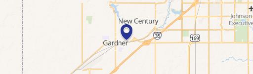
16300 Waverly Road Gardner, KS 66030
16300 Waverly Road, Gardner, KS, 66030
$1,960,000
For Sale
$1,960,000
LAND - Gardner, KS
Lot Size57.63 Acres
Days on Market430
Property Features for 16300 Waverly Road
General Information
- Property type
- Land
- Property subtype
- Other
- Zoning
- AG
- Standard status
- Active
- APN
- CF221415-4008
- Lot size
- 57.63 Acres
Taxes and HOA fees
- Tax Description
- 15-14-22 BG 2394.25' N SE CR SE1/4 W 1770' NW 297.36' TO N/L SE1/4 E 1870' TO NE CR SE1/4 S 280' TO POB EX .129 ACIN RD 11.57 ACS M/L AND 15-14-22 BG 2394.25' N SE CR SE1/4 W 1770' NW 297.36' TO N/L SE1/4 E 1870' TO NE CR SE1/4 S 280' TO POB EX .129 ACIN RD 11.57 ACS M/L
- Tax Annual Amount
- 591
Utilities
- Water source
- Public
Listing Agency
Compass Realty Group
(816) 280-2773
900 W 48th Place Ste 120, Kansas City, KS
Listed by
Nancy Kirk Matthew · License #SP00233965
(913) 244-5480
Added: May 17, 2025 Checked: Jul 20 at 5:06 am
MLS# 2552854
Listing URL
Copyright © 2026 Heartland Multiple Listing Service. All rights reserved. All information provided by the listing agent/broker is deemed reliable but is not guaranteed and should be independently verified.
Investment Insights
Based on property information with market context.
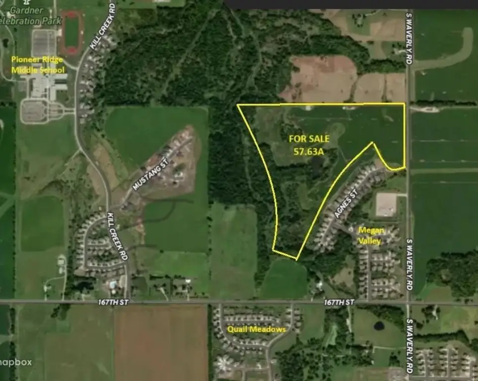
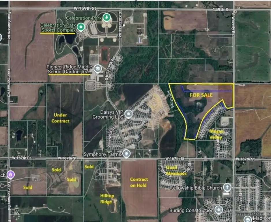
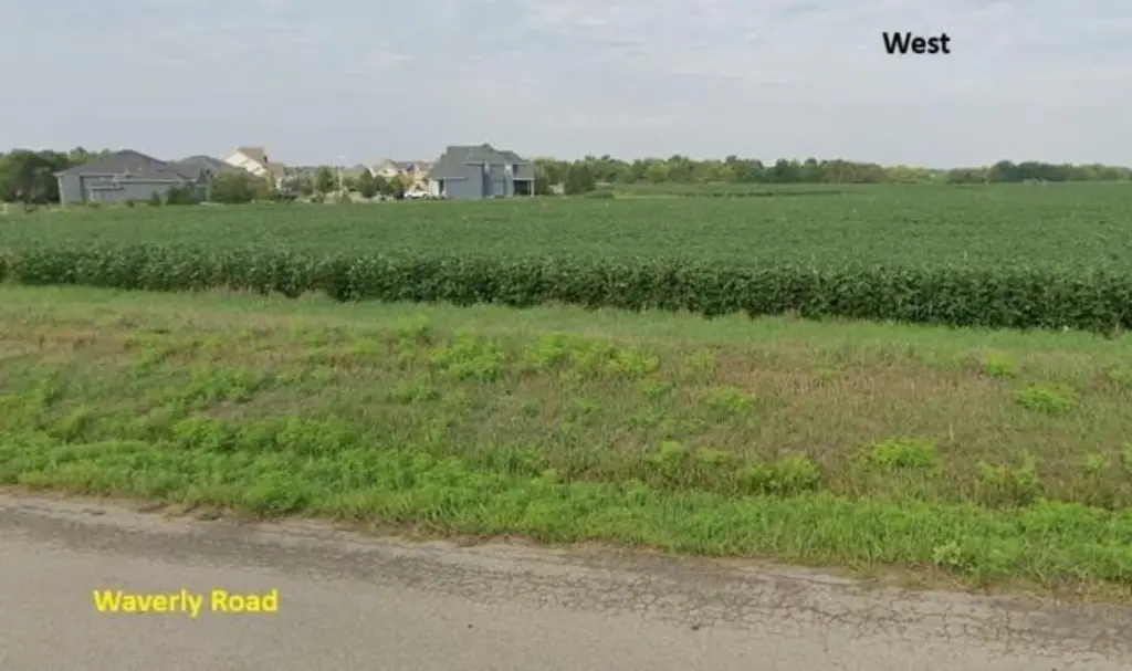
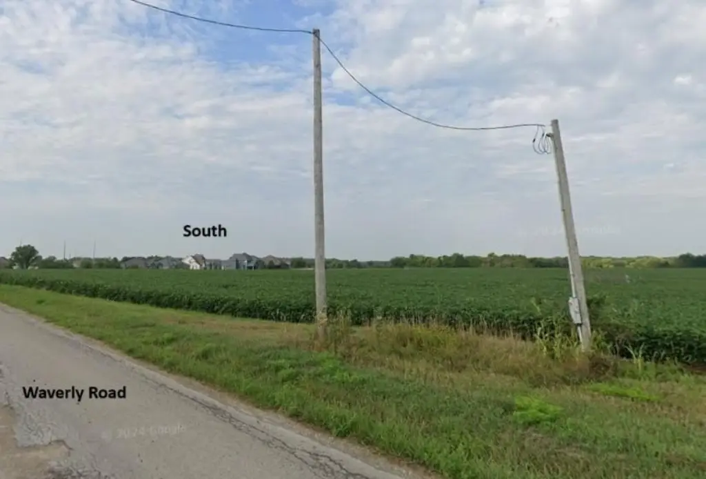
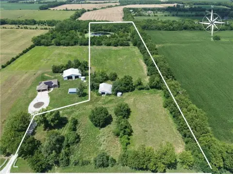
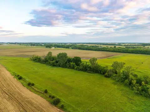
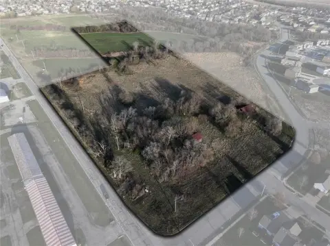
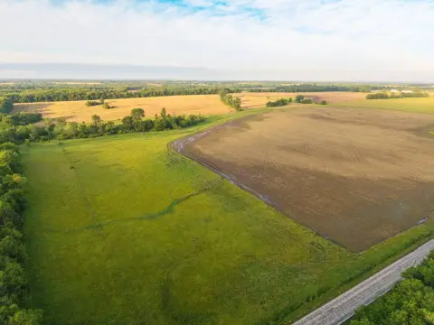
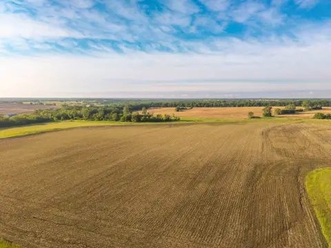
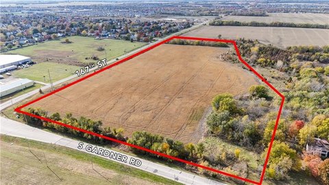
Offered for sale is a 57.63-acre agricultural tract in Gardner, Kansas, presented in a prime development location. The property is zoned AG, offering a rural land setting while remaining closely tied to ongoing residential growth in the immediate area.
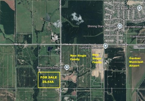
The land lies north of 167th Street along Waverly Road, on the north side of the Megan Valley subdivision. It also sits next to Kill Creek, where walking trails are being laid to connect with Johnson County trails, adding to the area’s pedestrian-oriented improvements and overall neighborhood momentum.
This tract may appeal to buyers looking for larger-scale land holdings in a transitioning market, especially those interested in agricultural use today with an eye toward long-term planning. The AG zoning and existing location context make it a practical option for investors and developers evaluating land strategy in a neighborhood that is seeing added trail infrastructure and continued development nearby.
Key Highlights
- 57+/- acres in a development‑focused location north of 167th Street on Waverly Road
- Situated on the north side of the Megan Valley subdivision
- Adjacent to Kill Creek, where walking trails are being laid to connect with Johnson County trails
Property Analytics
Property Profile
Location Intelligence
Current Use by Public Records
Agricultural land / Farmland
Similar For Sale Nearby

FAQs
What type of property is this?
Agricultural land / Farmland - Zoned AG and positioned near Megan Valley with trail access potential beside Kill Creek.
Where is this agricultural land / farmland located?
The property is located at 16300 Waverly Road Gardner, KS.
What is the asking price?
The asking price for this property is $1,960,000.
What are key features of this property?
This property features: 57+/- acres in a development‑focused location north of 167th Street on Waverly Road; Situated on the north side of the Megan Valley subdivision; Adjacent to Kill Creek, where walking trails are being laid to connect with Johnson County trails


