PN-229400 TBD BOB HOPE Drive, El Paso, TX 79928


- Added:
- Jun 17, 2026
- Days on Market:
- 10
- Last Refresh:
- Jun 26 at 1:06 pm
Property Features for PN-229400 TBD BOB HOPE Drive
General Information
- Property type
- Land
- Property subtype
- Other
- Zoning
- M1
- Standard status
- Active
- APN
- X57900031701140
- Lot size
- 5.00 Acres
Taxes and HOA fees
- Tax Year
- 2026
- Tax Description
- 79 TSP 3 SEC 17 T & P ABST 2154 W 1/2 OF SE 1/4 OF SW 1/4 OF SE 1/4 (5.00 AC)
- Tax Annual Amount
- 5468
Utilities
- Utilities
- Electricity Available

Listing agent Luis Ramirez (915) 412-9703
Listing office EP Real Estate Advisor Group 310 N Mesa Suite 411, El Paso, TX (915) 234-1002
Listing date Jun 17, 2026
Copyright © 2026 Greater El Paso Association of Realtors. All rights reserved. All information provided by the listing agent/broker is deemed reliable but is not guaranteed and should be independently verified.
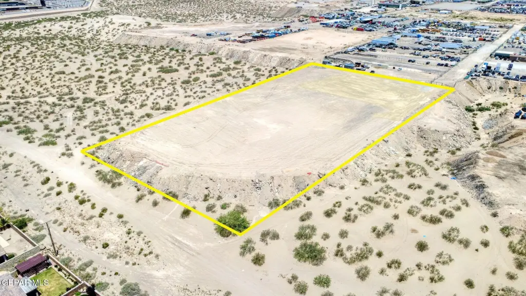
HighLights
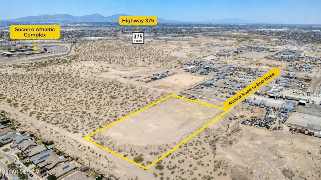
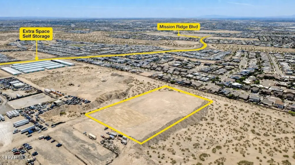
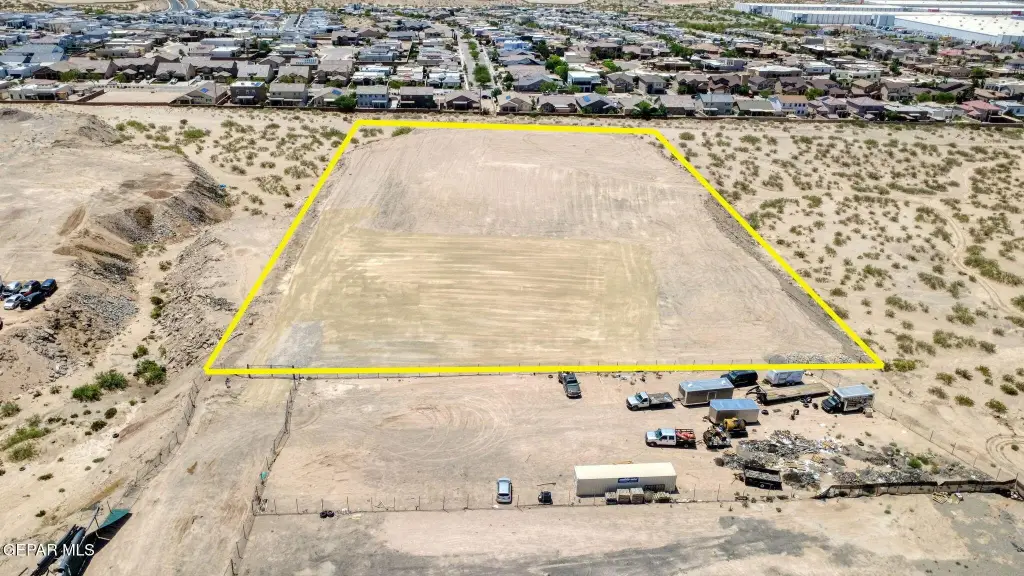
- 5.00‑acre cleared, level industrial tract in East El Paso’s development corridor
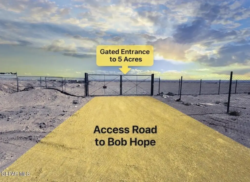
- Gated access via a dedicated access road connecting to Bob Hope Drive
- Convenient proximity to Mission Ridge Blvd
- Near Highway 375 (Loop 375) for access to major transportation routes
- Electricity available on the property
- Nearby landmarks include Extra Space Self Storage and the Socorro Athletic Complex
Overview
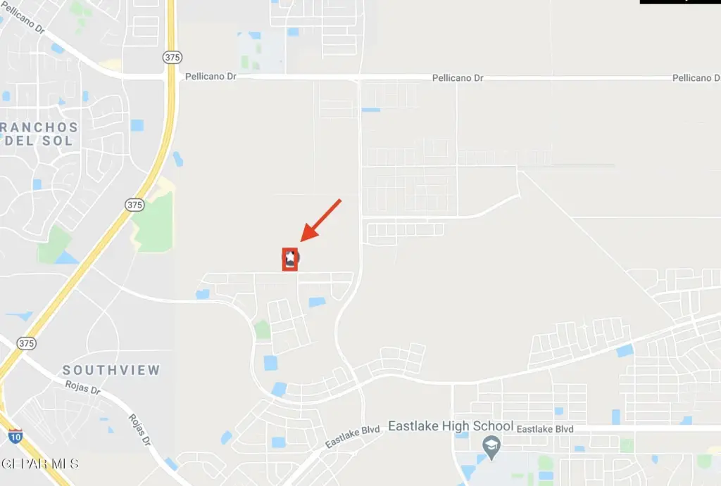
The parcel is located in an East El Paso development corridor with convenient proximity to Mission Ridge Blvd and Highway 375 (Loop 375). It is described as being surrounded by established industrial, transportation, and commercial businesses. Nearby landmarks include Extra Space Self Storage and the Socorro Athletic Complex, supporting everyday visibility and accessibility.
With its cleared site and M1 zoning, the property may suit investors, developers, contractors, logistics operators, equipment storage users, or fleet-oriented facilities. Prospective buyers can consider the land as a platform for future industrial development or as a secured staging and storage location, subject to verification of site-specific utility availability and permitted uses.
Current Use by Public Records
Map
- City
- El Paso
- County
- El Paso
- State
- Texas
- Longitude
- -106.255909
- Latitude
- 31.713155