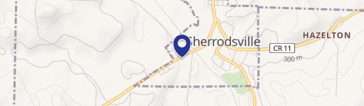
Sherrod Ave Sherrodsville, OH 44675
Property profile & analytics
Sherrod Ave, Sherrodsville, OH 44675
- Commercial real estate
- 1,040 SF
- 0.04 lot acres
Property ID
US66-0553967
The Realmo ID is a unique identifier assigned to every property, incorporating country codes and precise geo-coordinates for 300x300-foot land blocks. It enables standardized data collection and seamless integration of disparate sources such as ownership, tax, title data and physical specifications. By aggregating current and historical records, the Realmo ID powers advanced analytics and delivers deep, verifiable insights for real estate professionals.
Location Intelligence
Current Use by Public Records
- Sherrodsville Village Office / City Government Office
- Unified Bank / Bank / Loan Service
- Wise Insurance Agency / Insurance Agency
- United States Postal Service / Money Order Service / Shipping And Mailing Service
- Regional EMS Inc - Station / Ambulance Service
Property Details for Sherrod Ave
- Year built
- 1959
- Construction
- FRAME
- Lot size
- 0.04 lot acres
- Property type
- Commercial real estate
- APN
- 27-0000259.000
- APU
- 270000259000
Sales History
| Date | Price | Buyer | Seller | Deed Type | Mortgage |
|---|---|---|---|---|---|
| Sep 29, 2017 | $70,000 | Paul Stefas | Lincoln And Things INC | Warranty Deed | — |
| Feb 7, 2007 | — | Lincolns And Things INC | Robert C Stratton | Warranty Deed | — |
Value Estimations
based on Realmo’s proprietary methodology
-
AI approach
-
CAP approach
-
Comparable approach
-
Alternative Use
Get a detailed, property-specific estimation — fast and free
Location Insight
- Map
- Local Demand
- City
- Sherrodsville
- County
- Carroll
- State
- Ohio
- Longitude
- -81.2435
- Latitude
- 40.4944
- CBSA code
- 15940
- CBSA name
- CANTON-MASSILLON, OH METROPOLITAN STATISTICAL AREA
Property Tax & Assessments
Tax date
Tax Amount
Assessed Land Value
Assessed Improvement Value
Total Assessed Value
Applied Tax Rate
Land Market Value
Improvement Market Value
Total Market Value
2023
$8
$140
$0.00
$140
-
$400
$0.00
$400