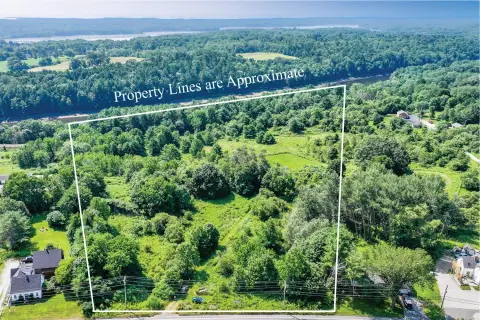
Ice House Rd Thomaston, ME 04861
Section 710 Rural Residential & Farming District (R1) 710.1 Purpose This district includes most of the town’s rural lands. It also includes lands with multiple natural resource con- straints or that are especially important for their recreational, scenic, or other resource-based opportunities. This district is designated as a rural, as opposed to a growth zo…
Cap rate
Implied · in-place · derived from last sale + estimated NOIValue
AI, CAP & Alternative Use estimations · Realmo proprietary blendProperty tax & assessments
Tax year 2023Comparables
6 recent transactions · within 1.5 miComparable in this City


Similar Nearby for Sale
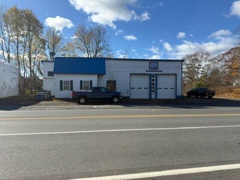
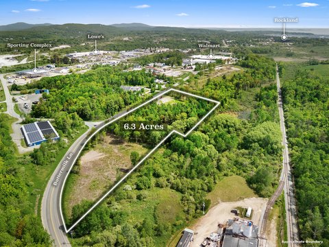
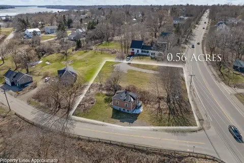
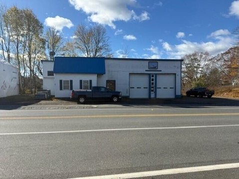
Property description
Physical attributes from public recordsZoning & alternative use
R1 · Thomaston, MESection 710 Rural Residential & Farming District (R1) 710.1 Purpose This district includes most of the town’s rural lands. It also includes lands with multiple natural resource con- straints or that are especially important for their recreational, scenic, or other resource-based opportunities. This district is designated as a rural, as opposed to a growth zone. Its purpose is to allow a level of development and activity, including farming and wood harvesting, consistent with the protection of the natural features of these lands. Any residential development in this district must be compatible with the character and traditional use of rural lands, preserving as much open space and forestland as possible, minimizing visual impact and protecting scenic views. Cluster development is preferred for any residential subdivision in this district. 710.1.1-The general standards of performance of Article II shall be observed. 710.2 Boundary Description THOMASTON STREET AREA Beginning at a point on the center line of Buttermilk Lane at the Thomaston-South Thomaston Town Line; thence East along the Marsh Brook and the Thomaston-South Thomaston, Thomaston-Owl’s Head and Thomaston-Rock- land Town Lines; thence Northerly along the Thomaston-Rockland Town Line to the center line of the MCRR ROW; thence Southwesterly along the MCRR ROW to the center line of Buttermilk Lane; thence Southerly along the center line of Buttermilk Lane to the point of beginning. HIGH STREET, OLD COUNTY ROAD, ROCKLAND/WARREN TOWN LINES Beginning at the North corner of the Town of Thomaston where the Thomaston-Warren-Rockland Town Lines converge; thence Southerly along the Westerly boundary of the Town of Thomaston to the center of the main chan- nel of the Oyster River; thence Southerly along the main channel of the Oyster River and the Thomaston-Warren Town Line to the Northwest corner of Map 203, Lot 043; thence Easterly, Southerly and Easterly along the boundary of Map 203, Lot 043 to the center line of Studley Lane; thence Northerly along the center line of Studley Lane to the Southwest corner of Map 402, Lot 025; thence Easterly along the boundary lines of Map 402, Lots 025 and 023; thence Southerly, Easterly, Northerly and Easterly along the boundary of Map 402, Lot 027; thence Southerly and Easterly along the boundary of Map 402, Lot 029; thence Northeasterly along the boundary lines of Map 402, Lots 029, to the Southeast corner of Map 402, Lot 033,; thence Westerly, Northerly, Westerly, Northerly and Easterly along the boundary of Map 402, Lot 033 to the boundary of Map 402, Lot 041;
No recorded transactions found for this property.
Costs & Benchmarks
Operating expenses, capex projections, utility benchmarks, and submarket comparables — all in one view.
Risks
Flood, climate, environmental, title, and tenant-concentration risk — surfaced with mitigations and source citations.


