Back to Search
Property profile & analytics
OFF-MARKET
Grocery and convenience stores
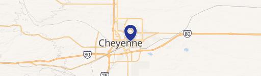
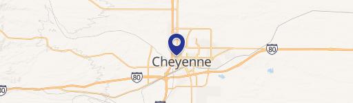
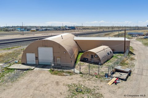
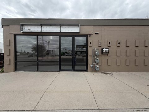
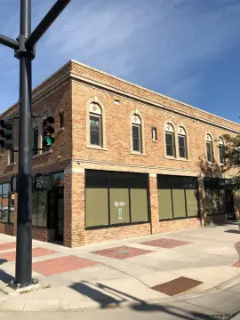
901 Pershing Blvd Cheyenne, WY 82001-7225
Entity Owned
1-yr Hold
~
Est. High Equity
Property ID
US95-0347555
Property profile
Verified
Property type
Grocery and convenience stores
Use group
CONVENIENCE STORE
Year built
1955
Total area
1,417 SF
Lot
0.16 ac (7,000 SF)
Zoning code
NB
APN
14630000300010
UPID
US95-0347555
Cap rate & NOI
Priority signal for investors
Implied cap rate, NOI & suggested price
Cap rate vs submarket · NOI estimate · 3 price anchors
Implied cap rate, NOI & suggested price
Cap vs submarket · NOI estimate · 3 price anchors
Current use
Occupant on record · Public records
-
Corner Stop Gas Station
-
Moody's Rock Shop Gas Station
Value estimations
Realmo proprietary · 4 methods
AI Approach
AI
by Request
CAP Approach
CAP
by Request
Comparable Approach
Comparable
by Request
Blend (final)
Blend
by Request
Owner & transaction history
Narang LLC · 1 yrs held
Narang LLC
since 2025
7 recorded transactions
Zoning & alternative use
NB · Cheyenne, WY
Permitted uses
Permitted uses
Allowed · conditional · prohibited
Cap rate
Implied · in-place · derived from last sale + estimated NOI
Implied Cap rate
#1
Implied · in-place · NOI ÷ last sale
In-place · derived from last sale + estimated NOI
Cap rate, NOI & submarket benchmark
Implied cap rate vs Cheyenne submarket · NOI estimate · Typical band, median & reading
Implied cap rate, NOI & submarket benchmark
Cap vs Cheyenne submarket · NOI estimate · typical band, median & reading
Refine your cap rate
8-question underwriting flow
1.
Property current status — Going-In vs Stabilized
2.
Price for denominator — asking / offer / market
3.
Leasing status & lease structure (NNN / Gross)
4.
Tenant risk profile & vacancy assumption
5.
Upload T12 / rent roll / OM (optional)
Refine in 60 seconds, get exact suggested price
T12 upload · Submarket benchmarks · Sensitivity grid
Suggested price · 3 cap rate anchors
Income approach @ 5% / 7% / 9% — aggressive / typical / conservative
Suggested price at 5% / 7% / 9% cap
Aggressive / typical / conservative · Implied $/SF per anchor · Sensitivity grid
Suggested price at 5% / 7% / 9% cap
Aggressive / typical / conservative · implied $/SF · sensitivity
Value
AI, CAP & Alternative Use estimations · Realmo proprietary blendValue Estimations
Based on Realmo’s proprietary methodology
AI Approach
CAP Approach
Comparable Approach
Alternative Use
Get a detailed, property-specific estimation — fast and free
Price per SF
Sale + rent benchmarks
Subject property
—
Submarket sale & rent benchmarks
Median sale $/SF · Asking & closed rent · Submarket vacancy
Submarket sale & rent benchmarks
Median sale $/SF · asking & closed rent · submarket vacancy
Property tax & assessments
Tax year 2023Property tax & assessments
Tax year 2023
Tax billed
$1,373
Tax year 2023
Assessed value
$20,164
Assessed 2024
Previous assessed
$19,421
+3.8% YoY
Effective rate
6.81%
On assessed value
Assessed land
$4,845
Assessed improvement
$15,319
Land market value
$51,000
Improvement market value
$161,249
Total market value
$212,249
Applied tax rate
150.0000
Comparables
6 recent transactions · within 1.5 miComparable in this city
6 recent transactions
Comparable in this City


Similar Nearby for Sale


Similar Nearby for Lease


Recent comparable sales
Sale price & price/SF · Sale date & distance · Adjustments & confidence
Recent comparable sales
Sale price & $/SF · sale date & distance · adjustments
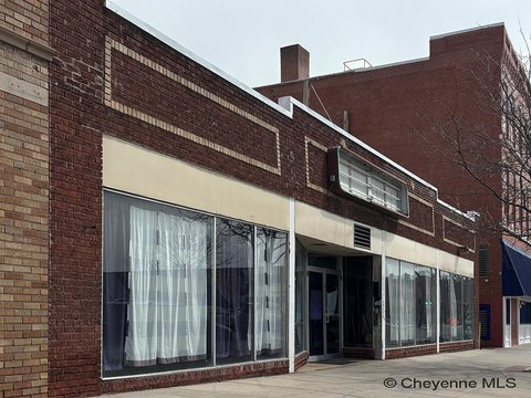
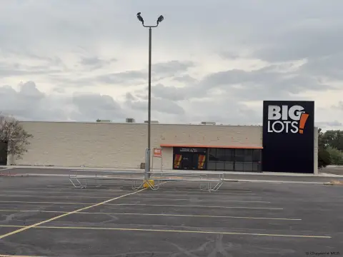
Property description
Physical attributes from public recordsBuilding & lot
Public records
Property type
Grocery and convenience stores
Use group
CONVENIENCE STORE
Status
Off-Market
Year built
1955
Heating
PACKAGE
Cooling
AC.PACKAGE
Stories
1
Units
1
Total area
1,417 SF
Lot
0.16 ac (7,000 SF)
Zoning code
NB
APN
14630000300010
UPID
US95-0347555
Jurisdiction
LARAMIE
Zoning & alternative use
NB · Cheyenne, WY
Zoning NB · permitted uses
NB · Cheyenne, WY
Permitted & conditional uses
Allowed uses · Special-permit conditions · Prohibited uses
Permitted & conditional uses
Allowed · special-permit conditions · prohibited
Cheyenne. Always verify with local authorities before improvements.
Building & site characteristics
From public records
Year built
1955
Heating
PACKAGE
Cooling
Yes
Stories
1
Units
1
Lot
0.16 ac
Current owner
From public records · entity-resolved
Narang LLC
Entity
Mailing address
5950 CANOGA AVE STE #510, WOODLAND HILLS, CA 91367-5089
Mailing matches property
Yes
Owner-occupied
Yes
Ownership since
2025
Owner contacts — direct phone, email, and related entities
Decision-maker phone · Verified email · Related entities & filings
Owner contacts
Email · phone · related entities
Sales History
7 recorded events · public records
Date
Price
Buyer
Seller
Deed Type
Mortgage
Apr 11, 2025
—
Narang LLC
Nova Proeprties LLC
Warranty Deed
$468,750 · Platte Valley Bank
Aug 12, 2022
—
Nova Properties LLC
Bernard Gilhuly
Quit Claim Deed
related
—
Feb 26, 2021
—
Caren Foley
—
Deed
related
$202,000 · Cf Enterprises LLC
Jul 22, 2013
—
Cf Ents LLC
Mighty One LLC
Warranty Deed
—
Nov 27, 2012
—
Mighty One LLC
Lara LLC
Warranty Deed
related
—
Jul 17, 2007
—
Graham & Lara LLC
High Plains Enterprises LLC
Warranty Deed
related
—
Jun 21, 2007
—
High Plains Enterprises LLC
Szadzinski,andrzej & Margaret
Warranty Deed
related
—
Coming soon
Costs & Benchmarks
Operating expenses, capex projections, utility benchmarks, and submarket comparables — all in one view.
Coming soon
Risks
Flood, climate, environmental, title, and tenant-concentration risk — surfaced with mitigations and source citations.
Try Rey
Ask anything about this address in plain English.
“Is 15.6% cap rate sustainable?” · “Best tenant mix for BU1?” · “What’s the redev upside?”
You own 901 Pershing Blvd?
List it free. Reach 20,000 daily buyers.
We’ve already pulled the facts. Confirm photos + price and you’re live in 2 minutes.
List this address →
Full reports are paid
Unlock the full Property Analytics report
Start free for 7 days — no card required. Full owner contacts, all 4 valuations with methodology, refine flow, comparable adjustments, foot-traffic deep dive, export to PDF / CSV.


