80 Campbell Rd Chandler, AZ 85225
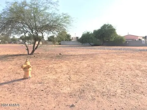
This exceptional 5.3-acre parcel in Chandler, Arizona (APN 302-24-034C), is zoned AG-1 and presents a unique development opportunity. Located in the Tremaine Park neighborhood near 80 E Campbell Rd, 85225, this level lot boasts Arizona Avenue frontage and is conveniently situated less than two miles south of US Route 60, providing easy access to the entire valley. All utilities—sewer, water, and electricity—are already connected to the property, along with existing curb, gutter, and sidewalk infrastructure on Arizona Avenue. Importantly, this property is not located within a floodplain. A conceptual site plan has already been initiated for a lot line adjustment, creating the potential for six individual lots, a process readily transferable to the new owner. The property's existing infrastructure and strategic location make it ideal for a variety of uses, including a church, school, or the development of six custom homes. This is a rare opportunity to acquire a sizable, well-prepared parcel in the desirable East Valley
Cap rate
Implied · in-place · derived from last sale + estimated NOIValue
AI, CAP & Alternative Use estimations · Realmo proprietary blendComparables
6 recent transactions · within 1.5 miComparable in this City


Similar Nearby for Sale
Similar Nearby for Lease


Property description
Physical attributes from public recordsZoning & alternative use
No recorded transactions found for this property.
Costs & Benchmarks
Operating expenses, capex projections, utility benchmarks, and submarket comparables — all in one view.
Risks
Flood, climate, environmental, title, and tenant-concentration risk — surfaced with mitigations and source citations.


