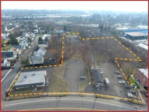
8 Branford Rd Branford, CT 06405-2807
Property profile & analytics
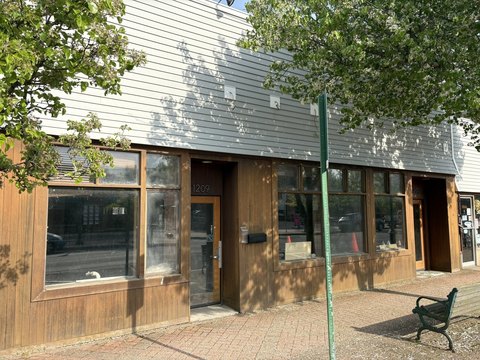
8 Branford Rd, Branford, CT 06405-2807
- Industrial land
- 1.53 lot acres
Property ID
US15-0642856
The Realmo ID is a unique identifier assigned to every property, incorporating country codes and precise geo-coordinates for 300x300-foot land blocks. It enables standardized data collection and seamless integration of disparate sources such as ownership, tax, title data and physical specifications. By aggregating current and historical records, the Realmo ID powers advanced analytics and delivers deep, verifiable insights for real estate professionals.
Location Intelligence
Current Use by Public Records
- Industrial land
Property Details for 8 Branford Rd
- Lot size
- 1.53 lot acres
- Property type
- Industrial land
- APN
- BRAN M:G05-000 B:002 L:00002
- APU
- BRANMG05000B002L00002
Sales History
| Date | Price | Buyer | Seller | Deed Type | Mortgage |
|---|---|---|---|---|---|
| Jul 20, 2010 | — | Sophias Bakery | — | Deed Of Trust · related | $382k · Worth Funding INC |
| Mar 10, 2003 | $250,000 | John Sousoulas | King,donald J | Warranty Deed | $250k · Zenon Grzybowski |
| Jan 31, 2000 | — | Donald J King | — | Deed Of Trust · related | $65k · Option One Mortgage Corp |
Value Estimations
based on Realmo’s proprietary methodology
-
AI approach
-
CAP approach
-
Comparable approach
-
Alternative Use
Get a detailed, property-specific estimation — fast and free
Location Insight
- Map
- Local Demand
- City
- Branford
- County
- New Haven
- State
- Connecticut
- Longitude
- -72.7813
- Latitude
- 41.2968
- CBSA code
- 35300
- CBSA name
- NEW HAVEN-MILFORD, CT METROPOLITAN STATISTICAL AREA
Property Tax & Assessments
Tax date
Tax Amount
Assessed Land Value
Assessed Improvement Value
Total Assessed Value
Applied Tax Rate
Land Market Value
Improvement Market Value
Total Market Value
2023
$6,205
$203,500
$4,100
$207,600
-
$0.00
$0.00
$0.00