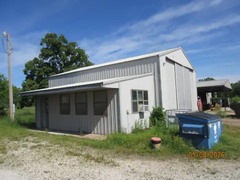
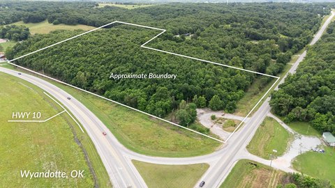
69400 Hwy 60 Wyandotte, OK 74370-2099
Property profile & analytics
69400 Hwy 60, Wyandotte, OK 74370-2099
- Warehouses
- 8,750 SF
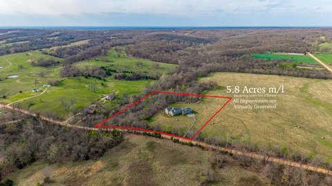
- 6.68 lot acres
Property ID
US69-1664205
The Realmo ID is a unique identifier assigned to every property, incorporating country codes and precise geo-coordinates for 300x300-foot land blocks. It enables standardized data collection and seamless integration of disparate sources such as ownership, tax, title data and physical specifications. By aggregating current and historical records, the Realmo ID powers advanced analytics and delivers deep, verifiable insights for real estate professionals.
Location Intelligence
Current Use by Public Records
- Firing Line / Gun Shop
Property Details for 69400 Hwy 60
- Year built
- 1996
- Lot size
- 6.68 lot acres
- Property type
- Warehouses
- APN
- 0000-17-027-025-0-021-00
- APU
- 17027025002100
Sales History
| Date | Price | Buyer | Seller | Deed Type | Mortgage |
|---|---|---|---|---|---|
| Oct 11, 2024 | — | Wyandotte Nation | Dwight Harold Vowels | Quitclaim Deed · related | — |
Value Estimations
based on Realmo’s proprietary methodology
-
AI approach
-
CAP approach
-
Comparable approach
-
Alternative Use
Get a detailed, property-specific estimation — fast and free
Location Insight
- Map
- Local Demand
- City
- Wyandotte
- County
- Ottawa
- State
- Oklahoma
- Longitude
- -94.6368
- Latitude
- 36.8181
- CBSA code
- 33060
- CBSA name
- MIAMI, OK MICROPOLITAN STATISTICAL AREA
Property Tax & Assessments
Tax date
Tax Amount
Assessed Land Value
Assessed Improvement Value
Total Assessed Value
Applied Tax Rate
Land Market Value
Improvement Market Value
Total Market Value
2023
$1,352
$582
$16,548
$17,130
-
$13,760
$160,195
$173,955