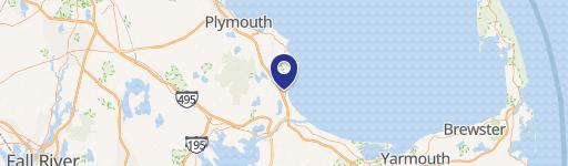
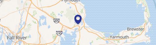
63rd Wareham Rd Plymouth, MA 02360-3234
§205-2. Rural Residential (RR). 1. To discourage residential sprawl by directing development into Village Centers and thereby reducing the need for costly infrastructure extension within rural areas of Town. 2. To preserve the natural, rural character of presently rural areas of the Town and discourage development in areas with characteristics making such ar…
Cap rate
Implied · in-place · derived from last sale + estimated NOIValue
AI, CAP & Alternative Use estimations · Realmo proprietary blendProperty tax & assessments
Tax year 2024Comparables
6 recent transactions · within 1.5 miComparable in this City


Similar Nearby for Sale


Similar Nearby for Lease


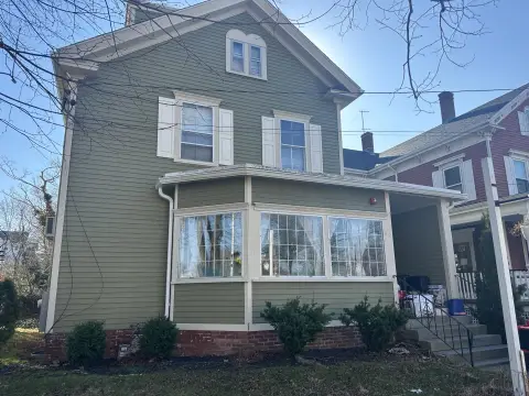
Property description
Physical attributes from public recordsZoning & alternative use
RR · Plymouth, MA§205-2. Rural Residential (RR). 1. To discourage residential sprawl by directing development into Village Centers and thereby reducing the need for costly infrastructure extension within rural areas of Town. 2. To preserve the natural, rural character of presently rural areas of the Town and discourage development in areas with characteristics making such areas generally less suitable for development than land in other Districts, such as land containing valuable wildlife habitat, having distinctive soil and slope characteristics or being served by limited municipal services. 76
No recorded transactions found for this property.
Costs & Benchmarks
Operating expenses, capex projections, utility benchmarks, and submarket comparables — all in one view.
Risks
Flood, climate, environmental, title, and tenant-concentration risk — surfaced with mitigations and source citations.


