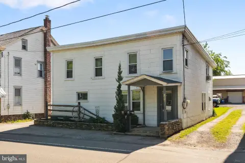
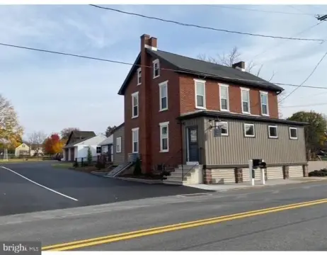
622 Walnut St Denver, PA 17517-1343
Property profile & analytics
622 Walnut St, Denver, PA 17517-1343
- Distribution centers
- 520 SF
- 0.14 lot acres
Property ID
US73-1369290
The Realmo ID is a unique identifier assigned to every property, incorporating country codes and precise geo-coordinates for 300x300-foot land blocks. It enables standardized data collection and seamless integration of disparate sources such as ownership, tax, title data and physical specifications. By aggregating current and historical records, the Realmo ID powers advanced analytics and delivers deep, verifiable insights for real estate professionals.
Location Intelligence
Current Use by Public Records
- Distribution centers
Property Details for 622 Walnut St
- Year built
- 1945
- Lot size
- 0.14 lot acres
- Zone code
- R-2
- Property type
- Distribution centers
- APN
- 140-08877-0-0000
- APU
- 1400887700000
Sales History
| Date | Price | Buyer | Seller | Deed Type | Mortgage |
|---|---|---|---|---|---|
| Dec 19, 2023 | — | Gary E Walls | — | Deed · related | $177k · Wells Fargo Bank NA |
| Jan 27, 2010 | $190,000 | Gary E Walls | Wagner,orville B & Joyce M | Grant Deed | $187k · Dover Mortgage |
| Oct 2, 2009 | — | Orville B Wagner | Wagner,orville B & Joyce M | Quit Claim Deed · related | — |
Value Estimations
based on Realmo’s proprietary methodology
-
AI approach
-
CAP approach
-
Comparable approach
-
Alternative Use
Get a detailed, property-specific estimation — fast and free
Location Insight
- Map
- Local Demand
- City
- Denver
- County
- Lancaster
- State
- Pennsylvania
- Longitude
- -76.1396
- Latitude
- 40.2353
- CBSA code
- 29540
- CBSA name
- LANCASTER, PA METROPOLITAN STATISTICAL AREA
Property Tax & Assessments
Tax date
Tax Amount
Assessed Land Value
Assessed Improvement Value
Total Assessed Value
Applied Tax Rate
Land Market Value
Improvement Market Value
Total Market Value
2024
$1,078
$36,200
$4,000
$40,200
-
$36,200
$4,000
$40,200