6210 Convenience Blvd Ankeny, IA 50021-9410
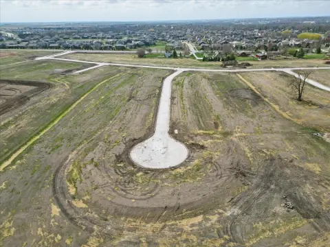
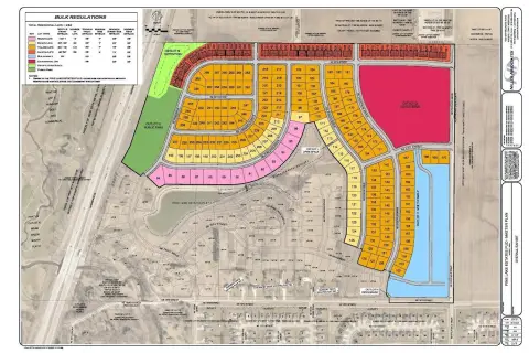
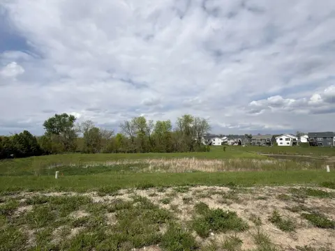
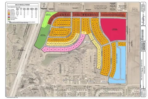
This exceptional 16.06-acre industrial land parcel in Ankeny, Iowa, presents a compelling investment opportunity. Located conveniently north of 6210 SE Convenience Blvd., in Polk County, zip code 50021 (41.6816856, -93.5737598), the property is zoned M-1, allowing for a variety of uses, including potential outdoor storage. The site offers significant flexibility for development, with two distinct building options outlined in the investment highlights. Option A includes a 138,200 square foot building and a 93,300 square foot building, providing a combined 231,500 square feet of space, along with 362 total auto parking spaces, approximately 32 and 22 loading docks respectively, and multiple drive-in bays. Option B offers a larger footprint with a 167,500 square foot building and a 74,900 square foot building, totaling 242,400 square feet. This option also includes an increased number of parking spaces (440), docks (approximately 66), and drive-in bays. Both options provide ample trailer parking. This prime location in Ankeny offers excellent access to transportation networks and a strong local economy, making it an ideal site for industrial development or expansion. The substantial lot size and flexible zoning provide a unique opportunity to tailor the property to meet specific business needs. Contact us today to learn more about this exceptional investment opportunity.
-
Hampton Inn & Suites Ankeny Hotel & Motel
192.15 PUD PLANNED UNIT DEVELOPMENT DISTRICT. The purpose of this district is to promote and encourage development or redevelopment of tracts of land on a planned, unified basis by allowing greater flexibility and diversification than is normally permitted by conventional single lot development in other zoning districts because of the substantial public adva…
Cap rate
Implied · in-place · derived from last sale + estimated NOIValue
AI, CAP & Alternative Use estimations · Realmo proprietary blendProperty tax & assessments
Tax year 2020Comparables
6 recent transactions · within 1.5 miComparable in this City


Similar Nearby for Sale

Similar Nearby for Lease


Property description
Physical attributes from public recordsZoning & alternative use
PUD · Ankeny, IA192.15 PUD PLANNED UNIT DEVELOPMENT DISTRICT. The purpose of this district is to promote and encourage development or redevelopment of tracts of land on a planned, unified basis by allowing greater flexibility and diversification than is normally permitted by conventional single lot development in other zoning districts because of the substantial public advantages of planned development. Although Planned Unit Developments (PUDs) may appear to deviate in certain respects from a literal interpretation of the comprehensive plan, regulations adapted to such unified planning and development are intended both to accomplish the purposes of zoning and other applicable regulations to an equivalent or higher degree than where such regulations are designed to control unscheduled development on individual lots, and to promote economical and efficient land use through an improved level of amenities, appropriate and harmonious variety, creative design, and a better living environment. 1. Where Permitted. Planned Unit Developments shall be permitted on any two-acre or larger tract of land that has been zoned or rezoned for PUD purposes by the Council. Said PUDs may consist of residential, commercial, industrial, public, semi-public and/or conservancy land uses. 2. Procedure. A. Pre-application Conference. In order to eliminate unnecessary expenditures of time and money, the developer shall first schedule a pre-application conference with the Department Director, who shall involve representatives of other departments as deemed appropriate. The Department Director may require submittal of a generalized sketch plan providing such information as follows: (1) Location and size of the overall site, and of the individual types of development or uses proposed within the site. (2) Existing topography, indicating major earthwork areas, storm water runoff and detention considerations, flood plains, and any problem areas. (3) Existing tree masses, geological and environmentally important characteristics. (4) Generalized vehicular and pedestrian systems and parking areas. (5) Generalized building locations. (6) Approximate gross density, and number and types of dwelling units in accordance with the comprehensive plan; approximate gross floor areas of commercial and industrial land use. (7) Generalized utility line considerations with sanitary sewer capacity limitations so noted. (8) Generalized public and private ownership boundaries, including common ownership areas, if any.
Costs & Benchmarks
Operating expenses, capex projections, utility benchmarks, and submarket comparables — all in one view.
Risks
Flood, climate, environmental, title, and tenant-concentration risk — surfaced with mitigations and source citations.


