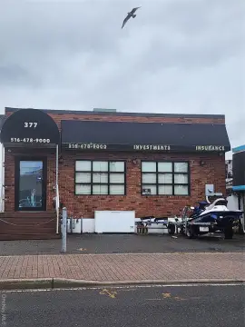
60-62 Merrick Rd Freeport, NY 11520
Property profile & analytics
60-62 Merrick Rd, Freeport, NY 11520
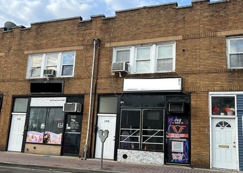
- Retail space
- 2,652 SF
- 0.24 lot acres
Property ID
US63-3815790
The Realmo ID is a unique identifier assigned to every property, incorporating country codes and precise geo-coordinates for 300x300-foot land blocks. It enables standardized data collection and seamless integration of disparate sources such as ownership, tax, title data and physical specifications. By aggregating current and historical records, the Realmo ID powers advanced analytics and delivers deep, verifiable insights for real estate professionals.
Location Intelligence
Current Use by Public Records
- Retail space
Property Details for 60-62 Merrick Rd
- Year built
- 1923
- Construction
- FRAME
- Lot size
- 0.24 lot acres
- Property type
- Retail space
- APN
- 55-288-00-0022
- APU
- 55288000022
Sales History
| Date | Price | Buyer | Seller | Deed Type | Mortgage |
|---|---|---|---|---|---|
| Apr 22, 2009 | $700,000 | Freeport 62 West Merrick Road | 62 West Merrick Road Corp | Grant Deed | $450k · 62 West Merrick Road Corp |
Value Estimations
based on Realmo’s proprietary methodology
-
Comparable approach
- Method
- Estimation
- Statistic Estimate
- $881,000
- AI Estimate
- $500,000
Market price range: $711k - $1.16MMarket price range: $43.3k - $925k -
Alternative Use
- Use
- Estimation
- RETAIL STORES
- $875,000 Current use
- WAREHOUSE, STORAGE
- $820,000 Change: -7% Conversion: Difficult
Get a detailed, property-specific estimation — fast and free
Location Insight
- Map
- Local Demand
- City
- Freeport
- County
- Nassau
- State
- New York
- Longitude
- -73.5829
- Latitude
- 40.6542
- CBSA code
- 35620
- CBSA name
- NEW YORK-NORTHERN NEW JERSEY-LONG ISLAND, NY-NJ-PA METROPOLITAN STATISTICAL AREA
Property Tax & Assessments
Tax date
Tax Amount
Assessed Land Value
Assessed Improvement Value
Total Assessed Value
Applied Tax Rate
Land Market Value
Improvement Market Value
Total Market Value
2023
$26,166
$2,222
$4,608
$6,830
-
$0.00
$0.00
$683,000