
New search
Property profile & analytics
OFF-MARKET
Estimated value
$1,460,000
Industrial properties
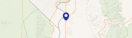
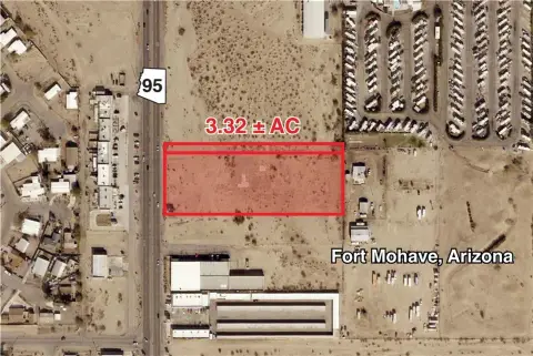
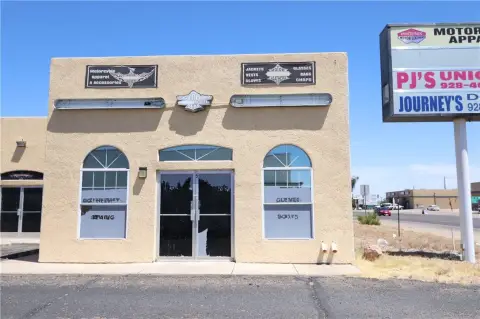
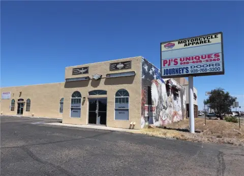
5630 Hwy 95, Fort Mohave, AZ 86426-6041
Entity Owned
12-yr Hold
~
Est. High Equity
Property ID
US07-0813619
Property profile
Verified
Property type
Industrial properties
Use group
MIXED USE (COMMERCIAL/INDUSTRIAL)
Year built
1989
Construction
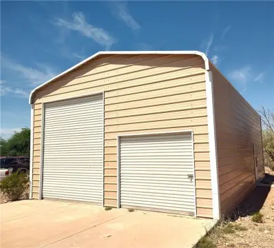
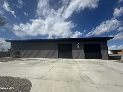
STEEL FRAME
Total area
13,143 SF
Lot
2.31 ac (100,624 SF)
APN
226-07-028
UPID
US07-0813619
Cap rate & NOI
Priority signal for investors
Implied cap rate, NOI & suggested price
Cap rate vs submarket · NOI estimate · 3 price anchors
Implied cap rate, NOI & suggested price
Cap vs submarket · NOI estimate · 3 price anchors
Value estimations
Realmo proprietary · 4 methods
AI Approach
AI
by Request
CAP Approach
CAP
by Request
Comparable Approach
Comparable
$1.46M
Blend (final)
Blend
$1.46M
Owner & transaction history
Performance Self Storage LLC · 12 yrs held
Performance Self Storage LLC
since 2014
6 recorded transactions
Zoning & alternative use
Permitted uses
Permitted uses
Allowed · conditional · prohibited
Top alternative use upside
Apartment house (5+ units)
$2.1M
+48.2%
Auto repair, garage
$1.6M
+8.4%
Medical building
$1.5M
+6.5%
Cap rate
Implied · in-place · derived from last sale + estimated NOI
Implied Cap rate
#1
Implied · in-place · NOI ÷ last sale
In-place · derived from last sale + estimated NOI
Cap rate, NOI & submarket benchmark
Implied cap rate vs Fort Mohave submarket · NOI estimate · Typical band, median & reading
Implied cap rate, NOI & submarket benchmark
Cap vs Fort Mohave submarket · NOI estimate · typical band, median & reading
Refine your cap rate
8-question underwriting flow
1.
Property current status — Going-In vs Stabilized
2.
Price for denominator — asking / offer / market
3.
Leasing status & lease structure (NNN / Gross)
4.
Tenant risk profile & vacancy assumption
5.
Upload T12 / rent roll / OM (optional)
Refine in 60 seconds, get exact suggested price
T12 upload · Submarket benchmarks · Sensitivity grid
Suggested price · 3 cap rate anchors
Income approach @ 5% / 7% / 9% — aggressive / typical / conservative
Suggested price at 5% / 7% / 9% cap
Aggressive / typical / conservative · Implied $/SF per anchor · Sensitivity grid
Suggested price at 5% / 7% / 9% cap
Aggressive / typical / conservative · implied $/SF · sensitivity
Value
AI, CAP & Alternative Use estimations · Realmo proprietary blendValue Estimations
Based on Realmo’s proprietary methodology
AI Approach
Method
Estimation
Statistic approach
by Request
ML approach
by Request
CAP Approach
CAP Return
Estimation
6%
by Request
6.5%
by Request
7%
by Request
Alternative Use
Use
Estimation
COMMERCIAL (GENERAL)
$1,435,000
Current use
APARTMENT HOUSE (5+ UNITS)
$2,125,000
Change: +48% · Conversion: Moderate
AUTO REPAIR, GARAGE
$1,555,000
Change: +8% · Conversion: Difficult
MEDICAL BUILDING
$1,525,000
Change: +7% · Conversion: Easy
RETAIL STORES
$1,430,000
Change: 0% · Conversion: Easy
NEIGHBORHOOD: SHOPPING CENTER
$1,420,000
Change: -1% · Conversion: Difficult
Blend value · Realmo final
$1.46M
Range $1.31M – $1.61M · ±10%
Realmo estimate · informational only.
These numbers are calculated by our models from public records and may not reflect actual market value.
Not an appraisal.
Verify with a licensed appraiser before transacting. Realmo accepts no liability for divergence from real-world outcomes.
View the full estimation — every method, every assumption
Confidence drivers & risk notes · Custom comparable set · Free for first 3 / day
Full estimation methodology
Every method · every assumption · confidence drivers
Price per SF
Sale + rent benchmarks
Subject property
$111 / SF
Submarket sale & rent benchmarks
Median sale $/SF · Asking & closed rent · Submarket vacancy
Submarket sale & rent benchmarks
Median sale $/SF · asking & closed rent · submarket vacancy
Property tax & assessments
Tax year 2020Property tax & assessments
Tax year 2020
Tax billed
$18,085
Tax year 2020
Assessed value
$254,972
Assessed 2025
Previous assessed
$254,593
+0.1% YoY
Effective rate
7.09%
On assessed value
Land market value
$296,455
Improvement market value
$1,120,055
Total market value
$1,416,510
Applied tax rate
1,621.0000
Comparables
6 recent transactions · within 1.5 miComparable in this city
6 recent transactions
Comparable in this City


Similar Nearby for Sale


Similar Nearby for Lease

Recent comparable sales
Sale price & price/SF · Sale date & distance · Adjustments & confidence
Recent comparable sales
Sale price & $/SF · sale date & distance · adjustments
Property description
Physical attributes from public recordsBuilding & lot
Public records
Property type
Industrial properties
Use group
MIXED USE (COMMERCIAL/INDUSTRIAL)
Status
Off-Market
Year built
1989
Construction
STEEL FRAME
Heating
HEAT PUMP
Cooling
YES
Buildings
5
Stories
1
Total area
13,143 SF
Lot
2.31 ac (100,624 SF)
APN
226-07-028
UPID
US07-0813619
Jurisdiction
MOHAVE
Zoning & alternative use
Zoning · permitted uses
Permitted & conditional uses
Allowed uses · Special-permit conditions · Prohibited uses
Permitted & conditional uses
Allowed · special-permit conditions · prohibited
Alternative use value scenarios
Repositioning upside vs current use
COMMERCIAL (GENERAL) Current
Est. value
$1.4M
APARTMENT HOUSE (5+ UNITS)
Est. value
$2.1M
AUTO REPAIR, GARAGE
Est. value
$1.6M
MEDICAL BUILDING
Est. value
$1.5M
RETAIL STORES
Est. value
$1.4M
NEIGHBORHOOD: SHOPPING CENTER
Est. value
$1.4M
COMMERCIAL (GENERAL) Current
APARTMENT HOUSE (5+ UNITS)
AUTO REPAIR, GARAGE
MEDICAL BUILDING
RETAIL STORES
NEIGHBORHOOD: SHOPPING CENTER
Alternative use deep dive — conversion cost, permits, timeline
Conversion cost estimate · Permit path & risks · Stabilized NOI per option
Alternative use deep dive
Conversion cost · permit path · stabilized NOI per option
Building & site characteristics
From public records
Year built
1989
Construction
STEEL FRAME
Heating
HEAT PUMP
Cooling
Yes
Stories
1
Buildings
5
Lot
2.31 ac
Current owner
From public records · entity-resolved
Performance Self Storage LLC
Entity
Mailing address
456 MELBOURNE GLN, ESCONDIDO, CA 92026-8565
Ownership since
2014
Owner contacts — direct phone, email, and related entities
Decision-maker phone · Verified email · Related entities & filings
Owner contacts
Email · phone · related entities
Sales History
6 recorded events · public records
Date
Price
Buyer
Seller
Deed Type
Mortgage
Mar 13, 2020
—
Performance Self Storage LLC
—
Deed
related
$765,500 · Glacier Bk Fsb
Jan 31, 2014
$1,040,000
Performance Self Storage LLC
Candice Louise Whittingham
Special Warranty Deed
$867,000 · Mohave State Bank
Mar 2, 2010
—
Whittingham Family Trust
Whittingham Family Trust
Quit Claim Deed
related
—
Apr 26, 2005
$1,975,000
Virginia C Whittingham
Ronald J Moscoso
Warranty Deed
$675,000 · The Stockmens Bank
—
—
Whittingham Family Trust A
—
Deed Of Trust
related
$870,000 · Affinity Bank
—
—
Performance Self Storage LLC
—
Deed Of Trust
related
$765,500 · Glacier Bk Fsb
Coming soon
Costs & Benchmarks
Operating expenses, capex projections, utility benchmarks, and submarket comparables — all in one view.
Coming soon
Risks
Flood, climate, environmental, title, and tenant-concentration risk — surfaced with mitigations and source citations.
Try Rey
Ask anything about this address in plain English.
“Is 15.6% cap rate sustainable?” · “Best tenant mix for BU1?” · “What’s the redev upside?”
You own 5630 Hwy 95?
List it free. Reach 20,000 daily buyers.
We’ve already pulled the facts. Confirm photos + price and you’re live in 2 minutes.
List this address →
Full reports are paid
Unlock the full Property Analytics report
Start free for 7 days — no card required. Full owner contacts, all 4 valuations with methodology, refine flow, comparable adjustments, foot-traffic deep dive, export to PDF / CSV.


