Back to Search
Property profile & analytics
OFF-MARKET
Estimated value
$38,175,000
High-rise multifamily apartments
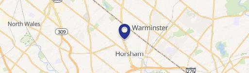
555 Dresher Rd Horsham, PA 19044-1998
Entity Owned
18-yr Hold
~
Est. High Equity
Property ID
US73-0834972
Property profile
Verified
Property type
High-rise multifamily apartments
Use group
HIGH-RISE APARTMENTS
Year built
2021
Total area
272,344 SF
Lot
9.76 ac (425,146 SF)
Zoning code
I2
APN
36-00-03637-00-8
UPID
US73-0834972
Cap rate & NOI
Priority signal for investors
Implied cap rate, NOI & suggested price
Cap rate vs submarket · NOI estimate · 3 price anchors
Implied cap rate, NOI & suggested price
Cap vs submarket · NOI estimate · 3 price anchors
Current use
Occupant on record · Public records
-
Gary Martin Law Law Firm
-
555 Flats Apartment Building Apartment Complex
Value estimations
Realmo proprietary · 4 methods
AI Approach
AI
by Request
CAP Approach
CAP
by Request
Comparable Approach
Comparable
$52.18M
Blend (final)
Blend
$38.18M
Owner & transaction history
Bt Witmer LP · 18 yrs held
Bt Witmer LP
since 2007
5 recorded transactions
Zoning & alternative use
I2 · Horsham, PA
Permitted uses
Permitted uses
Allowed · conditional · prohibited
Top alternative use upside
Office building
$44.6M
+17.7%
Medical building
$42.9M
+13.4%
Restaurant
$38.2M
+1.0%
Cap rate
Implied · in-place · derived from last sale + estimated NOI
Implied Cap rate
#1
Implied · in-place · NOI ÷ last sale
In-place · derived from last sale + estimated NOI
Cap rate, NOI & submarket benchmark
Implied cap rate vs Horsham submarket · NOI estimate · Typical band, median & reading
Implied cap rate, NOI & submarket benchmark
Cap vs Horsham submarket · NOI estimate · typical band, median & reading
Refine your cap rate
8-question underwriting flow
1.
Property current status — Going-In vs Stabilized
2.
Price for denominator — asking / offer / market
3.
Leasing status & lease structure (NNN / Gross)
4.
Tenant risk profile & vacancy assumption
5.
Upload T12 / rent roll / OM (optional)
Refine in 60 seconds, get exact suggested price
T12 upload · Submarket benchmarks · Sensitivity grid
Suggested price · 3 cap rate anchors
Income approach @ 5% / 7% / 9% — aggressive / typical / conservative
Suggested price at 5% / 7% / 9% cap
Aggressive / typical / conservative · Implied $/SF per anchor · Sensitivity grid
Suggested price at 5% / 7% / 9% cap
Aggressive / typical / conservative · implied $/SF · sensitivity
Value
AI, CAP & Alternative Use estimations · Realmo proprietary blendValue Estimations
Based on Realmo’s proprietary methodology
AI Approach
Method
Estimation
Statistic approach
by Request
ML approach
by Request
CAP Approach
CAP Return
Estimation
6%
by Request
6.5%
by Request
7%
by Request
Alternative Use
Use
Estimation
APARTMENT HOUSE (5+ UNITS)
$37,855,000
Current use
OFFICE BUILDING
$44,560,000
Change: +18% · Conversion: Moderate
MEDICAL BUILDING
$42,925,000
Change: +13% · Conversion: Moderate
RESTAURANT
$38,225,000
Change: +1% · Conversion: Difficult
NEIGHBORHOOD: SHOPPING CENTER
$35,495,000
Change: -6% · Conversion: Difficult
INDUSTRIAL (GENERAL)
$30,455,000
Change: -20% · Conversion: Difficult
Blend value · Realmo final
$38.18M
Range $34.36M – $41.99M · ±10%
Realmo estimate · informational only.
These numbers are calculated by our models from public records and may not reflect actual market value.
Not an appraisal.
Verify with a licensed appraiser before transacting. Realmo accepts no liability for divergence from real-world outcomes.
View the full estimation — every method, every assumption
Confidence drivers & risk notes · Custom comparable set · Free for first 3 / day
Full estimation methodology
Every method · every assumption · confidence drivers
Price per SF
Sale + rent benchmarks
Subject property
$140 / SF
Submarket sale & rent benchmarks
Median sale $/SF · Asking & closed rent · Submarket vacancy
Submarket sale & rent benchmarks
Median sale $/SF · asking & closed rent · submarket vacancy
Property tax & assessments
Tax year 2023Property tax & assessments
Tax year 2023
Tax billed
$888,165
Tax year 2023
Assessed value
$22,595,000
Assessed 2024
Previous assessed
$22,595,000
+0.0% YoY
Effective rate
3.93%
On assessed value
Total market value
$22,595,000
Applied tax rate
36.0000
Comparables
6 recent transactions · within 1.5 miComparable in this city
6 recent transactions
Comparable in this City


Similar Nearby for Sale


Similar Nearby for Lease


Recent comparable sales
Sale price & price/SF · Sale date & distance · Adjustments & confidence
Recent comparable sales
Sale price & $/SF · sale date & distance · adjustments
Property description
Physical attributes from public recordsBuilding & lot
Public records
Property type
High-rise multifamily apartments
Use group
HIGH-RISE APARTMENTS
Status
Off-Market
Year built
2021
Heating
FORCED AIR
Cooling
CENTRAL
Units
256
Total area
272,344 SF
Lot
9.76 ac (425,146 SF)
Zoning code
I2
APN
36-00-03637-00-8
UPID
US73-0834972
Jurisdiction
MONTGOMERY
Metro division
PHILADELPHIA, PA METROPOLITAN DIVISION
Zoning & alternative use
I2 · Horsham, PAZoning I2 · permitted uses
I2 · Horsham, PA
Permitted & conditional uses
Allowed uses · Special-permit conditions · Prohibited uses
Permitted & conditional uses
Allowed · special-permit conditions · prohibited
Alternative use value scenarios
Repositioning upside vs current use
APARTMENT HOUSE (5+ UNITS) Current
Est. value
$37.9M
OFFICE BUILDING
Est. value
$44.6M
MEDICAL BUILDING
Est. value
$42.9M
RESTAURANT
Est. value
$38.2M
NEIGHBORHOOD: SHOPPING CENTER
Est. value
$35.5M
INDUSTRIAL (GENERAL)
Est. value
$30.5M
APARTMENT HOUSE (5+ UNITS) Current
OFFICE BUILDING
MEDICAL BUILDING
RESTAURANT
NEIGHBORHOOD: SHOPPING CENTER
INDUSTRIAL (GENERAL)
Alternative use deep dive — conversion cost, permits, timeline
Conversion cost estimate · Permit path & risks · Stabilized NOI per option
Alternative use deep dive
Conversion cost · permit path · stabilized NOI per option
Building & site characteristics
From public records
Year built
2021
Heating
FORCED AIR
Cooling
Yes
Units
256
Lot
9.76 ac
Current owner
From public records · entity-resolved
Bt Witmer LP
Entity
Mailing address
200 DRYDEN RD E STE #2000, DRESHER, PA 19025-1048
Ownership since
2007
Owner contacts — direct phone, email, and related entities
Decision-maker phone · Verified email · Related entities & filings
Owner contacts
Email · phone · related entities
Sales History
5 recorded events · public records
Date
Price
Buyer
Seller
Deed Type
Mortgage
Sep 30, 2021
—
Bt Witmer LP
—
Deed
related
$58,000,000 · Grandbridge Real Estate
Nov 14, 2019
—
Bt Witmer LP
—
Grant Deed
related
$45,000,000 · Us Bk
Oct 25, 2007
$8,191,000
Bt Witmer LP
Capmark Finance INC
Deed
—
Sep 13, 1999
$9,550,000
Gmac Commercial Mortgage Corp
Betz Dearborn INC
Grant Deed
related
—
—
—
Bt Witmer LP
—
Loan Modification
related
$5,575,087 · First Niagara Bk
Coming soon
Costs & Benchmarks
Operating expenses, capex projections, utility benchmarks, and submarket comparables — all in one view.
Coming soon
Risks
Flood, climate, environmental, title, and tenant-concentration risk — surfaced with mitigations and source citations.
Try Rey
Ask anything about this address in plain English.
“Is 15.6% cap rate sustainable?” · “Best tenant mix for BU1?” · “What’s the redev upside?”
You own 555 Dresher Rd?
List it free. Reach 20,000 daily buyers.
We’ve already pulled the facts. Confirm photos + price and you’re live in 2 minutes.
List this address →
Full reports are paid
Unlock the full Property Analytics report
Start free for 7 days — no card required. Full owner contacts, all 4 valuations with methodology, refine flow, comparable adjustments, foot-traffic deep dive, export to PDF / CSV.


