5302 Hwy 71st E Del Valle, TX 78617-3224
Property profile & analytics
5302 Hwy 71st E, Del Valle, TX 78617-3224
- Commercial real estate
- 1,064 SF
- 3.53 lot acres
Property ID
US82-8692261
The Realmo ID is a unique identifier assigned to every property, incorporating country codes and precise geo-coordinates for 300x300-foot land blocks. It enables standardized data collection and seamless integration of disparate sources such as ownership, tax, title data and physical specifications. By aggregating current and historical records, the Realmo ID powers advanced analytics and delivers deep, verifiable insights for real estate professionals.
Location Intelligence
Current Use by Public Records
- Garfield RV Campground / Campground & RV Park
Property Details for 5302 Hwy 71st E
- Year built
- 1975
- Lot size
- 3.53 lot acres
- Property type
- Commercial real estate
- APN
- 323600436
- APU
- 323600436
Sales History
| Date | Price | Buyer | Seller | Deed Type | Mortgage |
|---|---|---|---|---|---|
| Jan 19, 2024 | — | Hwy 71 LLC | Red Bud Holdings LLC | Special Warranty Deed | — |
| Apr 1, 2021 | — | Red Bud Holdings LLC | Hwy 71 LLC | Warranty Deed | — |
| Dec 13, 2019 | — | Hwy 71 LLC | — | Deed · related | $574k · Heritage Bk |
| Sep 9, 2019 | — | Hwy 71 LLC | — | Deed · related | $117k · Allegiance Bk |
| May 16, 2019 | — | Hwy 71 LLC | — | Deed · related | $118k · Allegiance Bk |
| Aug 15, 2006 | — | Hwy 71 LLC | Flex Investments | Warranty Deed | — |
| Dec 29, 2005 | — | Hwy 71 LLC | Presley,sam | Warranty Deed · related | — |
| Oct 24, 2005 | — | Presley,sam | Hash,terry M | Grant Deed · related | — |
| Sep 26, 2005 | $300,000 | Sam Presley | Hash,terry M & Karen | Warranty Deed | $240k · Terry M & Karen Hash |
| — | — | Hwy 71 LLC | — | Loan Modification · related | $118k · Allegiance Bk |
| — | — | Hwy 71 LLC | — | Loan Modification · related | $117k · Allegiance Bk |
| — | — | Hwy 71 LLC | — | Deed Of Trust · related | $574k · Heritage Bk |
| — | — | Hwy 71 LLC | — | Deed Of Trust · related | $215k · Compass Bank |
Value Estimations
based on Realmo’s proprietary methodology
-
AI approach
-
CAP approach
-
Comparable approach
-
Alternative Use
Get a detailed, property-specific estimation — fast and free
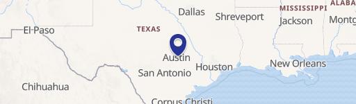
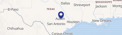
Location Insight
- Map
- Local Demand
- City
- Del Valle
- County
- Travis
- State
- Texas
- Longitude
- -97.5471
- Latitude
- 30.1831
- CBSA code
- 12420
- CBSA name
- AUSTIN-ROUND ROCK, TX METROPOLITAN STATISTICAL AREA
Property Tax & Assessments
Tax date
Tax Amount
Assessed Land Value
Assessed Improvement Value
Total Assessed Value
Applied Tax Rate
Land Market Value
Improvement Market Value
Total Market Value
2022
$0.00
$153,767
$246,947
$400,714
-
$153,767
$246,947
$400,714