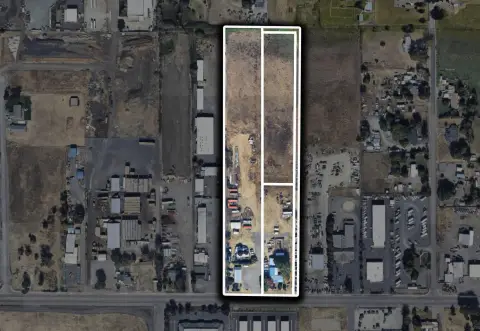
4597 Table Rock Rd Central Point, OR 97502-3149
Property profile & analytics
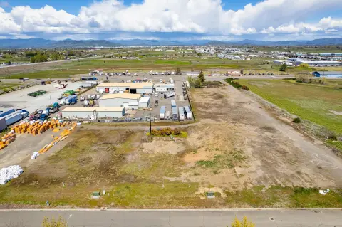
4597 Table Rock Rd, Central Point, OR 97502-3149
- Warehouses
- 8,800 SF
- 0.79 lot acres
Property ID
US71-0086451
The Realmo ID is a unique identifier assigned to every property, incorporating country codes and precise geo-coordinates for 300x300-foot land blocks. It enables standardized data collection and seamless integration of disparate sources such as ownership, tax, title data and physical specifications. By aggregating current and historical records, the Realmo ID powers advanced analytics and delivers deep, verifiable insights for real estate professionals.
Location Intelligence
Current Use by Public Records
- Warehouses
Property Details for 4597 Table Rock Rd
- Lot size
- 0.79 lot acres
- Zone code
- AD-MU
- Property type
- Warehouses
- Property subtype
- Self storage facilities
- APN
- 1-0195086
- APU
- 10195086
Sales History
| Date | Price | Buyer | Seller | Deed Type | Mortgage |
|---|---|---|---|---|---|
| Dec 29, 2005 | — | Dutson Family Trust | Dutson,val J | Quit Claim Deed · related | — |
| Dec 23, 1988 | — | — | Dutson,val J | Grant Deed · related | — |
| Apr 9, 1986 | $100,000 | Dutson,val J | Northwest,j M (sos) | Grant Deed · related | — |
| Nov 25, 1983 | — | Northwest,j M (sos) | — | Deed Of Trust · related | — |
| — | — | Val J Dutson | — | Deed Of Trust · related | $75k · Timberline Community Bank |
| — | — | Val J Dutson | — | Deed Of Trust · related | $80k · Timberline Community Bank |
Value Estimations
based on Realmo’s proprietary methodology
-
Comparable approach
- Method
- Estimation
- Statistic Estimate
- $576,000
Market price range: $576k - $1.25M -
Alternative Use
- Use
- Estimation
- WAREHOUSE, STORAGE
- $825,000 Current use
- INDUSTRIAL (GENERAL)
- $855,000 Change: +4% Conversion: Easy
Get a detailed, property-specific estimation — fast and free
Location Insight
- Map
- Local Demand
- City
- Central Point
- County
- Jackson
- State
- Oregon
- Longitude
- -122.886
- Latitude
- 42.3833
- CBSA code
- 32780
- CBSA name
- MEDFORD, OR METROPOLITAN STATISTICAL AREA
Property Tax & Assessments
Tax date
Tax Amount
Assessed Land Value
Assessed Improvement Value
Total Assessed Value
Applied Tax Rate
Land Market Value
Improvement Market Value
Total Market Value
2023
$4,550
$53,150
$315,560
$368,710
-
$90,460
$279,540
$370,000