
New search
Property profile & analytics
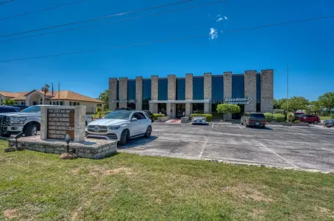
FOR SALE
Commercial real estate
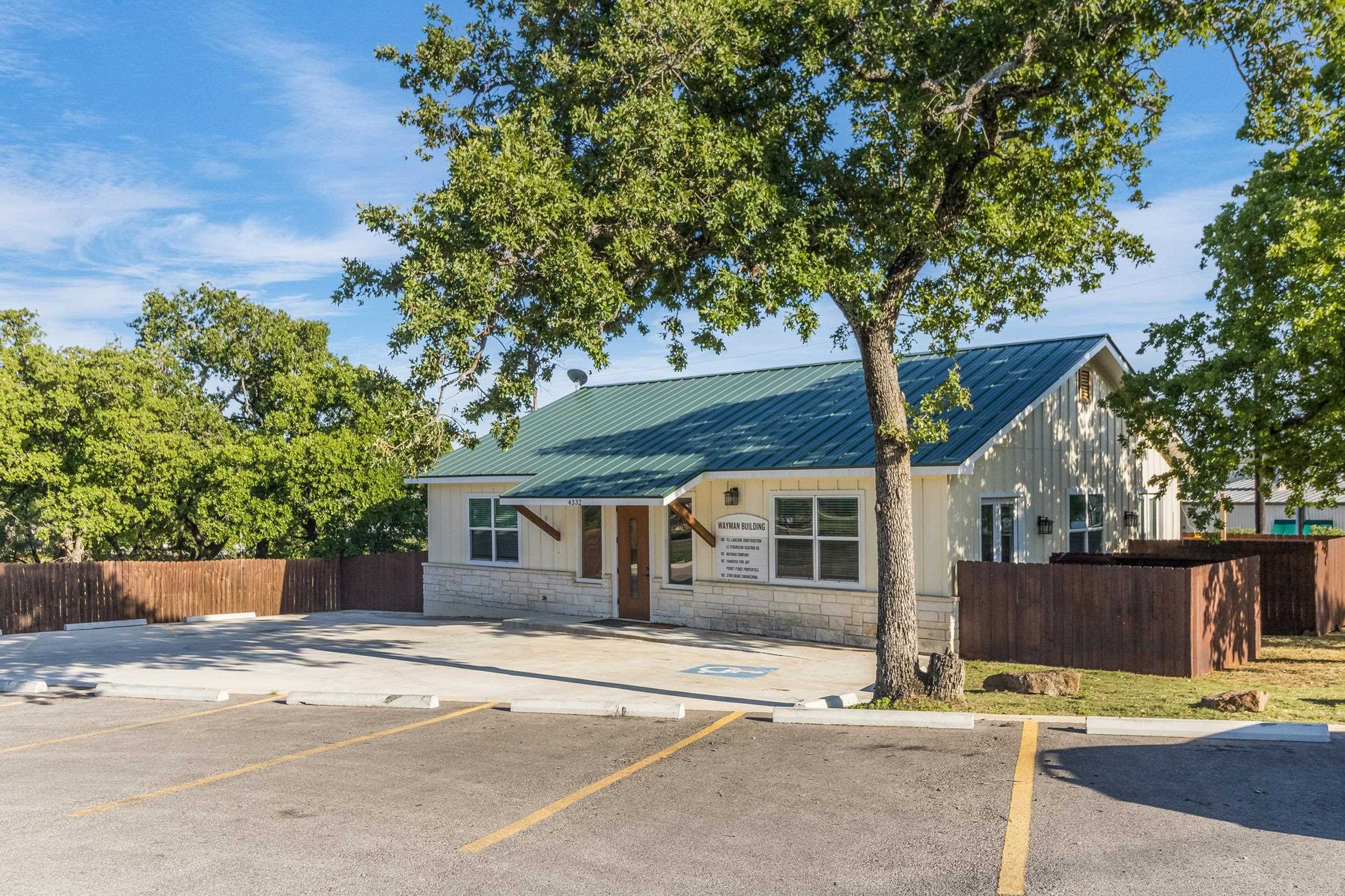
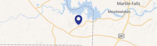
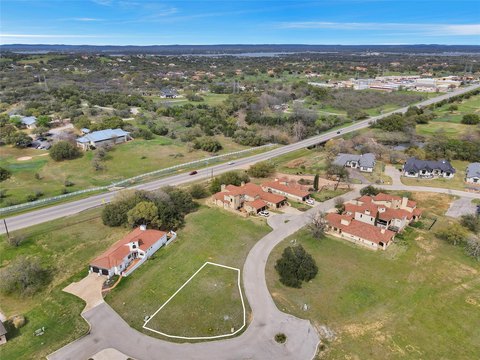
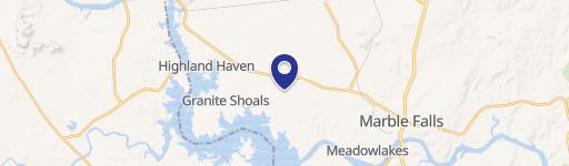
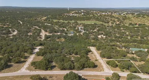
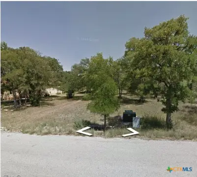
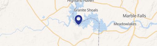
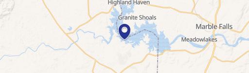
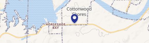
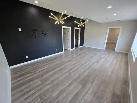
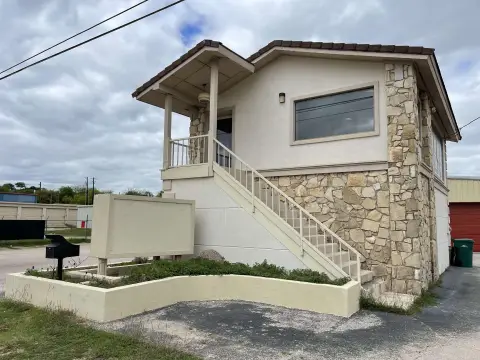
4332 Oak Park Dr, Cottonwood Shores, TX 78657
Entity Owned
9-yr Hold
Absentee Owner
Free & Clear
Property ID
US82-7827838
 For Sale
1 / 30
For Sale
1 / 30
$495,000
4332 Oak Park Dr, Cottonwood Shores, TX 78657
View Listing →
Property profile
Verified
Property type
Commercial real estate
Use group
COMMERCIAL (GENERAL)
Year built
2022
Total area
1,794 SF
Lot
0.26 ac (11,234 SF)
APN
5795
UPID
US82-7827838
Cap rate & NOI
Priority signal for investors
Implied cap rate, NOI & suggested price
Cap rate vs submarket · NOI estimate · 3 price anchors
Implied cap rate, NOI & suggested price
Cap vs submarket · NOI estimate · 3 price anchors
Value estimations
Realmo proprietary · 4 methods
AI Approach
AI
by Request
CAP Approach
CAP
by Request
Comparable Approach
Comparable
by Request
Blend (final)
Blend
by Request
Owner & transaction history
Brohart LLC · 9 yrs held
Brohart LLC
since 2017
2 recorded transactions
Zoning & alternative use
Permitted uses
Permitted uses
Allowed · conditional · prohibited
Cap rate
Implied · in-place · derived from last sale + estimated NOI
Implied Cap rate
#1
Implied · in-place · NOI ÷ last sale
In-place · derived from last sale + estimated NOI
Cap rate, NOI & submarket benchmark
Implied cap rate vs Cottonwood Shores submarket · NOI estimate · Typical band, median & reading
Implied cap rate, NOI & submarket benchmark
Cap vs Cottonwood Shores submarket · NOI estimate · typical band, median & reading
Refine your cap rate
8-question underwriting flow
1.
Property current status — Going-In vs Stabilized
2.
Price for denominator — asking / offer / market
3.
Leasing status & lease structure (NNN / Gross)
4.
Tenant risk profile & vacancy assumption
5.
Upload T12 / rent roll / OM (optional)
Refine in 60 seconds, get exact suggested price
T12 upload · Submarket benchmarks · Sensitivity grid
Suggested price · 3 cap rate anchors
Income approach @ 5% / 7% / 9% — aggressive / typical / conservative
Suggested price at 5% / 7% / 9% cap
Aggressive / typical / conservative · Implied $/SF per anchor · Sensitivity grid
Suggested price at 5% / 7% / 9% cap
Aggressive / typical / conservative · implied $/SF · sensitivity
Value
AI, CAP & Alternative Use estimations · Realmo proprietary blendValue Estimations
Based on Realmo’s proprietary methodology
AI Approach
CAP Approach
Comparable Approach
Alternative Use
Get a detailed, property-specific estimation — fast and free
Price per SF
Sale + rent benchmarks
Subject property
—
Submarket sale & rent benchmarks
Median sale $/SF · Asking & closed rent · Submarket vacancy
Submarket sale & rent benchmarks
Median sale $/SF · asking & closed rent · submarket vacancy
Property tax & assessments
Tax year 2023Property tax & assessments
Tax year 2023
Tax billed
$6,447
Tax year 2023
Assessed value
$365,572
Assessed 2023
Previous assessed
$365,572
+0.0% YoY
Effective rate
1.76%
On assessed value
Assessed land
$64,601
Assessed improvement
$300,971
Land market value
$64,601
Improvement market value
$300,971
Total market value
$365,572
Comparables
6 recent transactions · within 1.5 miComparable in this city
6 recent transactions
Comparable in this City
Similar Nearby for Sale
Similar Nearby for Lease
Recent comparable sales
Sale price & price/SF · Sale date & distance · Adjustments & confidence
Recent comparable sales
Sale price & $/SF · sale date & distance · adjustments
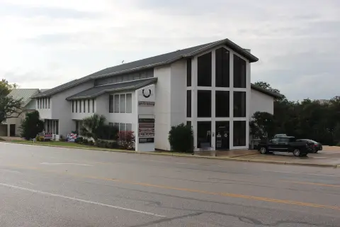
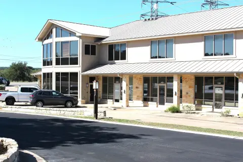
Property description
Physical attributes from public recordsBuilding & lot
Public records
Property type
Commercial real estate
Use group
COMMERCIAL (GENERAL)
Status
For Sale
Year built
2022
Heating
NONE
Total area
1,794 SF
Lot
0.26 ac (11,234 SF)
APN
5795
UPID
US82-7827838
Jurisdiction
BURNET
Zoning & alternative use
Zoning · permitted uses
Permitted & conditional uses
Allowed uses · Special-permit conditions · Prohibited uses
Permitted & conditional uses
Allowed · special-permit conditions · prohibited
Building & site characteristics
From public records
Year built
2022
Heating
NONE
Lot
0.26 ac
Current owner
From public records · entity-resolved
Brohart LLC
Entity
Free & Clear · 9 yrs held
Mailing address
12881 PARK DR, AUSTIN, TX 78732-1841
Mailing matches property
Different — outreach signal
Owner-occupied
No
Ownership since
2017
Owner contacts — direct phone, email, and related entities
Decision-maker phone · Verified email · Related entities & filings
Owner contacts
Email · phone · related entities
Sales History
2 recorded events · public records
Date
Price
Buyer
Seller
Deed Type
Mortgage
Jun 22, 2017
—
Brohart LLC
New Castle Rock Development LLC
Deed
—
Nov 17, 2009
—
City Of Cottonwood Shores
New Castle Rock Development LLC
Gift Deed
related
—
Coming soon
Costs & Benchmarks
Operating expenses, capex projections, utility benchmarks, and submarket comparables — all in one view.
Coming soon
Risks
Flood, climate, environmental, title, and tenant-concentration risk — surfaced with mitigations and source citations.
Try Rey
Ask anything about this address in plain English.
“Is 15.6% cap rate sustainable?” · “Best tenant mix for BU1?” · “What’s the redev upside?”
Full reports are paid
Unlock the full Property Analytics report
Start free for 7 days — no card required. Full owner contacts, all 4 valuations with methodology, refine flow, comparable adjustments, foot-traffic deep dive, export to PDF / CSV.


