
New search
Property profile & analytics
OFF-MARKET
Commercial real estate
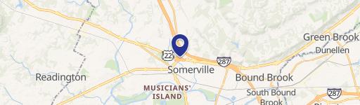
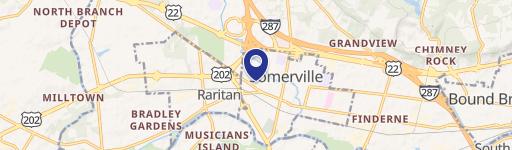
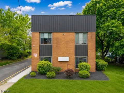
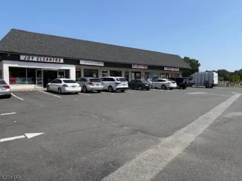
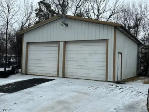
3494 Us Hwy 22, Branchburg, NJ 08876-3446
Entity Owned
5-yr Hold
Free & Clear
Property ID
US59-1155479
Property profile
Verified
Property type
Commercial real estate
Use group
COMMERCIAL (GENERAL)
Year built
2000
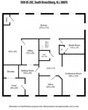
Total area
3,628 SF
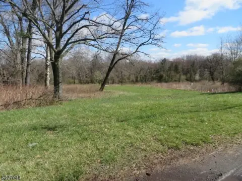
Lot
6.03 ac (262,667 SF)
Zoning code
POAR
APN
22 00015-0000-00019
UPID
US59-1155479
Cap rate & NOI
Priority signal for investors
Implied cap rate, NOI & suggested price
Cap rate vs submarket · NOI estimate · 3 price anchors
Implied cap rate, NOI & suggested price
Cap vs submarket · NOI estimate · 3 price anchors
Value estimations
Realmo proprietary · 4 methods
AI Approach
AI
by Request
CAP Approach
CAP
by Request
Comparable Approach
Comparable
by Request
Blend (final)
Blend
by Request
Owner & transaction history
Atlantic Coast Management & Co · 5 yrs held
Atlantic Coast Management & Co
since 2021
Last sale
$490,000
1 recorded transaction
Zoning & alternative use
POAR · Branchburg, NJ
Permitted uses
Permitted uses
Allowed · conditional · prohibited
Cap rate
Implied · in-place · derived from last sale + estimated NOI
Implied Cap rate
#1
Implied · in-place · NOI ÷ last sale
In-place · derived from last sale + estimated NOI
Cap rate, NOI & submarket benchmark
Implied cap rate vs Branchburg submarket · NOI estimate · Typical band, median & reading
Implied cap rate, NOI & submarket benchmark
Cap vs Branchburg submarket · NOI estimate · typical band, median & reading
Refine your cap rate
8-question underwriting flow
1.
Property current status — Going-In vs Stabilized
2.
Price for denominator — asking / offer / market
3.
Leasing status & lease structure (NNN / Gross)
4.
Tenant risk profile & vacancy assumption
5.
Upload T12 / rent roll / OM (optional)
Refine in 60 seconds, get exact suggested price
T12 upload · Submarket benchmarks · Sensitivity grid
Suggested price · 3 cap rate anchors
Income approach @ 5% / 7% / 9% — aggressive / typical / conservative
Suggested price at 5% / 7% / 9% cap
Aggressive / typical / conservative · Implied $/SF per anchor · Sensitivity grid
Suggested price at 5% / 7% / 9% cap
Aggressive / typical / conservative · implied $/SF · sensitivity
Value
AI, CAP & Alternative Use estimations · Realmo proprietary blendValue Estimations
Based on Realmo’s proprietary methodology
AI Approach
CAP Approach
Comparable Approach
Alternative Use
Get a detailed, property-specific estimation — fast and free
Price per SF
Sale + rent benchmarks
Subject property
—
Submarket sale & rent benchmarks
Median sale $/SF · Asking & closed rent · Submarket vacancy
Submarket sale & rent benchmarks
Median sale $/SF · asking & closed rent · submarket vacancy
Property tax & assessments
Tax year 2022Property tax & assessments
Tax year 2022
Tax billed
$15,091
Tax year 2022
Assessed value
$596,000
Assessed 2023
Previous assessed
$596,000
+0.0% YoY
Effective rate
2.53%
On assessed value
Assessed land
$400,800
Assessed improvement
$195,200
Land market value
$400,800
Improvement market value
$195,200
Total market value
$596,000
Applied tax rate
22.0000
Comparables
6 recent transactions · within 1.5 miComparable in this city
6 recent transactions
Comparable in this City


Similar Nearby for Sale

Similar Nearby for Lease


Recent comparable sales
Sale price & price/SF · Sale date & distance · Adjustments & confidence
Recent comparable sales
Sale price & $/SF · sale date & distance · adjustments
Property description
Physical attributes from public recordsBuilding & lot
Public records
Property type
Commercial real estate
Use group
COMMERCIAL (GENERAL)
Status
Off-Market
Year built
2000
Heating
NONE
Units
1
Total area
3,628 SF
Lot
6.03 ac (262,667 SF)
Zoning code
POAR
APN
22 00015-0000-00019
UPID
US59-1155479
Jurisdiction
HUNTERDON
Metro division
NEWARK-UNION, NJ-PA METROPOLITAN DIVISION
Zoning & alternative use
POAR · Branchburg, NJ
Zoning POAR · permitted uses
POAR · Branchburg, NJ
Permitted & conditional uses
Allowed uses · Special-permit conditions · Prohibited uses
Permitted & conditional uses
Allowed · special-permit conditions · prohibited
Branchburg. Always verify with local authorities before improvements.
Building & site characteristics
From public records
Year built
2000
Heating
NONE
Units
1
Lot
6.03 ac
Current owner
From public records · entity-resolved
Atlantic Coast Management & Co
Entity
Free & Clear · 5 yrs held
Mailing address
16912 CROWN BRG DR, DELRAY BEACH, FL 33446-2407
Ownership since
2021
Owner contacts — direct phone, email, and related entities
Decision-maker phone · Verified email · Related entities & filings
Owner contacts
Email · phone · related entities
Sales History
1 recorded event · public records
Date
Price
Buyer
Seller
Deed Type
Mortgage
Jan 7, 2021
$490,000
Atlantic Coast Management & Co
Norman Falk
Grant Deed
—
Coming soon
Costs & Benchmarks
Operating expenses, capex projections, utility benchmarks, and submarket comparables — all in one view.
Coming soon
Risks
Flood, climate, environmental, title, and tenant-concentration risk — surfaced with mitigations and source citations.
Try Rey
Ask anything about this address in plain English.
“Is 15.6% cap rate sustainable?” · “Best tenant mix for BU1?” · “What’s the redev upside?”
You own 3494 Us Hwy 22?
List it free. Reach 20,000 daily buyers.
We’ve already pulled the facts. Confirm photos + price and you’re live in 2 minutes.
List this address →
Full reports are paid
Unlock the full Property Analytics report
Start free for 7 days — no card required. Full owner contacts, all 4 valuations with methodology, refine flow, comparable adjustments, foot-traffic deep dive, export to PDF / CSV.


