270 Bomarc Rd Bangor, ME 04401
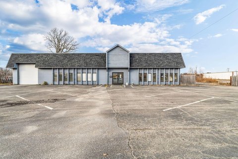
This 1,104-square-foot warehouse at 270 Bomarc Road in Bangor, Maine, presents a compelling investment opportunity. Built in 1950, this property sits on a 0.3-acre lot and is zoned for Urban Industry, offering considerable versatility. The building features two offices and a large bathroom upon entry. Beyond the offices, a spacious workshop area includes a convenient exterior garage door. Adding to the functionality is a substantial lean-to structure at the rear, providing ample storage space. The asking price is $80,000, reflecting an attractive entry point for investors seeking a property with significant potential. The property's location in Bangor offers convenient access to local amenities and transportation routes. The APN is BANG-000045R-000000-000001-N000000. This property is being sold "as is". This is a great opportunity for a creative buyer to transform this space into a thriving business.
Cap rate
Implied · in-place · derived from last sale + estimated NOIValue
AI, CAP & Alternative Use estimations · Realmo proprietary blendComparables
6 recent transactions · within 1.5 miComparable in this City


Similar Nearby for Sale
Similar Nearby for Lease


Property description
Physical attributes from public recordsZoning & alternative use
No recorded transactions found for this property.
Costs & Benchmarks
Operating expenses, capex projections, utility benchmarks, and submarket comparables — all in one view.
Risks
Flood, climate, environmental, title, and tenant-concentration risk — surfaced with mitigations and source citations.


