
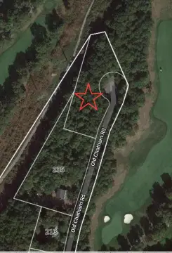
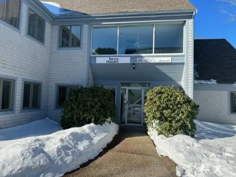
2639 Main St, Unit 2655 Brewster, MA 02631-1953
Property profile & analytics
2639 Main St, Unit 2655, Brewster, MA 02631-1953
- Commercial real estate
- 11,398 SF
- 2.04 lot acres
Property ID
US38-1675397
The Realmo ID is a unique identifier assigned to every property, incorporating country codes and precise geo-coordinates for 300x300-foot land blocks. It enables standardized data collection and seamless integration of disparate sources such as ownership, tax, title data and physical specifications. By aggregating current and historical records, the Realmo ID powers advanced analytics and delivers deep, verifiable insights for real estate professionals.
Location Intelligence
Current Use by Public Records
- Cumberland Farms / Grocery & Convenience Store
- Citizens ATM / Atm
Property Details for 2639 Main St
- Year built
- 1992
- Construction
- FRAME
- Lot size
- 2.04 lot acres
- Zone code
- VILLAG
- Property type
- Commercial real estate
- APN
- BREW M:89 B:18
- APU
- BREWM89B18
Sales History
| Date | Price | Buyer | Seller | Deed Type | Mortgage |
|---|---|---|---|---|---|
| Dec 28, 2012 | $2,400,000 | Brewster Main St Rlty LLC | Mardin Realty LLC | Grant Deed | — |
| Sep 3, 2009 | — | Mardin Realty LLC | — | Deed Of Trust · related | $650k · Everett Coop Bank |
| Jul 25, 2008 | $1 | Mardin Realty LLC | Mardin RT | Grant Deed · related | — |
| Jul 25, 2008 | — | Mardin Realty LLC | — | Deed Of Trust · related | $650k · Everett Coop Bank |
| May 20, 2003 | — | Mardin RT | — | Deed Of Trust · related | $600k · Thomas M Sykes |
| Oct 31, 1994 | $600,000 | Mardin RT | Mcmullen,john Porter | Grant Deed | — |
| Apr 15, 1987 | — | John P Mcmullen | — | Deed Of Trust · related | $75k · Cape Cod Five Cent Bank |
Value Estimations
based on Realmo’s proprietary methodology
-
CAP approach
- CAP Return
- Estimation
- 6%
- $2,650,000
- 6.5%
- $2,445,000
- 7%
- $2,270,000
-
Comparable approach
- Method
- Estimation
- AI Estimate
- $2,188,000
Market price range: $1.00M - $2.65M -
Alternative Use
- Use
- Estimation
- COMMERCIAL (GENERAL)
- $3,165,000 Current use
- RESTAURANT
- $2,825,000 Change: -11% Conversion: Difficult
- RETAIL STORES
- $2,580,000 Change: -19% Conversion: Easy
- OFFICE BUILDING
- $2,570,000 Change: -19% Conversion: Easy
Get a detailed, property-specific estimation — fast and free
Location Insight
- Map
- Local Demand
- City
- Brewster
- County
- Barnstable
- State
- Massachusetts
- Longitude
- -70.059
- Latitude
- 41.7679
- CBSA code
- 12700
- CBSA name
- BARNSTABLE TOWN, MA METROPOLITAN STATISTICAL AREA
Property Tax & Assessments
Tax date
Tax Amount
Assessed Land Value
Assessed Improvement Value
Total Assessed Value
Applied Tax Rate
Land Market Value
Improvement Market Value
Total Market Value
2024
$20,748
$632,400
$2,414,300
$3,046,700
-
$0.00
$0.00
$0.00
Comparable in this City


Similar Nearby for Sale


Similar Nearby for Lease

Property Visit Statistics
-
Visits by month15.2k
-
Visitors by month7.9k
-
Avg Time on site8 min


