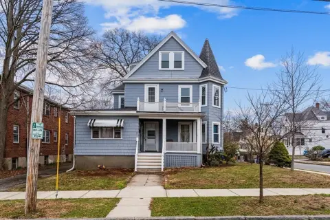
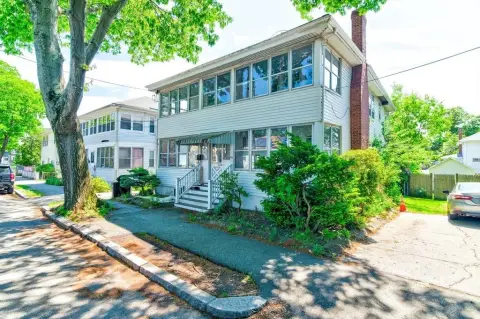
26-28 Hobart St Quincy, MA 02170
Property profile & analytics
26-28 Hobart St, Quincy, MA 02170
- Retail space
- 1,974 SF
- 0.11 lot acres
Property ID
US38-0850062
The Realmo ID is a unique identifier assigned to every property, incorporating country codes and precise geo-coordinates for 300x300-foot land blocks. It enables standardized data collection and seamless integration of disparate sources such as ownership, tax, title data and physical specifications. By aggregating current and historical records, the Realmo ID powers advanced analytics and delivers deep, verifiable insights for real estate professionals.
Location Intelligence
Current Use by Public Records
- Retail space
Property Details for 26-28 Hobart St
- Year built
- 2000
- Construction
- STEEL FRAME
- Lot size
- 0.11 lot acres
- Zone code
- BUSB
- Property type
- Retail space
- APN
- QUIN M:5108 B:23 L:19
- APU
- QUINM5108B23L19
Sales History
| Date | Price | Buyer | Seller | Deed Type | Mortgage |
|---|---|---|---|---|---|
| Jan 9, 2007 | $1 | Hobart Street LLC | Greenberg,alan | Grant Deed | — |
| Nov 26, 1997 | $102,500 | Alan Greenberg | Matthew RT | Grant Deed | — |
| Mar 5, 1997 | — | Davidson,geoffrey A Tr | — | Deed Of Trust · related | $60k · Zwi Kohorn |
| Feb 20, 1997 | $40,000 | Matthew RT | Josselyn & Perry T | Grant Deed | — |
Value Estimations
based on Realmo’s proprietary methodology
-
AI approach
-
CAP approach
-
Comparable approach
-
Alternative Use
Get a detailed, property-specific estimation — fast and free
Location Insight
- Map
- Local Demand
- City
- Quincy
- County
- Norfolk
- State
- Massachusetts
- Longitude
- -71.025
- Latitude
- 42.2691
- CBSA code
- 14460
- CBSA name
- BOSTON-CAMBRIDGE-QUINCY, MA-NH METROPOLITAN STATISTICAL AREA
Property Tax & Assessments
Tax date
Tax Amount
Assessed Land Value
Assessed Improvement Value
Total Assessed Value
Applied Tax Rate
Land Market Value
Improvement Market Value
Total Market Value
2024
$9,050
$150,100
$253,000
$403,100
-
$0.00
$0.00
$0.00